Fort Story in Virginia Beach, Virginia — The American South (Mid-Atlantic)
Cape Henry Memorial
— Colonial National Historical Park —
Inscription.
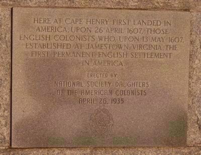
Here at Cape Henry first landed in America, upon 26 April 1607, those English colonists who, upon 13 May 1607, established at Jamestown, Virginia, the first permanent English colony in America.
Erected by the National Society,
Daughters of the American Colonists
April 26, 1935
[logo of the National Society]
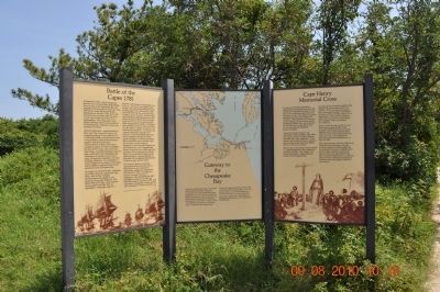
[Interpretive Sign at Site:]
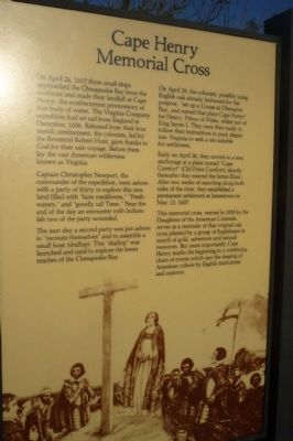
Memorial Cross
Captain Christopher Newport, the commander of the expedition, went ashore with a party of thirty to explore this new land filled with “faire meddowes,” “Freshwaters,” and “goodly tall Trees.” Near the end of the day an encounter with Indians left two of the party wounded.
The next day a party was put ashore to “recreate themselves” and to assemble a small boat (shallop). The “shallop” was launched and used to explore the lower reaches of the Chesapeake Bay.
On April 29, the colonists, possibly using English oak already fashioned for the purpose, “set up a Crosse at Chesupoic Bay, and named that place Cape Henry” for Henry, Prince of Wales, oldest son of King James I. They where then ready to follow their instructions to push deeper into Virginia to seek a site suitable for settlement.
Early on April 30, they moved to a new anchorage at a place named “Cape Comfort” (Old Point Comfort); shortly thereafter they entered the James River. After two weeks of searching along both sides of the river, they established a permanent settlement at Jamestown on May 13, 1607.
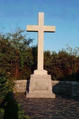
This memorial cross, erected in 1935 by the Daughters of the American Colonists, serves as a reminder of that original oak cross planted by a group of Englishmen in search of gold, adventure and natural resources. But more importantly, Cape Henry marks the beginning in a continuing chain of events which saw the shaping of American culture by English institutions and customs.
Erected 1935 by National Society, Daughters of the American Colonists.
Topics and series. This historical marker and memorial is listed in these topic lists: Colonial Era • Exploration • Notable Events • Notable Places • Settlements & Settlers • Waterways & Vessels. In addition, it is included in the Daughters of the American Colonists series list. A significant historical date for this entry is April 26, 1607.
Location. 36° 55.68′ N, 76° 0.532′ W. Marker is in Virginia Beach, Virginia. It is in Fort Story. Follow U.S. 60 (Atlantic
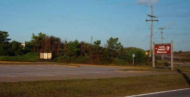
Avenue/Shore Road) into the First Landing State Park and enter the Fort Story military compound. Obtain directions at gate and proceed to the Cape Henry Memorial parking lot - corner of Atlantic Avenue and New Guinea Road. The memorial site is within Fort Story, but it is part of the National Park Service's Colonial National Historical Park. The marker is on the base of the memorial cross, northeast of the parking area. Touch for map. Marker is in this post office area: Virginia Beach VA 23459, United States of America. Touch for directions.
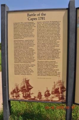
Other nearby markers. At least 8 other markers are within walking distance of this marker. Battle of the Capes 1781 (within shouting distance of this marker); French British Naval Engagement Off the Virginia Capes (within shouting distance of this marker); François Joseph Paul de Grasse (within shouting distance of this marker); Battle of the Capes (within shouting distance of this marker); First Landing (approx. 0.2 miles away); First Public Works Project of the United States Government (approx. 0.2 miles away); History of Cape Henry Lighthouse (approx. 0.2 miles away); British Naval Blockade and Cape Henry Lighthouse / The War of 1812 (approx. 0.2 miles away). Touch for a list and map of all markers in Virginia Beach.
Related marker. Click here for another marker that is related to this marker. An additional marker commemorating the "First Landing"
Also see . . . National Park Service: Cape Henry Memorial. (Submitted on October 12, 2009, by Richard E. Miller of Oxon Hill, Maryland.)
Additional keywords. Virginia
Company; Chesapeake Bay; First Landing; Christopher Newport; Susan Constant.
Credits. This page was last revised on February 1, 2023. It was originally submitted on October 11, 2009, by Richard E. Miller of Oxon Hill, Maryland. This page has been viewed 2,389 times since then and 94 times this year. Photos: 1, 2, 3. submitted on October 11, 2009, by Richard E. Miller of Oxon Hill, Maryland. 4. submitted on October 15, 2011, by Sandra Hughes Tidwell of Killen, Alabama, USA. 5. submitted on December 22, 2010, by Sandra Hughes Tidwell of Killen, Alabama, USA. 6. submitted on October 12, 2009, by Richard E. Miller of Oxon Hill, Maryland. • Syd Whittle was the editor who published this page.
