
Cannon Ferry in Chowan County, North Carolina — The American South (South Atlantic)
War on the Chowan River
Buffalo Country
Photographed by Bernard Fisher, October 27, 2012
1. War on the Chowan River CWT Marker
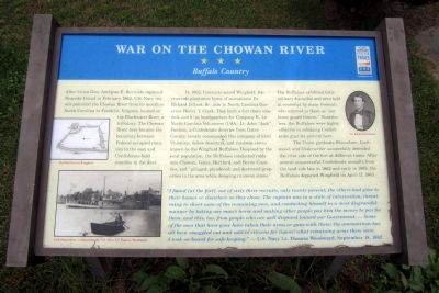
After Union Gen. Ambrose E. Burnside captured Roanoke Island in February 1862, U.S. Navy vessels patrolled the Chowan River from its mouth in North Carolina to Franklin, Virginia, located on the Blackwater River, a tributary. The Chowan River here became the boundary between Federal-occupied counties to the east and Confederate-held counties to the west.
In 1862, Unionists seized Wingfield, the riverside plantation home of secessionist Dr. Richard Dillard, Sr., aide to North Carolina governor Henry T. Clark. They built a fort there (one mile south) as headquarters for Company E, 1st North Carolina Volunteers (USA). Lt. John “Jack” Fairless, a Confederate deserter from Gates County loosely commanded this company of local Unionists, fellow deserters and runaway slaves known as the Wingfield Buffaloes. Despised by the local population, the Buffaloes conducted raids into Chowan, Gates, Hertford, and Bertie Counties, and “pillaged, plundered, and destroyed properties in the area while decoying runaway slaves.”
The Buffaloes exhibited little military discipline and were held in contempt by many Federals, who referred
this page online
The Union gunboats, Shawsheen, Lockwood, and Underwriter successfully defended the river side of the fort at different times. After several unsuccessful Confederate assaults from the land side late in 1862 and early in 1863, the Buffaloes departed Wingfield on April 17, 1863.
“I found [at the fort], out of sixty three recruits, only twenty present; the others had gone to their homes or elsewhere as they chose. The captain was in a state of intoxication, threatening to shoot some of the remaining men, and conducting himself in a most disgraceful manner by taking one man’s horse and making other people pay him the money to pay for them, and this, too, from people who are well disposed toward our Government. … Some of the men that have gone have taken their arms or guns with them; the ammunition has all been smuggled out and sold to citizens for liquor; what remaining arms there were I took on board for safe-keeping.” — U.S. Navy Lt. Thomas Woodward, September 18, 1862
(captions)
Buffalo Fort at Wingfield
USS Shawsheen, commanded by U.S. Navy Lt. Thomas Woodward
Dr. Richard Dillard
Erected by North
Photographed by Bernard Fisher, October 27, 2012
2. War on the Chowan River CWT Marker
Topics and series. This historical marker is listed in these topic lists: War, US Civil • Waterways & Vessels. In addition, it is included in the North Carolina Civil War Trails series list. A significant historical month for this entry is February 1862.
Location. Marker has been reported missing. It was located near 36° 16.235′ N, 76° 40.347′ W. Marker was in Cannon Ferry, North Carolina, in Chowan County. It was on Cannon's Ferry Road 0.4 miles west of Dillard’s Mill Road, on the left when traveling north. Touch for map. Marker was at or near this postal address: 117 Cannon's Ferry Rd, Tyner NC 27980, United States of America. Touch for directions.

Regionally, this marker was in North Carolina’s Coastal Plain. It was also in the American South, specifically in the Upper South, in the Tidewater, and on the Eastern Seaboard. Globally, it was in the North Atlantic Region, North America, the Western Hemisphere, the Western World, and the Anglosphere. Historically, it found itself in what was once the territory of the Mississippian Culture, one of the original Thirteen Colonies, one of the Confederate
Photographed by Bernard Fisher, October 27, 2012
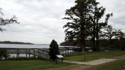
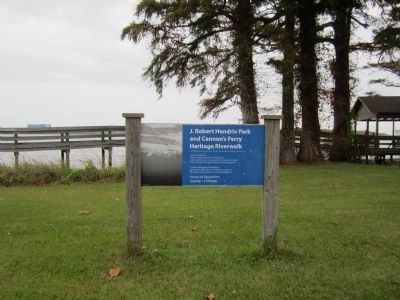
3. CWT marker is located in this park
Other nearby markers. At least 8 other markers are within 11 miles of this location, measured as the crow flies: The Chowan River (a few steps from this marker); The Herring Fishing Industry (within shouting distance of this marker); The Cannon’s Ferry Community (within shouting distance of this marker); Choanoac (approx. 6.4 miles away); Mary Louise Manley Thompson (approx. 7.1 miles away); Dr. Walter Reed (approx. 7.1 miles away); William P. Roberts (approx. 10.2 miles away); Gates County Confederate Monument (approx. 10.2 miles away). Touch for a list and map of all markers in Cannon Ferry.
Credits. This page was last revised on June 23, 2025. It was originally submitted on October 29, 2012, by Bernard Fisher of Richmond, Virginia. This page has been viewed 1,850 times since then and 112 times this year. Last updated on September 3, 2023, by Thomas Corwin of Fairfax, Virginia. Photos: 1, 2, 3. submitted on October 29, 2012, by Bernard Fisher of Richmond, Virginia.
