University in Minneapolis in Hennepin County, Minnesota — The American Midwest (Upper Plains)
You Are Here… Bohemian Flats
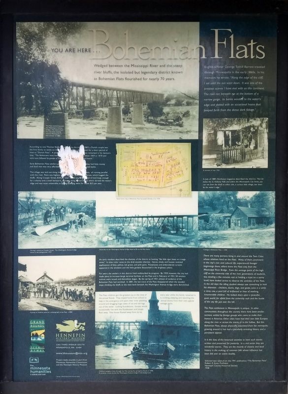
Photographed by McGhiever, June 12, 2022
1. You Are Here... Bohemian Flats Marker
Wedged between the Mississippi River and the steep river bluffs, the isolated but legendary district known as Bohemian Flats flourished for nearly 70 years.
English scholar George Tuthill Barrett traveled through Minneapolis in the early 1860s. In his memoirs he wrote, "Along the edge of the cliff, I sat until the sun went down. It was one of the prettiest scenes I have met with on this continent. The river ran beneath me at the bottom of a narrow gorge, its banks wooded to the water's edge and dotted with an occasional house that peeped forth from the dense dark foliage."
According to one Thomas Shafer who … to the area in 1869, a Danish couple was the first family to settle on the … known for a short period of time as "Danish Flats". A pioneer … had remarked in his memoirs that, "The Bohemians must have … about 1869 or 1870 and were soon followed by groups of Sla… and French."
Early Bohemian Flats settlers grew … they had little money and land rent was very affordable… ated banks.
The village was laid out along the … streets, all running parallel with the river. Rent was highest, about $… per year, on …
this page online
In July of 1887, Northwest magazine described the district, "Not far below the St. Anthony Falls and within the Minneapolis City limits, you can see from the bluff on either side, a curious little village, low down by the water's edge."
An early resident described the shanties of the district as looking "like little cigar boxes on a stage street." In time, color came to the drab wooden shanties - fences, sheds, and houses received applications of blue, yellow, red, green, and pink paint. Flowerpots and embroidered curtains appeared in the windows and the little gardens blossomed in the brightest colors.
For years, the settlers in this district lived undisturbed by progress. By 1929, however, the city had made plans to increase barge terminal facilities on the Flats and in February of 1931, 50 eviction notices were issued, and demolition began. By the spring
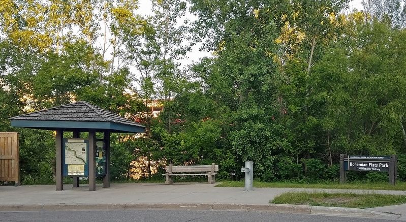
Photographed by McGhiever, June 12, 2022
2. Marker at the entrance to Bohemian Flats Park
The Flats children got the greatest joy at the time of the annual floods. They stayed home from school to help in the emergency and spent their time splashing around and dragging huge cakes of ice and old logs out of the water. Lacking foundations, houses would occasionally rise with the floodwaters and simply float away. One house floated away form its lot every year while the family remained in it, cooking, sleeping, and watching the annual drama from their own special vantage point.
There are many persons living in and around the Twin Cities whose relatives lived on the Flats. Many of them, prominent in the city's civic and cultural life, experienced meager beginnings there; others knew the Flats only from the Mississippi River Bridge. From the vantage point of the high cliff on the university side of the river, generations of students, too, stealing a few minutes rest or holding a tryst on a sunny knoll, have looked across to observe the activities of the Flats. In the old days the idling students always saw something to hold his attention - chickens, ducks, dogs, and goats, once in a while a stray cow, a yard full of driftwood or lines of washing, innumerable children. He looked down upon a peaceful, quiet world, far afield from the university rush and the bustle of the city life just over the hill.
The Flats settlement in Minneapolis is unique. In other communities throughout the country there have been similar sections settled by foreign groups who came to make their homes in America. Other cities have had their own little Europes along the river or across the tracks or in the hollow. But this Bohemian Flats, always physically separated from the metropolis growing around it, has had a peculiarly arresting history and a persistent appeal.
It is the duty of the historical societies to have such stories written and preserved for posterity. In a real sense they are wonderful stories. They are the records of citizens and local history in the making, of common folk whose influence has been felt over an entire locality.
Selected text taken from the 1941 publication "The Bohemian Flats"
Robert E. Scott, President
Hennepin County Historical Society
1938
Erected 2004 by Hennepin History Museum.
Topics. This historical marker is listed in these topic lists: Bridges & Viaducts • Immigration • Settlements & Settlers • Waterways & Vessels. A significant historical year for this entry is 1860.
Location. 44° 58.45′ N, 93° 14.474′ W. Marker is in Minneapolis, Minnesota, in Hennepin County. It is in University. It is on West River Parkway north of 22nd Avenue South, on the right when traveling north. The marker is on a kiosk at the entrance to Bohemian Flats Park. Touch for map. Marker is at or near this postal address: 2200 W River Pkwy, Minneapolis MN 55454, United States of America. Touch for directions.

Regionally, this marker is in the Twin Cities Metropolitan Area. It is also in the American Midwest, in the Corn Belt, and in the Great River Road Region. Globally, it is in North America, the Western Hemisphere, the Western World, and the Anglosphere. Historically, it finds itself in what was once Rupert’s Land, the territory of the Mississippian Culture, and the Louisiana Purchase.
Other nearby markers. At least 8 other markers are within walking distance of this marker: The West Bank (approx. 0.2 miles away); Mulford Q. Sibley Grove (approx. 0.2 miles away); Old Portage Trail (approx. 0.2 miles away); Rail Traffic in the Twin Cities (approx. 0.2 miles away); A Legacy of Public Service (approx. 0.2 miles away); A Global University (approx. ¼ mile away); Spanning the Sciences (approx. ¼ mile away); Distance Learning (approx. 0.3 miles away). Touch for a list and map of all markers in Minneapolis.
Credits. This page was last revised on September 4, 2023. It was originally submitted on December 4, 2022, by McGhiever of Minneapolis, Minnesota. This page has been viewed 533 times since then and 58 times this year. Last updated on September 3, 2023, by McGhiever of Minneapolis, Minnesota. Photos: 1, 2. submitted on December 4, 2022, by McGhiever of Minneapolis, Minnesota. • J. Makali Bruton was the editor who published this page.
