Cochranton in Crawford County, Pennsylvania — The American Northeast (Mid-Atlantic)
George Washington Actually Slept Near Here!
Inscription.
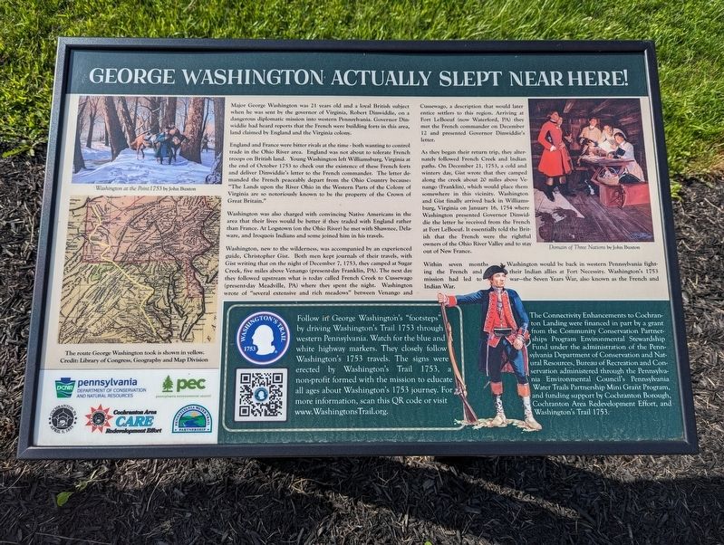
Major George Washington was 21 years old and a loyal British subject when he was sent by the governor of Virginia, Robert Dinwiddie, on a dangerous diplomatic mission into western Pennsylvania. Governor Dinwiddie had heard reports that the French were building forts in this area, land claimed by England and the Virginia colony.
England and France were bitter rivals at the time — both wanting to control trade in the Ohio River area. England was not about to tolerate French troops on British land. Young Washington left Williamsburg, Virginia at the end of October 1753 to check out the existence of these French forts and deliver Dinwiddie's letter to the French commander. The letter demanded the French peaceably depart from the Ohio Country because: "The Lands upon the River Ohio in the Western Parts of the Colony of Virginia are so notoriously known to be the property of the Crown of Great Britain."
Washington was also charged with convincing Native Americans in the area that their lives would be better if they traded with England rather than France. At Logstown (on the Ohio River) he met with Shawnee, Delaware, and Iroquois Indians and some joined him in his travels.
Washington, new to the wilderness, was accompanied by an experienced guide, Christopher Gist. Both men kept journals of their travels, with Gist writing that on the night of December 7, 1753, they camped at Sugar Creek, five miles above Venango (present day Franklin, PA). The next day they followed upstream what is today called French Creek to Cussewago (present-day Meadhville, PA where they spent the night. Washington wrote of "several extensive and rich meadows" between Venango and Cussewago, description that would later entice settlers to this region. Arriving at Fort LeBoeuf (now Watford, PA) they met the French commander on December 12 and presented Governor Diwwiddie's letter.
As they began their return trip, they alternately followed French Creek and Indian paths. On December 21, 1753, a cold and wintery day, Gist wrote that they camped along the creek about 20 miles above Venango (Franklin), which would place them somewhere in this vicinity. Washington and Gist finally arrived back in Williamsburg, Virginia on January 16, 1754 where Washington presented Governor Dinwiddie the letter he received from the French at Fort Leboeuf. It essentially told the British that the French were the rightful owners of the Ohio River Valley and to stay out of New France.
Within seven months Washington would be back in western Pennsylvania fighting the French and their Indian allies at Fort Necessity. Washington's 1753 mission had led to war — the Seven Years War, also known as the French and Indian War.
Follow
in George Washington's "footsteps" by driving Washington's Trail 1753 through western Pennsylvania. Watch for the blue and white highway markers. They closely follow Washington's 1753 travels. The signs were erected by Washington's Trail 1753, a non-profit formed with the mission to educate all ages about Washington's 1753 journey. For more information, scan this QR code or visit www.WashingtonsTrail.org.
The Connectivity Enhancements to Cochranton Landing were financed in part by a grant from the Community Conservation Partnerships Program Environmental Stewardship Fund under the administration of the Pennsylvania Department of Conservation and Natural Resources, Bureau of Recreation and Conservation administered through the Pennsylvania Environmental Council's Pennsylvania Water Trails Partnership Mini Grant Program, and funding support by Cochranton Borough, Cochranton Area Redevelopment Effort, and Washington's Trail 1753.
[Illustration captions]
• Washington at the Point 1753 by John Buxton
• Domain of the Three Nations by John Buxton
Erected by Pennsylvania DCNR - Pennsylvania Environmental Council - Cochranton Area Redevelopment Effort - Pennsylvania Water Trail Partnership.
Topics. This historical marker is listed in these topic lists: Colonial Era • Native Americans • Settlements & Settlers • War, French and Indian. A significant historical date for this entry is January 16, 1754.
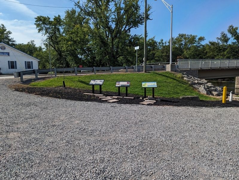
Location. 41° 31.122′ N, 80° 3.21′ W. Marker is in Cochranton, Pennsylvania, in Crawford County. Marker can be reached from Adams Street (Pennsylvania Route 173) west of West Street, on the right when traveling west. Located at Cochranton Landing. Touch for map. Marker is in this post office area: Cochranton PA 16314, United States of America. Touch for directions.
Other nearby markers. At least 8 other markers are within 8 miles of this marker, measured as the crow flies. French Creek (here, next to this marker); Cochranton Boat Launch (here, next to this marker); a different marker also named French Creek (a few steps from this marker); McFate Archaeological Site (a few steps from this marker); Carlton Bridge (approx. 3.7 miles away); a different marker also named French Creek (approx. 3.9 miles away); French Creek Feeder (approx. 5.6 miles away); a different marker also named French Creek Feeder (approx. 7.3 miles away). Touch for a list and map of all markers in Cochranton.
Credits. This page was last revised on September 5, 2023. It was originally submitted on September 5, 2023, by Mike Wintermantel of Pittsburgh, Pennsylvania. This page has been viewed 80 times since then and 32 times this year. Photos: 1, 2. submitted on September 5, 2023, by Mike Wintermantel of Pittsburgh, Pennsylvania.

