Wawatam Township in Mackinaw City in Cheboygan County, Michigan — The American Midwest (Great Lakes)
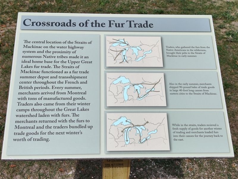
Crossroads of the Fur Trade
Captions
Traders, who gathered the furs from the Native Americans in the wilderness, brought their pelts to the Straits of Mackinac in early summer.
Also in the early summer, merchants shipped 90-pound bales of trade goods in large 40-foot long canoes from eastern cities to the Straits of Mackinac.
While in the straits, traders received a fresh supply of goods for another winter of trading and merchants loaded furs into their canoes for the journey back to the east.
Topics. This historical marker is listed in these topic lists: Anthropology & Archaeology • Colonial Era • Native Americans • Settlements & Settlers.
Location. 45° 47.277′ N, 84° 43.967′ W. Marker is in Mackinaw City, Michigan, in Cheboygan County. It is in Wawatam Township. Marker is on 03-12. The marker is on the foot path within the fort area, past the admission gate. Touch for map. Marker is at or near this postal address: 42 03-12, Mackinaw City MI 49701, United States of America. Touch for directions.
Other nearby markers. At least 8 other markers are within walking distance of this marker. Michigan's First Jewish Settler (within shouting distance of this marker); Revolutionary Times (within shouting distance of this marker); Mackinac Bridge (within shouting distance of this marker); Flags of Michilimackinac (within shouting distance of this marker); Fort Michilimackinac / Michilimackinac State Park (about 300 feet away, measured in a direct line); The Community Outside the Walls: Suburbs of Michilimackinac (about 400 feet away); Ironworkers Walk of Fame (about 700 feet away); Lighthouses of the Mackinac Straits (approx. 0.2 miles away). Touch for a list and map of all markers in Mackinaw City.
Credits. This page was last revised on October 5, 2023. It was originally submitted on September 6, 2023, by John Ridley of Chelsea, Michigan. This page has been viewed 47 times since then and 12 times this year. Photo 1. submitted on September 6, 2023, by John Ridley of Chelsea, Michigan. • J. Makali Bruton was the editor who published this page.
