Near Alto in Cherokee County, Texas — The American South (West South Central)
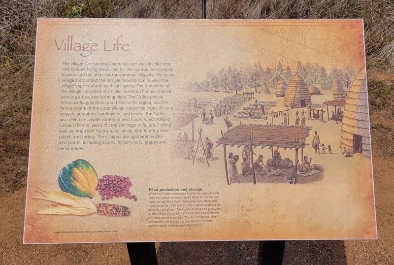
Village Life
Caption
Food production and storage
While the Caddo consumed freshly harvested foods, they also preserved and stored them for winter and early spring. Most foods, including corn, fruit, and meat could be dried and stored in woven baskets or ceramic containers. The Caddo built raised granaries in the village to store their foodstuffs and seeds for the next planting season. The air circulation under and around the granary protected its contents against mold, mildew, and infestations.
Images: Olivier, Emu, Banariou, Fotolla; illustration, Howell Golson
Erected by Caddo Mounds State Historic Site.
Topics. This historical marker is listed in these topic lists: Agriculture • Anthropology & Archaeology • Native Americans.
Location. 31° 35.721′ N, 95° 9.028′ W. Marker is near Alto, Texas, in Cherokee County. Marker is at the intersection of State Highway 21 and Farm to Market Road 2907 on State Highway 21. The marker is located in the southeast section of the Caddo Mounds State Historic Site. . Touch for map. Marker is at or near this postal address: 1649 TX-21, Alto TX 75925, United States of America. Touch for directions.
Other nearby markers. At least 8 other markers are within walking distance of this marker. Natural Spring (about 600 feet away, measured in a direct line); High Temple Mound (about 600 feet away); Borrow Pit (about 700 feet away); Low Platform Mound (about 700 feet away); Burial Mound (approx. 0.2 miles away); Waystation for Travelers and Traders (approx. 0.2 miles away); A Welcome Rest (approx. ¼ mile away); Zebulon Pike Campsite (approx. ¼ mile away). Touch for a list and map of all markers in Alto.
More about this marker. The marker is located in the Caddo Mounds State Historic Site and it does require a small entry fee to visit.
Also see . . . Caddo Mounds State Historic Site. Texas State Historical Association (TSHA)
Caddo Mounds State Historic Site, one of the best known and intensively investigated Indian sites in Texas, is on State Highway 21 about six miles southwest of Alto in southern Cherokee County. It comprises much of what is known to archeologists as the George C. Davis Site, the southwesternmost ceremonial center of the Caddoan peoples who flourished on the western edge of the woodlands of eastern North America between 1000 B.C. and A.D. 1550. Caddo Mounds consists of three large earthen mounds, as well as a large portion of a prehistoric village.(Submitted on September 8, 2023, by James Hulse of Medina, Texas.)
Credits. This page was last revised on September 8, 2023. It was originally submitted on September 8, 2023, by James Hulse of Medina, Texas. This page has been viewed 51 times since then and 10 times this year. Photos: 1, 2, 3, 4. submitted on September 8, 2023, by James Hulse of Medina, Texas.


