Near Alto in Cherokee County, Texas — The American South (West South Central)
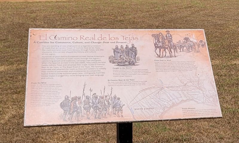
El Camino Real de los Tejas
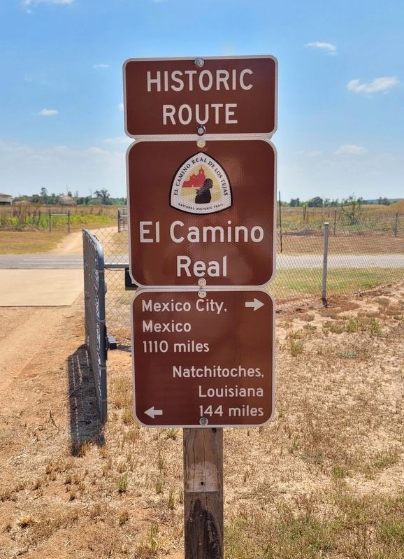
You are standing at one small point on a legendary network of roads that arc across Texas - El Camino Real de los Tejas. The main overland route from Mexico, through Texas, and into Louisiana, this corridor shaped the history and culture of the region.
Hundreds of years before Europeans arrived, Native Americans established a network of trade routes through the region - connecting people and traditions, carrying crops and goods. When the Spanish arrived in the late 1600s, they called the local Caddo Indians Tejas and renamed their trade routes El Camino Real de los Tejas, or The Royal Road of the Tejas. The Spanish extended and adapted the roads as they sent soldiers to solidify their claims of possession and missionaries to convert the Native Americans. A hundred years later, immigrants from the United States traveled this route bringing their own language and culture.
Captions
From the West
Alonso De León led four Spanish military explorations, known as entradas, between 1686 and 1689 to search for La Salle's doomed French settlement, Fort St. Louis. His entradas likely used the existing Native American routes and opened the way to establishing the first mission in East Texas, San Francisco de los Tejas, in 1690. The missions provided a foundation for the Spanish presence in Texas and developed into towns and cities that flourish today, like Nacogdoches, Crockett, and San Antonio.
Caught in the Middle
European settlers from both east and west converged in Texas and forced many of the local Native American groups, like the Caddo and Ais, away from their traditional homelands. Today the Caddo Nation Tribal Complex is located in Binger, Oklahoma.
El Camino Real de los Tejas
The route, made up of many routes, stretched across 2,500 miles, and parts of it are still in use today as Texas State Highway 21 and other highways in south and east Texas.
From East to West
Immigrants from the United States began arriving in Mexican-held Texas around 1823, settling on the coastal plain between the San Antonio and Brazos Rivers. Over the next few years, increasing southwest-bound traffic along El Camino Real de los Tejas brought more Americans looking for opportunities and inexpensive farmland. When Texas declared its independence from Mexico in 1836, more than 25,000 American immigrants called Texas their home.
Texas Mapped
French geographer Guillaume de I'Isle published this map of "La Louisiane" in 1718. It is the first detailed map of the Gulf Coast region and the Mississippi River, as well
as the first printed map to include Texas.
Illustration: Howell Golson
Erected by Caddo Mounds State Historic Site.
Topics. This historical marker is listed in these topic lists: Anthropology & Archaeology • Industry & Commerce • Native Americans • Roads & Vehicles. A significant historical year for this entry is 1686.
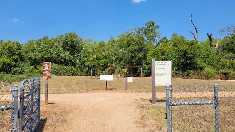
Location. 31° 35.943′ N, 95° 9.063′ W. Marker is near Alto, Texas, in Cherokee County. Marker is at the intersection of State Highway 21 and Farm to Market Road 2907 on State Highway 21. The marker is located in the northern section of the Caddo Mounds State Historic Site. Touch for map. Marker is at or near this postal address: 1649 TX-21, Alto TX 75925, United States of America. Touch for directions.
Other nearby markers. At least 8 other markers are within walking distance of this marker. Famous and Infamous Journeys (a few steps from this marker); Zebulon Pike Campsite (a few steps from this marker); A Welcome Rest (within shouting distance of this marker); Waystation for Travelers and Traders (about 400 feet away, measured in a direct line); Travel Encounters (about 500 feet away); Burial Mound (about 500 feet away); Natural Spring (approx. 0.2 miles away); Low Platform Mound (approx. ¼ mile away). Touch for a list and map of all markers in Alto.
More about this marker. The marker is located in the Caddo Mounds State Historic Site and it does require a small entry fee to visit.
Also see . . . Caddo Mounds State Historic Site. Texas State Historical Association (TSHA)
Caddo Mounds State Historic Site, one of the best known and intensively investigated Indian sites in Texas, is on State Highway 21 about six miles southwest of Alto in southern Cherokee County. It comprises much of what is known to archeologists as the George C. Davis Site, the southwesternmost ceremonial center of the Caddoan peoples who flourished on the western edge of the woodlands of eastern North America between 1000 B.C. and A.D. 1550. Caddo Mounds consists of three large earthen mounds, as well as a large portion of a prehistoric village.(Submitted on September 8, 2023, by James Hulse of Medina, Texas.)
Credits. This page was last revised on September 9, 2023. It was originally submitted on September 8, 2023, by James Hulse of Medina, Texas. This page has been viewed 64 times since then and 18 times this year. Photos: 1, 2, 3. submitted on September 9, 2023, by James Hulse of Medina, Texas.


