Morrisville in Wake County, North Carolina — The American South (South Atlantic)
The Trading Path
A Wilderness Road
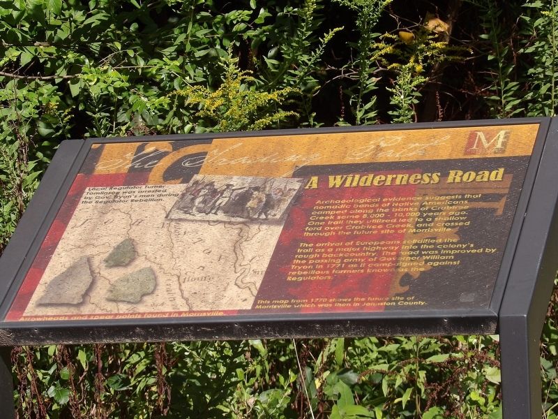
Archaeological evidence suggests that nomadic bands of Native Americans camped along the banks of Crabtree Creek some 8,000-10,000 years ago. One trail they utilized led to a shallow ford over Crabtree Creek, and crossed through the future site of Morrisville.
The arrival of Europeans solidified the trail as a major highway into the colony's rough backcountry. The road was improved by the passing army of Governor William Tryon in 1771 as it campaigned against rebellious farmers known as the Regulators.
[Captions]
• Local Regulator Turner Tomlinson was arrested by Gov. Tryon's men during the Regulator Rebellion.
• This map from 1770 shows the future site of Morrisville which was then in Johnston County.
• Arrowheads and spear points found in Morrisville.
Erected by Morrisville History Center.
Topics. This historical marker is listed in these topic lists: Colonial Era • Native Americans • Roads & Vehicles. A significant historical year for this entry is 1771.
Location. 35° 49.346′ N, 78° 49.625′ W. Marker is in Morrisville, North Carolina, in Wake County. Marker is on Morrisville Carpenter Road west of Church Street (North Carolina Road 1637), on the right when traveling west. Touch for map. Marker is in this post office area: Morrisville NC 27560, United States of America. Touch for directions.
Other nearby markers. At least 8 other markers are within walking distance of this marker. Morrisville Station (within shouting distance of this marker); An Ancient Past (within shouting distance of this marker); Morrisville Engagement (about 300 feet away, measured in a direct line); Pugh House (about 300 feet away); The New South (about 500 feet away); Keeping the Faith (about 700 feet away); Skirmish at Morrisville (about 800 feet away); William G. Clements (approx. 0.2 miles away). Touch for a list and map of all markers in Morrisville.
Also see . . .
1. Regulator Movement. NCpedia website entry:
Regulator Movement in mid-eighteenth-century North Carolina was a rebellion initiated by residents of the colony's inland region, or backcountry, who believed that royal government officials were charging them excessive fees, falsifying records, and engaging in other mistreatments. (William S. Powell, Encyclopedia of North Carolina via NCPedia, 2006) (Submitted on September 17, 2023, by Duane and Tracy Marsteller of Murfreesboro, Tennessee.)
2. William Tryon. American Battlefield Trust website entry:
A Royal governor of both North Carolina and New York, he was extremely loyal to the British crown – including being involved in a plot to kidnap George Washington during the Revolution. (Submitted on September 17, 2023, by Duane and Tracy Marsteller of Murfreesboro, Tennessee.)
Credits. This page was last revised on October 13, 2023. It was originally submitted on September 17, 2023, by Duane and Tracy Marsteller of Murfreesboro, Tennessee. This page has been viewed 55 times since then and 13 times this year. Photos: 1, 2. submitted on September 17, 2023, by Duane and Tracy Marsteller of Murfreesboro, Tennessee.

