Riverside in Cook County, Illinois — The American Midwest (Great Lakes)
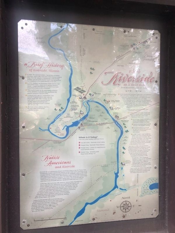
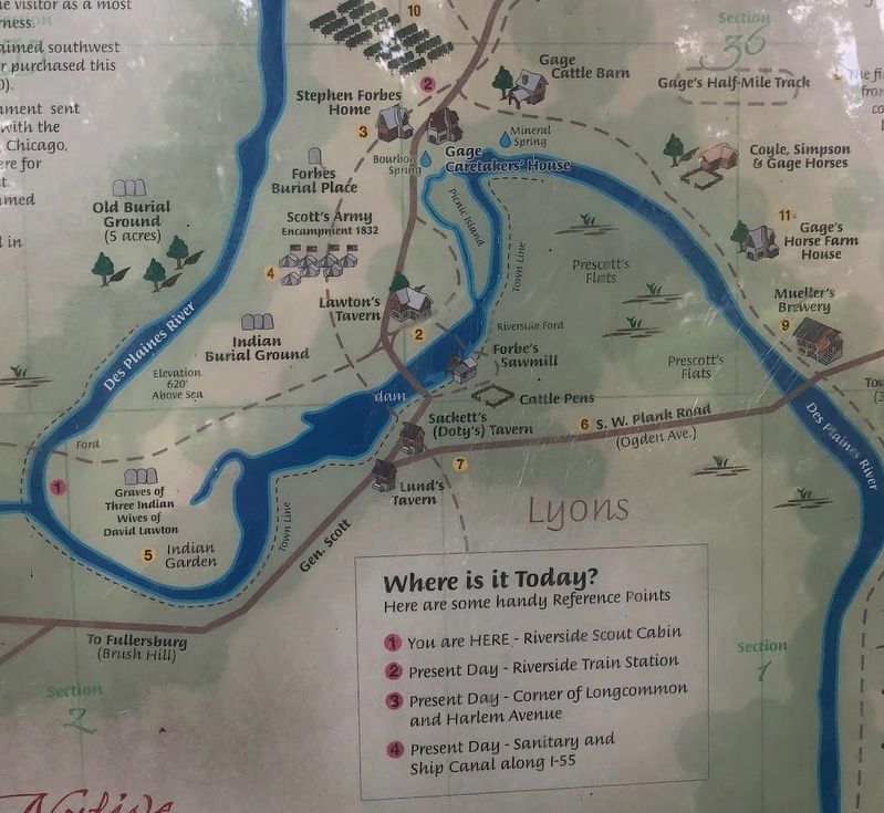
Riverside As It Once Was
1. In 1828, The Lawton brothers, David and Bernardus (Barney), came to the area and established an outpost. They chose the area for its proximity to the Chicago Portage and one of the busiest land trails going from Fort Dearborn to the fertile prairies in the west.
2. In 1831, Stephen Van Rensselaer Forbes and his wife, Elvira Bates Forbes, came out to Barley Lawton's Tavern - a place described by one visitor as a most remarkable home in the wilderness.
3. They built a home on the unclaimed southwest corner of Section 36 (Forbes later purchased this quarter section in 1835 for $200.
4. In July of 1832, the U.S. Government sent General Winfield Scott to help with the Black Hawk War. After leaving Chicago, Scott and his army camped here for 10 days before proceeding west. Today's Scottwood Road is named after the general.
5. The Potawatomi Indians lived in the area and traded goods with the Lawtons.
6. The first stage of the Southwest Plank Road was completed from Chicago to Riverside in 1848. It consisted of a continuous line of two stringers onto which eight foot long, three inch thick planks were laid. It was eventually extended to Naperville and was operated as a toll road, run by the private company that built it. Tolls ranged from 37½ cents for a four-horse vehicle to 12½ cents for a horse and rider. It was a very successful endeavour since the areas crossed were oftentimes muddy.
With new main arteries for traffic came commercial enterprise.
7. Sackett's Tavern and Lund's Tavern were opened to provide shelter and food for both travelers and horses on the Southwest Plank Road.
8. And, Kellogg's Tavern and Storr's Tavern were operated on the northeast on Barry Point Road.
9. Another prominent landmark at the time, was Mueller's Brewery.
10. The Wesencraft family arrived in 1855, purchased 26½ acres and established a small farm and orchard.
11. In 1864, David A. Gage bought up about 1600 acres of land in the area for an estate and horse farm. This purchase was made in the same year as the opening of the newly laid double-track of the Chicago, Burlington and Quincy Railroad that ran parallel to the Southwest Plank Road.
And then, in 1868, a group of eastern businessmen formed a company to build a suburb accessible to the large city on the shore of Lake Michigan. Emery Childs purchased the 1600 acres of land that Gage owned and transferred it to the newly incorporated Riverside Improvement Company in 1869.
The next step... hire a landscape architect to carry out the company's dream of a perfect village in a perfect setting. They settled on Olmsted, Vaux and Company with Frederick Law Olmsted taking a lead role and construction began.
Then, in 1875, an election was held with twenty nine votes polled in which Carol Gaytes was elected town president and the Village of Riverside was born!
Native Americans and Riverside
Riverside sits on a peninsula of land created by a loop in the Des Plaines River, strategically located opposite the junction of Salt Creek and in proximity to the Chicago Portage, a land connection between the navigable waters of the Great Lakes and the Mississippi River. Those features made it a desirable location for its earliest Native American residents. The Green Pay, Barry Point, and Portage Trails, as well as numerous smaller Indian trails, all passed through the area that is now Riverside and were significant trade and travel routes.
In the late 18th and early 19th centuries, various tribes migrated into Illinois and took over land formerly occupied by the Illinois and Miami Indians. The Potawatomi was the dominant tribe that inhabited the area that is now Riverside, and together with the Chippewa and Ottawa formed a tribal alliance known as the "Council of Three Fires" and "Original People." Migratory hunters/gatherers, they lived on wild game, fish, and roots, but later adapted to farming, tending fields of corn, beans, and squash.
Indian
burial grounds and encampments were located between the Des Plaines River and Fairbank Road. Arrowheads and other artifacts have been found in Indian Gardens and Scottswood Common. Although Native Americans were forced off their lands in the early 1800's, some Potawatomi remained in the area into the 1850's.
Topics and series. This historical marker is listed in these topic lists: Native Americans • Roads & Vehicles • Settlements & Settlers • Waterways & Vessels. In addition, it is included in the Black Hawk War series list. A significant historical year for this entry is 1828.
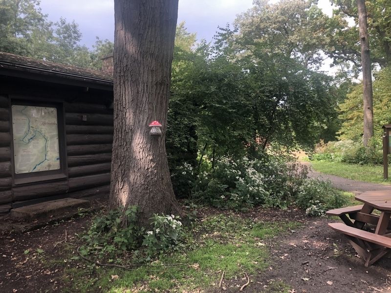
Location. 41° 49.125′ N, 87° 49.888′ W. Marker is in Riverside, Illinois, in Cook County. Marker is on Fairbank Road, 0.3 miles west of Coonley Road. The marker is on the wall to the right of the entrance into the Riverside Scout Cabin, which is about a 250-foot walk across a grass field from Fairbank Road. Touch for map. Marker is at or near this postal address: 417 Fairbank Road, Riverside IL 60546, United States of America. Touch for directions.
Other nearby markers. At least 8 other markers are within walking distance of this marker. Avery Coonley House (approx. 0.2 miles away); The Hofmann Dam (approx. half a mile away); Old River-Crossing (approx. 0.6 miles away); Bourbon Spring (approx. 0.7 miles away); Stephen Van Rensselaer Forbes Home Site (approx. ¾ mile away); Veterans Memorial (approx. ¾ mile away); World War Memorial (approx. 0.8 miles away); Sergeant James P. Quinn (approx. 0.8 miles away). Touch for a list and map of all markers in Riverside.
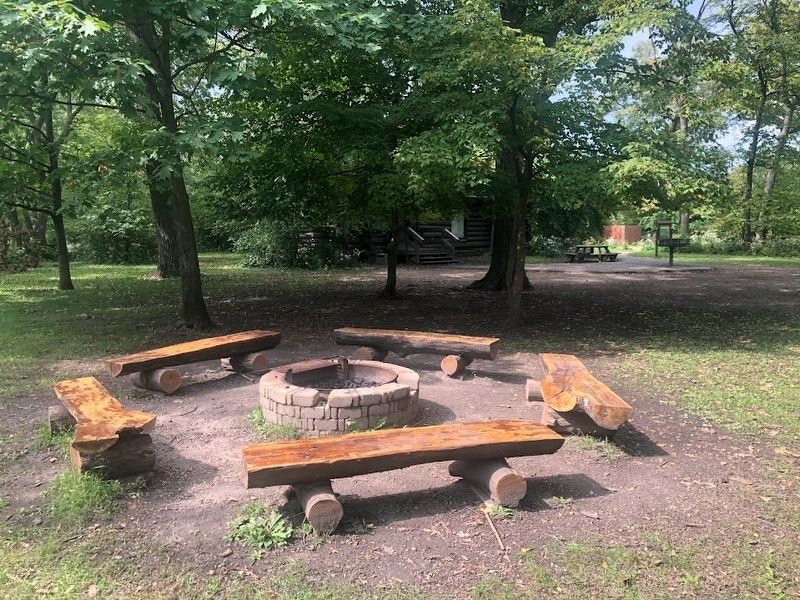
More about this marker. The Scout Cabin was built in 1928 as an overnight retreat for Boy Scouts. It is owned and operated by the Riverside Department of Parks and Recreation.
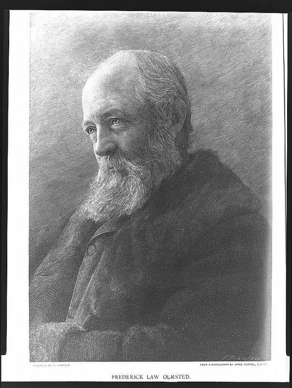
Library of Congress, 1893
5. Frederick Law Olmsted (1822-1903)
Riverside was laid out in 1869 by Olmsted, Vaux & Co., the firm co-founded by famed landscape architect Frederick Law Olmsted, whose many other famous works include New York's Central Park and the grounds of the Capitol in Washington, D.C. Riverside is considered one of the first planned communities in the United States.
Credits. This page was last revised on October 4, 2023. It was originally submitted on September 26, 2023, by Sean Flynn of Oak Park, Illinois. This page has been viewed 175 times since then and 125 times this year. Photos: 1, 2, 3, 4, 5. submitted on September 26, 2023, by Sean Flynn of Oak Park, Illinois. • Andrew Ruppenstein was the editor who published this page.
