East Side in Independence in Jackson County, Missouri — The American Midwest (Upper Plains)
Thomson House
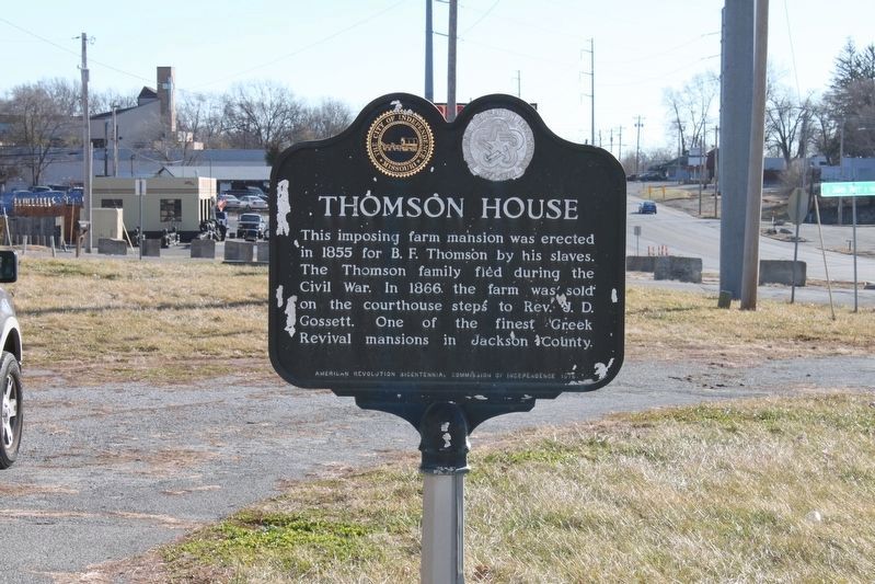
Photographed by Michael E Sanchez, Jr., January 4, 2020
1. Thomson House Marker
Erected 1976 by American Revolution Bicentennial Commission of Independence.
Topics and series. This historical marker is listed in these topic lists: African Americans • Agriculture • Architecture • War, US Civil. In addition, it is included in the The Spirit of ’76, America’s Bicentennial Celebration series list. A significant historical year for this entry is 1855.
Location. Marker has been permanently removed. It was located near 39° 3.394′ N, 94° 27.797′ W. Marker was in Independence, Missouri, in Jackson County. It was in the East Side. It was at the intersection of U.S. 40 and East 36th Street, on the left when traveling east on U.S. 40. The driveway is gravel, u-shaped, and fully accessible. Touch for map. Marker was at or near this postal address: 9800 E US Hwy 40, Independence MO 64052, United States of America.
We have been informed that
this page online
Regionally, this marker was in Greater Kansas City. It was also in the American Midwest, in the Lewis & Clark Corridor, in the Corn Belt, and on the Santa Fe Trail Corridor. Globally, it was in North America, the Western Hemisphere, the Western World, and the Anglosphere. Historically, it found itself in what was once the territory of the Mississippian Culture, the Louisiana Purchase, and the Antebellum South.

Other nearby markers. At least 8 other markers are within 3 miles of this location, measured as the crow flies: The Truman Sports Complex (approx. 1.1 miles away); Hill Farm & Cemetery (approx. 1.8 miles away); World War Memorial (approx. 1.9 miles away); Woodson House (approx. 2½ miles away); Battle Line at Railroad Cut (approx. 2.7 miles away); Mount Washington Cemetery Bridge Facts (approx. 2.8 miles away); James Bridger Gravesite (approx. 2.9 miles away); William Rockhill Nelson Chapel (approx. 3 miles away). Touch for a list and map of all markers in Independence.
More about this marker. Unfortunately, the
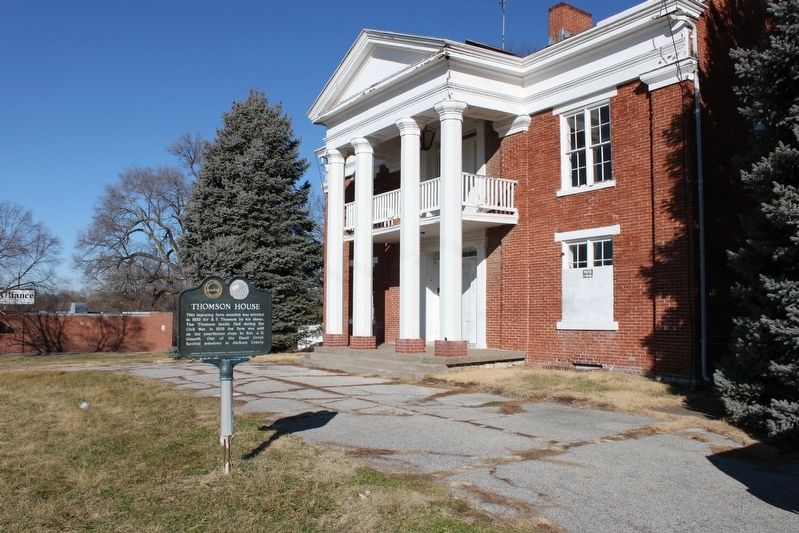
Photographed by Michael E Sanchez, Jr., January 4, 2020
2. Thomson House Marker
Additional commentary.
1. The Home Burned
Unfortunately, the home caught fire twice and was demolished.
— Submitted September 29, 2023, by Trisha W Osburn of Kingsville, Missouri.
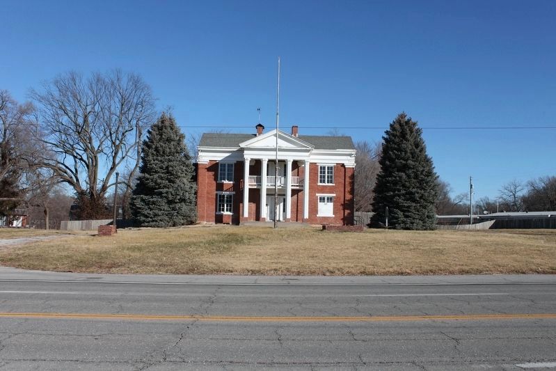
Photographed by Michael E Sanchez, Jr., January 4, 2020
3. Thomson House
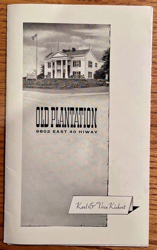
Photographed by Richard Thomson, January 30, 2022
4. Thomson House Marker
Brochure from home as a restaurant in the 50’s.
Photographed by Richard Thomson, January 30, 2022
5. Thomson House Marker
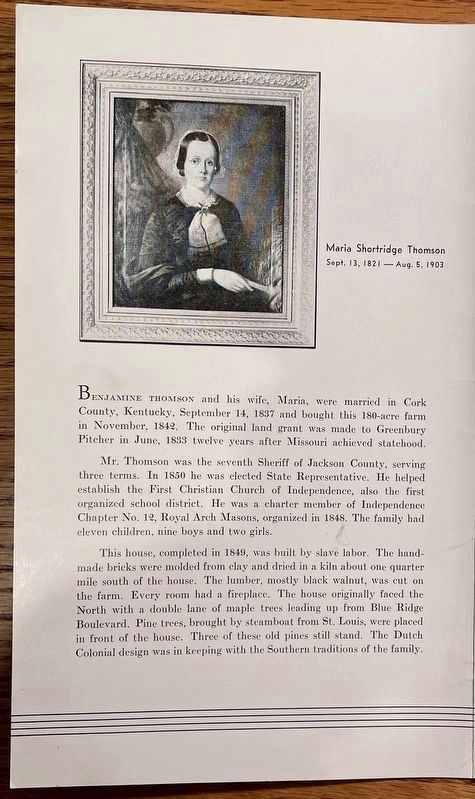
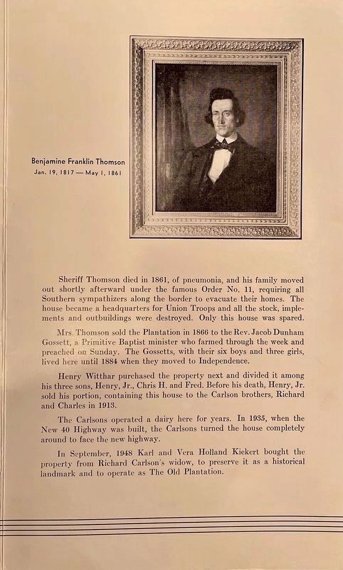
Photo/bio of Mr and Mrs. B.F. Thomson from the brochure.
Photographed by Richard Thomson, January 30, 2022
6. Thomson House Marker
Photo/bio of B.F. Thomson cont’d
Credits. This page was last revised on February 13, 2026. It was originally submitted on January 5, 2020, by Michael E Sanchez, Jr. of Kansas City, Missouri. This page has been viewed 3,469 times since then and 52 times this year. Last updated on September 29, 2023, by Trisha W Osburn of Kingsville, Missouri. Photos: 1, 2, 3. submitted on January 5, 2020, by Michael E Sanchez, Jr. of Kansas City, Missouri. 4, 5, 6. submitted on January 30, 2022, by Richard Thomson of Oxnard, California. • Devry Becker Jones was the editor who published this page.
