
Near Minnieville in Prince William County, Virginia — The American South (Mid-Atlantic)
Minnieville
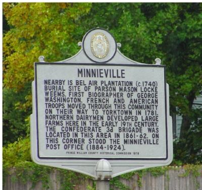
Photographed by J. J. Prats, September 24, 2006
1. Minnieville Marker
Erected 1978 by the Prince William County Historical Commission. (Marker Number 21.)
Topics and series. This historical marker is listed in these topic lists: Agriculture • Settlements & Settlers • War, US Civil • War, US Revolutionary. In addition, it is included in the Virginia, Prince William County Historical Commission series list. A significant historical year for this entry is 1781.
Location. 38° 38.161′ N, 77° 21.136′ W. Marker is near Minnieville, Virginia, in Prince William County. It is at the intersection of Minnieville Road (County Route 640) and Cardinal Drive, on the right when traveling north on Minnieville Road. Touch for map. Marker is in this post office area: Woodbridge VA 22193,
this page online

Regionally, this marker is in the Washington Metropolitan Area, in Northern Virginia, and in the Piedmont. It is also in the American South, specifically in the Upper South, in the Mid-Atlantic, and on the Eastern Seaboard. Globally, it is in the North Atlantic Region, North America, the Western Hemisphere, the Western World, and the Anglosphere. Historically, it finds itself in what was once the territory of the Mississippian Culture, one of the original Thirteen Colonies, one of the Confederate States of America, and the Antebellum South.
Other nearby markers. At least 8 other markers are within 2 miles of this marker, measured as the crow flies: Greenwood Presbyterian Church and Cemetery (approx. half a mile away); Bel Air Plantation (approx. ¾ mile away); Carey M. Perkinson (approx. ¾ mile away); Montclair Veterans Flagpole (approx. 0.8 miles away); “Camp Fisher” Civil War Campsite (approx. 1.1 miles away); “Let There Be Lights” (approx. 1.6 miles away); Howison Homestead (approx. 1.6 miles away); a different marker also named Howison Homestead (approx. 1.6 miles away).
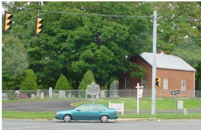
Photographed by J. J. Prats, September 24, 2006
2. Minnieville Marker
Also see . . .
1. Mason Locke Weems (1759-1825). Brief biography on the Historic Dumfries Virginia website. (Submitted on December 19, 2006.)
2. Architectural Description of Bel Air Plantation. From the Historic Prince William website. Historic Prince William is a non-profit organization, working in partnership with other historical groups in the local area to preserve the history of Prince William County. (Submitted on August 29, 2007, by Kevin W. of Stafford, Virginia.)
3. Bel Air - the oldest (or second oldest...) house in Prince William County. Photo credit: Karyn Warburton (Submitted on August 29, 2007, by Kevin W. of Stafford, Virginia.)
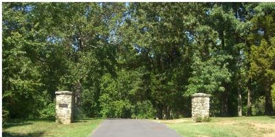
Photographed by Kevin W., September 12, 2007
3. The gates to Bel Air
Bel Air is on private property. While not gated, No Trespassing signs warn against unwanted visitors.
Credits. This page was last revised on October 2, 2023. It was originally submitted on December 19, 2006, by J. J. Prats of Powell, Ohio. This page has been viewed 5,518 times since then and 81 times this year. Last updated on October 2, 2023, by N. Jozsa of Woodbridge, Virginia. Photos: 1, 2. submitted on December 19, 2006, by J. J. Prats of Powell, Ohio. 3. submitted on September 12, 2007, by Kevin W. of Stafford, Virginia. • Bernard Fisher was the editor who published this page.
