Marker Logo
THE HISTORICAL
MARKER DATABASE
“Bite-Size Bits of Local, National, and Global History”
Near Lake Ridge in Prince William County, Virginia — The American South (Mid-Atlantic)
 

Selecman’s (Snyder’s) Ford
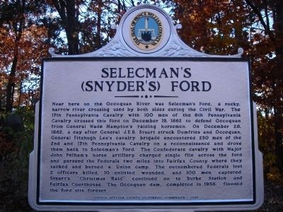
 
 
Selecman's (Snyder's) Ford Marker image. Click for full size.
November 14, 2010
1. Selecman's (Snyder's) Ford Marker
Inscription. Near here on the Occoquan River was Selecman’s Ford, a rocky, narrow river crossing used by both sides during the Civil War. The 17th Pennsylvania Cavalry with 100 men of the 6th Pennsylvania Cavalry crossed this ford on December 19, 1862 to defend Occoquan from General Wade Hampton’s raiding horsemen. On December 28, 1862, a day after General J.E.B. Stuart struck Dumfries and Occoquan, General Fitzhugh Lee’s cavalry brigade encountered 250 men of the 2nd and 17th Pennsylvania Cavalry on a reconnaissance and drove them back to Selecman’s Ford. The Confederate cavalry with Major John Pelham’s horse artillery charged single file across the ford and pursued the Federals two miles into Fairfax County where they sacked and burned a Union camp. The outnumbered Federals lost 2 officers killed, 10 enlisted wounded, and 100 men captured. Stuart’s “Christmas Raid” continued on to Burke Station and Fairfax Courthouse. The Occoquan dam, completed in 1958, flooded the ford site forever.
 
Erected 2010 by Prince William County Historical Commission.
 
Topics and series. This historical marker is listed in these topic lists: War, US Civil
Paid Advertisement
Click or scan to see
this page online
Waterways & Vessels. In addition, it is included in the Virginia, Prince William County Historical Commission series list. A significant historical month for this entry is December 1917.
 
Location. 38° 41.639′ N, 77° 17.799′ W. Marker is near Lake Ridge, Virginia, in Prince William County. It is on Antietam Road, on the left when traveling north. Marker is located beside the Antietam Elementary School. Touch for map. Marker is at or near this postal address: 12000 Antietam Road, Woodbridge VA 22192, United States of America. Touch for directions.

Regionally, this marker is in the Washington Metropolitan Area, in Northern Virginia, and in the Piedmont. It is also in the American South, specifically in the Upper South, and in the Mid-Atlantic. Globally, it is in the North Atlantic Region, North America, the Western Hemisphere, the Western World, and the Anglosphere. Historically, it finds itself in what was once the territory of the Mississippian Culture, one of the original Thirteen Colonies, one of the Confederate States of America, and the Antebellum South.

Other nearby markers. At least 8 other markers are within 2 miles of
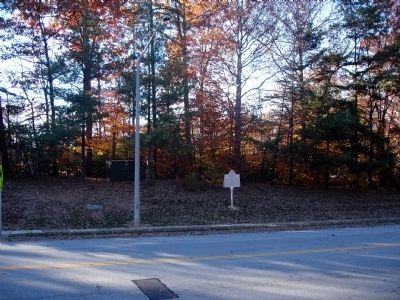
Selecman's (Snyder's) Ford Marker image. Click for full size.
November 14, 2010
2. Selecman's (Snyder's) Ford Marker
this marker, measured as the crow flies: A different marker also named Selecman’s (Snyder’s) Ford (approx. 0.7 miles away); Woodbridge Airport (approx. 1.2 miles away); James John McCoart (approx. 1½ miles away); Mary Williams (approx. 1½ miles away); Deloris Hampton (approx. 1½ miles away); Lillie Gallman Jessie (approx. 1½ miles away); Trevor Blake (approx. 1½ miles away); G. Richard (Rick) Pfizner (approx. 1½ miles away). Touch for a list and map of all markers in Lake Ridge.
 
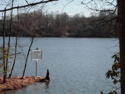
The Other Selecman's (Snyder's) Ford Marker image. Click for full size.
Photographed by B Horton, March 2, 2011
3. The Other Selecman's (Snyder's) Ford Marker
This one is on Fairfax County side of Occoquan Reservoir with view of Prince William County in distance. Location is in Sandy Run Regional Park.
Occoquan Reservoir image. Click for full size.
November 14, 2010
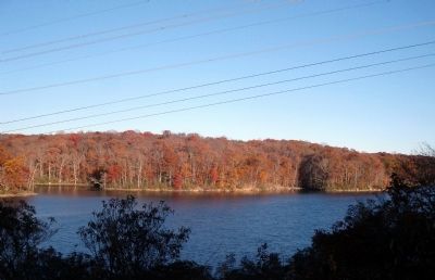
4. Occoquan Reservoir
Typical view north across the Occoquan River Reservoir into Fairfax County - near the area of the former Selecman's Ford - about 1 mile upstream of the Occoquan Dam.
 
 
Credits. This page was last revised on December 2, 2023. It was originally submitted on November 14, 2010. This page has been viewed 2,340 times since then and 90 times this year. Last updated on October 3, 2023. Photos:   1, 2. submitted on November 14, 2010.   3. submitted on March 3, 2011, by B Horton of Fairfax Station, Virginia.   4. submitted on November 14, 2010. • Bernard Fisher was the editor who published this page.

m=233890

CeraNet Cloud Computing sponsors the Historical Marker Database.
This website earns income from purchases you make after using our links to Amazon.com. We appreciate your support.
Paid Advertisement
Jul. 8, 2026