Grimsby in Niagara Region, Ontario — Central Canada (North America)
Fisheries in Grimsby
Grimsby Nature
Fisheries in Grimsby
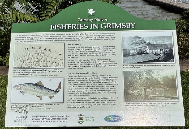
The fish once caught in Lake Ontario help tell the story of settlement and growth around Forty Mile Creek. The Neutral Confederacy, Niagara's first inhabitants, were well established in the area, benefitting from the abundant fish and wildlife and the natural travelling system provided by Lake Ontario. In the 1790s, the creek was resettled by United Empire Loyalists coming from the United States. They called their new community "The Forty" and would soon build a harbour that would become a bustling hub of trade and the centre of the local commercial fishing industry.
The Hand Family
The Hand family were particularly prominent in Grimsby's fishing industry. Coming to Grimsby in the 1880s, the Hands purchased land around Forty Mile Pond to establish a commercial fishing business. John Hand, along with his sons Edward, Phillip. Frank and Jim, built processing facilities on shore and shared in running the operation. Between April and November, Grimsby's fishermen caught Whitefish, Lake Trout, Lake Herring, Cisco and Atlantic Salmon. The fish caught were filleted and packed at the Hand facilities and then shipped to nearby markets in St. Catharines. Hamilton and as far as New York City.
Changing Environmental Conditions
Though Lake Ontario commercial fishing prospered in the nineteenth century, environmental changes caused by development eventually led to its demise. The dams built in the 1800s to power mills along the creeks restricted Allantic Salmon spawning. By the 1830s Sea Lamprey and other invasive species began to appear, in Lake Ontario, deteriorating native fish populations. Pollution was also a contributor, first from silt flowing off agricultural tracts and other cleared lands and then from industrial chemical pollutants introduced after the Second World War. The commercial fishing industry was no longer viable. In 1965, a fire destroyed the Hand's fishing facilities and the pond was filled in. Foran's Marine and Lakecourt Marine now operate where the fisher was once located. Even though commercial fishing is no longer viable, many enthusiasts continue to fish in Grimsby for fun and for sport.
This plaque was provided thanks to the generosity of Water Smart Niagara in conjunction with the Town of Grimsby.
Erected by Town of Grimsby.
Topics. This historical marker is listed in these topic lists: Industry & Commerce • Native Americans • Settlements & Settlers • Waterways & Vessels.
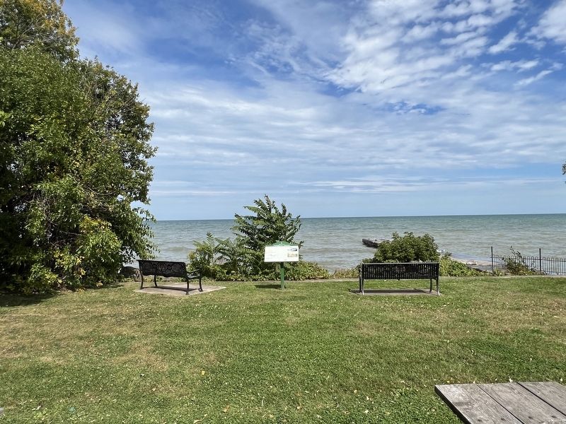
Location. 43° 12.288′ N, 79° 33.21′ W. Marker is in Grimsby, Ontario, in Niagara Region. The marker is in the Grimsby 1812 Bicentennial Peace Garden, past the end of Elizabeth Street, approx. 100 metres north of Lakeside Drive. It is accessible from the parking lot. Touch for map. Marker is in this post office area: Grimsby ON L3M 2K6, Canada. Touch for directions.
Other nearby markers. At least 8 other markers are within 2 kilometers of this marker, measured as the crow flies. Grimsby 1812 Bicentennial Gazebo (within shouting distance of this marker); The War of 1812 (within shouting distance of this marker); Grimsby 1812 Bicentennial Flagpole (within shouting distance of this marker); Forty Mile Creek (within shouting distance of this marker); Engagement at the Forty Mile Creek (within shouting distance of this marker); Grimsby Town Bell (approx. 1.7 kilometers away); First Town Meeting (approx. 1.7 kilometers away); Colonel Robert Nelles 1761-1842 (approx. 1.7 kilometers away). Touch for a list and map of all markers in Grimsby.
Credits. This page was last revised on October 6, 2023. It was originally submitted on October 6, 2023, by Tim Boyd of Hamilton, Ontario. This page has been viewed 75 times since then and 18 times this year. Photos: 1, 2, 3. submitted on October 6, 2023, by Tim Boyd of Hamilton, Ontario. • Andrew Ruppenstein was the editor who published this page.


