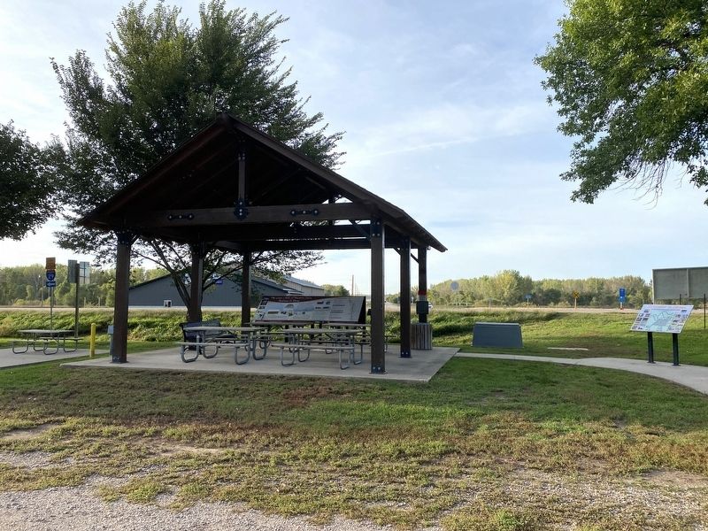
Akron in Plymouth County, Iowa — The American Midwest (Upper Plains)
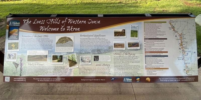
The Loess Hills of Western Iowa
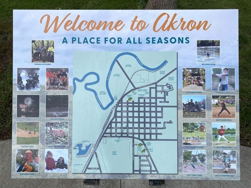
Welcome to Akron
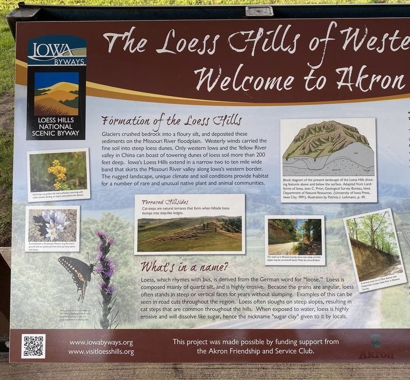
Fall brings out goldenrods and sunflowers swarming with soldier beetles feeding on insects attracted to the blooms.
Early bloomers, like pasque flowers, hug the warm ground and are protected from frost by hairy stems and leaves.
Mid-summer flowers are taller to rise above growing grasses in view of pollinating insects, like this black swallowtail on blazing star.
Formation of the Loess Hills
Glaciers crushed bedrock into a floury silt, and deposited these sediments on the Missouri River floodplain. Westerly winds carried the fine soil into steep loess dunes. Only western Iowa and the Yellow River valley in China can boast of towering dunes of loess soil more than 200 feet deep. Iowa's Loess Hills extend in a narrow two to ten mile wide band that skirts the Missouri River valley along Iowa's western border. The rugged landscape, unique climate and soil conditions provide habitat for a number of rare and unusual native plant and animal communities.
Terraced Hillsides
Cat-steps are natural terraces that form when hillside loess slumps into step-like ledges.
Block diagram of the present landscape of the Loess Hills showing features above and below the surface. Adapted from Landforms of Iowa, Jean C. Prior, Geological Survey Bureau, Iowa Department of Natural Resources. (University of Iowa Press, Iowa City, 1991). Illustration by Patricia J. Lohmann, p. 49.
This road cut in Monona County shows how steep and thin slopes may be cut and still stand. Photo by Lance Brisbois.
A vertical road cut on Olive Avenue near Preparation Canyon State Park in Monona County.
What's in a name?
Loess, which rhymes with bus, is derived from the German word for "loose." Loess is composed mainly of quartz silt, and is highly erosive. Because the grains are angular, loess often stands in steep or vertical faces for years without slumping. Examples of this can be seen in road cuts throughout the region. Loess often sloughs on steep slopes, resulting in cat steps that are common throughout the hills. When exposed to water, loess is highly erosive and will dissolve like sugar, hence the nickname "sugar clay" given to it by locals.
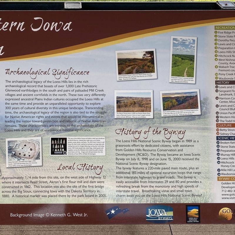
Archaeological Significance
The archaeological legacy of the Loess Hills lies in the rich archaeological record that boasts of over 1,000 Late Prehistoric Glenwood earthlodges in the south and pairs of palisaded Mill Creek villages and ancient cornfields in the north. These two very differently expressed ancestral Plains Indian cultures occupied the Loess Hills at the same time and provide an unparalleled opportunity to explore 300 years
of cultural diversity in this unique landscape. Transcending time, the archaeological legacy of the region is also tied to the struggle for Native American rights and events that would be instrumental in leading the nation toward protection and reburial of Native American remains. These characteristics are intrinsic to the archaeology of the Loess Hills and they are of unequivocal national significance.
House floor plan, excavated earth lodge in Mills County. Used with permission from the University of Iowa Office of the State Archaeologist.
This was a time before horses and before metal was introduced to North America. Instead they made tools out of stone, pottery, wood, plants, and bone. The Mill Creek Culture is well known for their small, notched arrowheads and large pots with trailing lines and rim designs featuring running deer and turkey tracks. Mill Creek people also raised dogs, traded goods with neighbors across the Midwest and created beautiful artwork out of stone and clay. Image used with permission from the University of Iowa Office of State Archaeologist.
Local History
Approximately 1/4 mile from this site, on the west side of Highway 12 where it intersects Reed Street, Akron's first flour mill and dam were constructed in 1862. This location was also the site of the first bridge across the Big Sioux, connecting
Iowa with the Dakota Territory in 1880. A historical marker was placed there by the park board in 2005.
Pottawattamie County's Hitchcock Nature Center provides plenty of hiking trails with great views like this one at Badger Ridge. Photo by Lance Brisbois.
Preparation Canyon's overlook provides one of the most iconic views in the Loess Hills. Photo by Lance Brisbois.
The Nature Conservancy's 3,000 acre Broken Kettle Grasslands in Plymouth County is home to Iowa's largest remnant prairie and over 200 bison. Photo by Lance Brisbois.
Each season provides its own unique recreational opportunities in the Loess Hills, but the fall colors are one of the most popular draws to the area. Photo by Lance Brisbois.
History of the Byway
The Loess Hills National Scenic Byway began in 1989 as a grassroots effort by dedicated citizens, with assistance from Golden Hills Resource Conservation and Development (RC&D). The Byway became an Iowa Scenic Byway on July 8, 1998 and on June 15, 2000 received the National Scenic Byway designation.
The byway features a 220-mile paved main route, plus an additional 185 miles of optional excursion loops that range from interstate highways to gravel roads. The byway is easily accessible from Interstates 29 and 80 and provides a refreshing break from the monotony and high speeds
of interstate travel. Breathtaking vistas and small town charm await you on the Loess Hills National Scenic Byway!
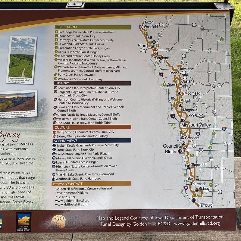
Recreation
1 Five Ridge Prairie State Preserve, Westfield
2 Stone State Park, Sioux City
3 Dorothy Pecaut Nature Center, Sioux City
4 Lewis and Clark State Park, Onawa
5 Preparation Canyon State Park, Pisgah
6 Loess Hills State Forest, Pisgah
7 Hitchcock Nature Center, Honey Creek
8 West Nishnabotna River Water Trail, Pottawattamie County, Avoca to Macedonia
9 Wabash Trace Nature Trail, Pottawattamie, Mills and Fremont counties, Council Bluffs to Blanchard
10 Pony Creek Park, Glenwood
11 Waubonsie State Park, Hamburg
History
12 Lewis and Clark Interpretive Center, Sioux City
13 Sergeant Floyd Monument National Historic Landmark, Sioux City
14 Harrison County Historical Village and Welcome Center, Missouri Valley
15 Lewis and Clark Monument and Scenic Overlook, Council Bluffs
16 Union Pacific Railroad Museum, Council Bluffs
17 Western Historic Trails Center, Council Bluffs
18 The Todd House (Rev. John Todd), Tabor
Culture
19 Betty Strong Encounter Center, Sioux City
20 Sidney Championship Rodeo, Sidney
Scenic Views
21 Broken Kettle Grasslands Preserve, Sioux City
22 Stone State Park, Sioux City
23 Preparation Canyon State Park, Pisgah
24 Murray Hill Scenic Overlook, Little Sioux
25 Loess Hills State Forest, Pisgah
26 Hitchcock Nature Center observation tower, Honey Creek
27 Mile Hill Lake Scenic Overlook, Glenwood
28 Waubonsie State Park, Hamburg
Byway Contact
Golden Hills Resource Conservation and Development, Oakland
712-482-3029
www.goldenhillsrcd.org
www.visitloesshills.org
Erected by the Akron Friendship and Service Club, Iowa Byways, Loess Hills National Scenic Byway, and Golden Hills RC&D.
Topics. This historical marker is listed in these topic lists: Anthropology & Archaeology • Environment • Industry & Commerce • Waterways & Vessels. A significant historical date for this entry is June 15, 2000.
Location. 42° 49.909′ N, 96° 33.376′ W. Marker is in Akron, Iowa, in Plymouth County. Marker can be reached from 5th Street, 0.1 miles north of Mill Street, on the left when traveling north. Located in Akron City Park. Touch for map. Marker is in this post office area: Akron IA 51001, United States of America. Touch for directions.
Other nearby markers. At least 8 other markers are within 9 miles of this marker, measured as the crow flies. American Legion Post 186 Memorial (within shouting distance of this marker); Old Mill Site (approx. 0.3 miles away); Akron's History Begins Here (approx. 0.3 miles away); Richland Methodist Episcopal Church (approx. 7 miles away in South Dakota); Fort Brule (approx. 7.7 miles away in South Dakota); Giants in the Earth Country (approx. 7.7 miles away in South Dakota); St. Paul Lutheran Church (approx. 8.3 miles away in South Dakota); Sioux County Founded Here (approx. 8.3 miles away). Touch for a list and map of all markers in Akron.
Credits. This page was last revised on October 13, 2023. It was originally submitted on October 12, 2023. This page has been viewed 85 times since then and 26 times this year. Photos: 1, 2, 3, 4, 5. submitted on October 12, 2023. 6, 7. submitted on October 13, 2023.
