Melrose-Rugby in Roanoke, Virginia — The American South (Mid-Atlantic)
Brown-Robertson Park and the Flood of 1985
Inscription.
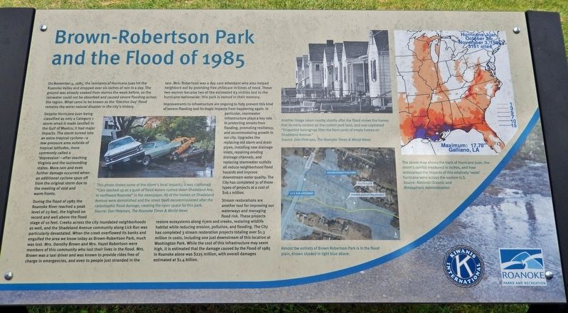
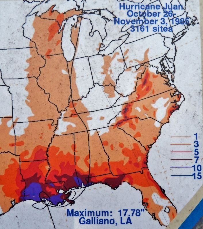
On November 4, 1985, the remnants of Hurricane Juan hit the Roanoke Valley and dropped over six inches of rain in a day. The ground was already soaked from storms the week before, so the rainwater could not be absorbed and caused severe flooding across the region. What came to be known as the 'Election Day' flood remains the worst natural disaster in the city's history.
Despite Hurricane Juan being classified as only a Category 1 storm when it made landfall in the Gulf of Mexico, it had major impacts. The storm turned into an extra-tropical cyclone — a low-pressure area outside of tropical latitudes, more commonly called a 'depression' — after reaching Virginia and the surrounding states. More rain and even further damage occurred when an additional cyclone spun off from the original storm due to the meeting of cold and warm fronts.
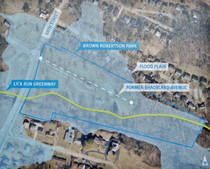
During the flood of 1985 the Roanoke River reached a peak level of 23 feet, the highest on record and well above the flood stage of 10 feet. Creeks across the city inundated neighborhoods as well, and the Shadeland Avenue community along Lick Run was particularly devastated. When the creek overflowed its banks and engulfed the area we know today as Brown-Robertson Park, much was lost. Mrs. Dorothy Brown and Mrs. Hazel Robertson were members of this community who lost their lives in the flood. Mrs. Brown was a taxi driver and was known to provide rides free of charge in emergencies, and even to people just stranded in the rain. Mrs. Robertson was a day care attendant who also helped neighbors out by providing free childcare in times of need. These two women became two of the estimated 63 victims lost to the hurricane nationwide; this park is named in their memory.
Improvements to infrastructure are ongoing to help prevent this kind of severe flooding and its tragic impacts from happening again. In particular, stormwater infrastructure plays a key role in protecting streets from flooding, promoting resiliency, and accommodating growth in our city. Upgrades like replacing old storm and drain pipes, installing new drainage inlets, repairing eroding drainage channels, and replacing stormwater outfalls all reduce neighborhood flood hazards and improve downstream water quality. The City has completed 31 of these types of projects at a cost of $16.1 million.
Stream restorations are another tool for improving our waterways and managing flood risk. These projects restore ecosystems along rivers and creeks, restoring wildlife habitat while reducing erosion, pollution, and flooding. The City has completed 3 stream restoration projects totaling over $1.3 million in costs, including one just downstream of this location at Washington Park. While the cost of
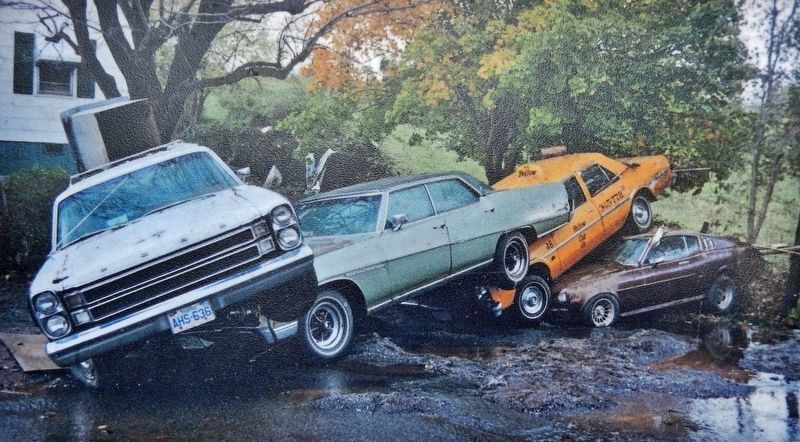
2. Marker detail: Cars Stacked up by the Flood
This photo shows some of the storm's local impacts; it was captioned "Cars stacked up as a gush of flood waters rushed down Shadeland Ave. in northwest Roanoke" in the newspaper. All of the homes on Shadeland Avenue were demolished and the street itself decommissioned after the catastrophic flood damage, creating the open space for this park.
Source: Don Petersen, The Roanoke Times & World-News
Source: Don Petersen, The Roanoke Times & World-News
Erected by Kiwanis International; and Roanoke Parks and Recreation.
Topics. This historical marker is listed in these topic lists: Disasters • Parks & Recreational Areas • Waterways & Vessels • Women. A significant historical date for this entry is November 4, 1985.
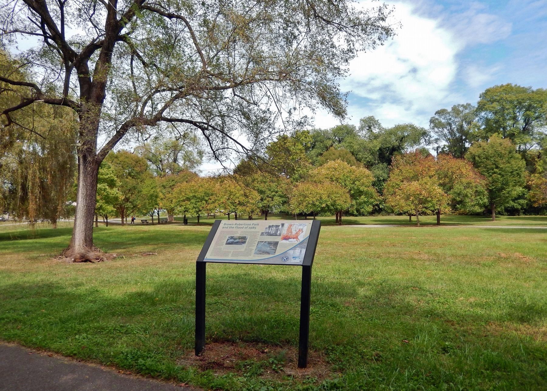
Location. 37° 17.323′ N, 79° 57.06′ W. Marker is in Roanoke, Virginia. It is in Melrose-Rugby. Marker can be reached from the intersection of 10th Street Northwest and Andrews Road, on the left when traveling south. The marker is located along the Lick Run Greenway trail in Brown-Robertson Park, just east of 10th Street Northwest. Touch for map. Marker is in this post office area: Roanoke VA 24012, United States of America. Touch for directions.
Other nearby markers. At least 8 other markers are within one mile of this marker, measured as the crow flies. Burrell Memorial Hospital (approx. half a mile away); Childhood Home of Oliver White Hill, Sr. (approx. 0.8 miles away); Oliver White Hill Sr. (approx. 0.8 miles away); Gainsboro Branch of the Roanoke City Public Library (approx. one mile away); Hunton Life Saving And First Aid Crew (approx. 1.1 miles away); Henry Street Business District
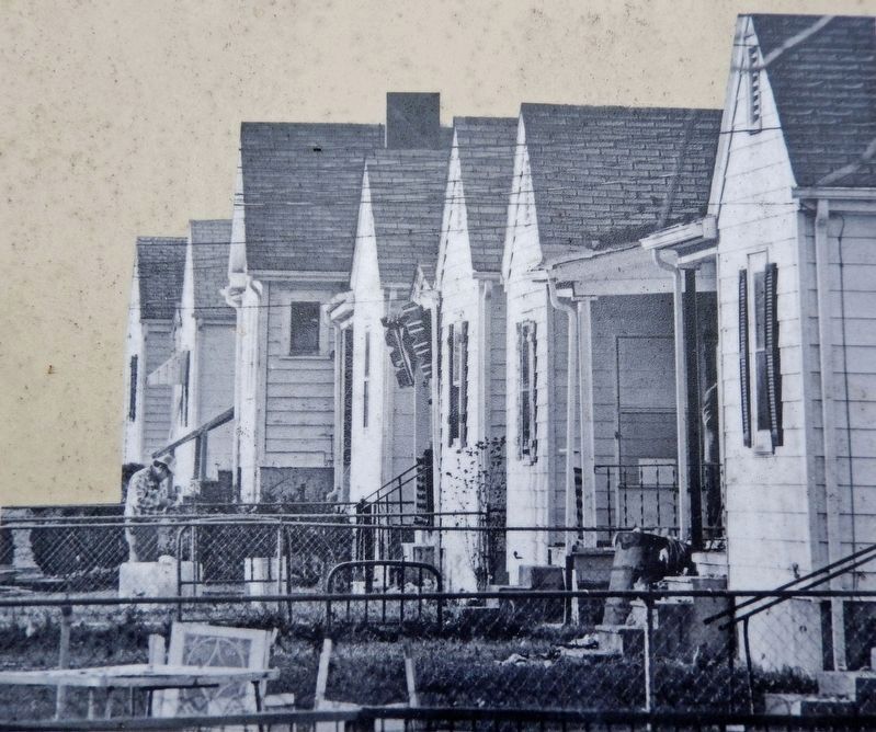
3. Marker detail: Empty Homes on Shadeland Avenue
Another image taken nearby shortly after the flood shows the homes that formerly existed on the current park land, and was captioned "Discarded belongings litter the front yards of empty homes on Shadeland Avenue."
Source: Don Petersen, The Roanoke Times & World-News
Source: Don Petersen, The Roanoke Times & World-News
Also see . . .
1. 1985 Election Day floods. Wikipedia entry:
Excerpt:
The high rainfall caused many rivers to rise above their banks across Virginia, becoming among the top three highest crests on record along several rivers in the state. Across the state, about 3,500 houses were destroyed. Overall, the storm system caused 22 deaths and $753 million, greater than the devastating hurricanes Camille and Agnes, and making it the costliest flood in the state's history. The city of Roanoke recorded 6.61 inches in a 24‑hour period, the highest 24‑hour total on record for the city since records began in 1912.(Submitted on October 18, 2023, by Cosmos Mariner of Cape Canaveral, Florida.)
2. The Floods of November, 1985: Then and Now.
PDF by Peter Corrigan, Senior Service Hydrologist, National Weather Service, Blacksburg VA
Excerpt:
Downtown Roanoke was completely inundated by the Roanoke River, and many other area streams such as Tinker Creek, Mason Creek and Peters Creek poured out across roadways, rail lines, bridges and into homes and businesses. Numerous rescues were performed that day and the loss of life might certainly have been higher were it not for the heroic efforts of rescue workers. Newspaper accounts written after the event and photographs depict near utter mayhem across much of the region, with photos of people clinging to trees and trapped in vehicles. One helicopter crew alone rescued about 125 people during the day.(Submitted on October 18, 2023, by Cosmos Mariner of Cape Canaveral, Florida.)
Credits. This page was last revised on April 17, 2024. It was originally submitted on October 18, 2023, by Cosmos Mariner of Cape Canaveral, Florida. This page has been viewed 151 times since then and 63 times this year. Photos: 1, 2, 3, 4, 5, 6. submitted on October 18, 2023, by Cosmos Mariner of Cape Canaveral, Florida.
