Inner Harbor in Baltimore, Maryland — The American Northeast (Mid-Atlantic)
Tilly's Escape
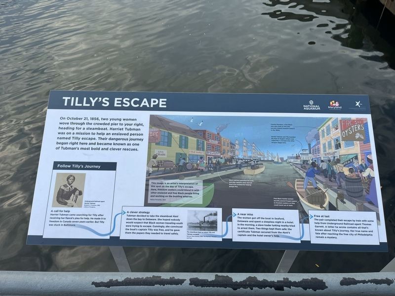
On October 21, 1856, two young women wove through the crowded pier to your right, heading for a steamboat. Harriet Tubman was on a mission to help an enslaved person named Tilly escape. Their dangerous journey began and became known as one of Tubman's most bold and clever rescues.
Follow Tilly's Journey
A call for help
Harriet Tubman came searching for Tilly after receiving her fiancé's plea for help. He made it to freedom in Canada seven years earlier. But Tilly was stuck in Baltimore.
Tubman decided to take the steamboat Kent down the bay to Delaware. She hoped nobody would suspect that Black women traveling south were trying to escape. Cunningly, she convinced the boat's captain Tilly was free, and he gave them the papers they needed to travel safely.
A near miss
The women got off the boat in Seaford, Delaware and spent a sleepless night in a hotel. In the morning, a slave trader lurking nearby tried to arrest them. Two things kept them safe: the certificate Tubman secured from the Kent's captain and the hotel owner's help.
Free at last
The pair completed their escape by train with
this page online
[Captions:]
This image is an artist's interpretation of this spot on the day of Tilly's escape. Here, freedom seekers could blend in with other enslaved and free Black people living and working on the bustling wharves.
Melissa Fernandez, 2023.
Charles Manokey, a free Black who lived on this pier, secretly helped freedom seekers in the 1850s.
Harriet Tubman and Tilly boarded the Kent at Dugan's Wharf, now called Pier 4. At least nine other escapes began here.
Slave catchers patrolled the area, and ship captains were warned they'd be arrested for helping people flee.
Free Black market women secretly passed forged papers to freedom seekers so they could travel out of state.
Erected 2023 by National Aquarium; The State of Maryland; National Underground Railroad Network to Freedom.
Topics and series. This historical marker is listed in these topic lists: Abolition & Underground RR • African Americans
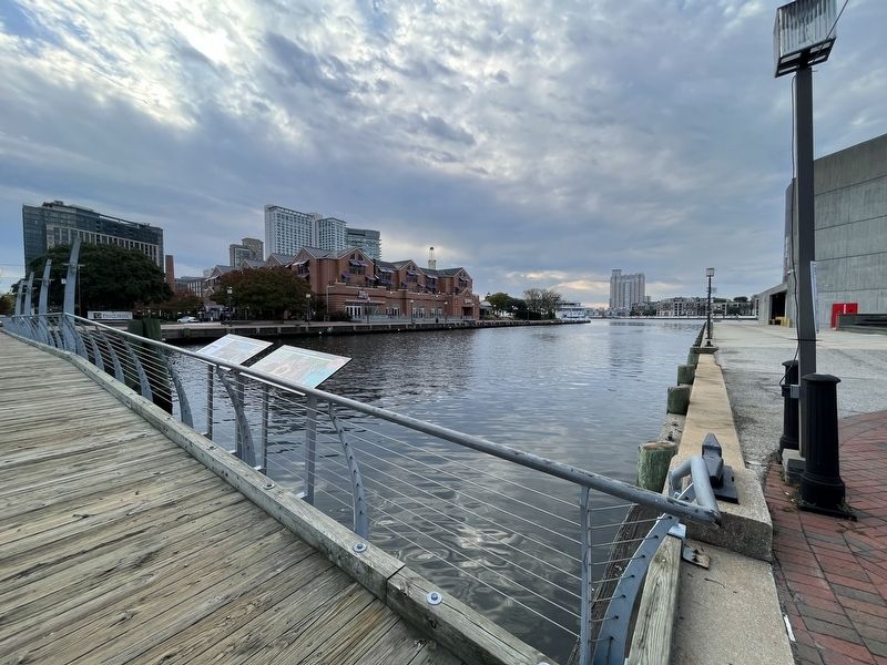
Location. 39° 17.106′ N, 76° 36.396′ W. Marker is in Baltimore, Maryland. It is in the Inner Harbor. It is at the intersection of Harbor Bridge Walk and Pier 4, on the right when traveling east on Harbor Bridge Walk. Touch for map. Marker is at or near this postal address: 621 E Pratt St, Baltimore MD 21202, United States of America. Touch for directions.

Regionally, this marker is in Central Maryland. It is also in the American Mid-Atlantic, in the Chesapeake Bay Region, and on the Eastern Seaboard. Globally, it is in the North Atlantic Region, North America, the Western Hemisphere, the Western World, and the Anglosphere. Historically, it finds itself in what was once one of the original Thirteen Colonies and also the Antebellum South.
Other nearby markers. At least 8 other markers are within walking distance of this marker: Pathways to Freedom (here, next to this marker); The Last Pearl Harbor Survivor (within shouting distance of this marker); Always Changing (about 300 feet away, measured in a direct line); How Can We All Help? (about 300 feet away); Discover Baltimore: Four Centuries of Change (about 500 feet away); Living with Wildlife (about 600 feet away); a different marker also named Seven Foot Knoll Lighthouse (about 600 feet away); Atlantic Coastal Plain (about 600 feet away). Touch for a list and map of all markers in Baltimore.
Other markers no longer nearby. The Coast Guard Cutter Taney (was within shouting distance of this marker but has been replaced with another marker now near it); Coast Guard Cutter Taney - WHEC-37 (was within shouting distance of this marker but has been replaced with another marker now near it); Seven Foot Knoll Lighthouse (was about 600 feet away but has been replaced with another marker now near it); Seven-Foot Knoll Lighthouse (was about 600 feet away but has been replaced with another marker now near it).
Credits. This page was last revised on October 21, 2023. It was originally submitted on October 21, 2023, by Devry Becker Jones of Washington, District of Columbia. This page has been viewed 563 times since then and 67 times this year. Photos: 1, 2. submitted on October 21, 2023, by Devry Becker Jones of Washington, District of Columbia.
