Houlton in St. Croix County, Wisconsin — The American Midwest (Great Lakes)
Native American Communities
Photographed by McGhiever, September 15, 2023
1. Native American Communities Marker
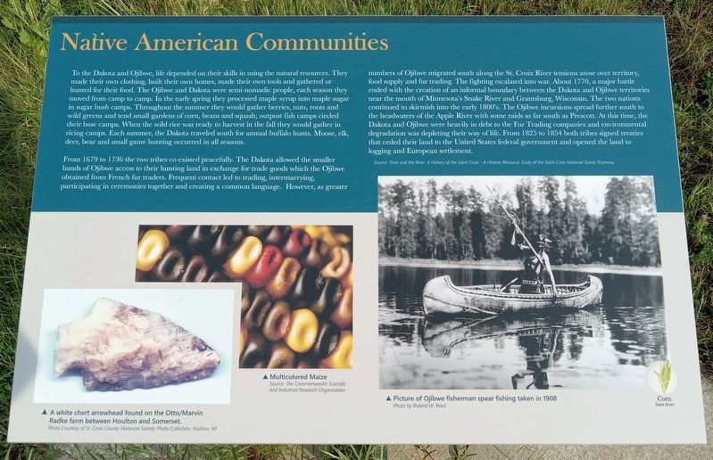
To the Dakota and Ojibwe, life depended on their skills in using the natural resources. They made their own clothing, built their own homes, made their own tools and gathered or hunted for their food. The Ojibwe and Dakota were semi-nomadic people, each season they moved from camp to camp. In the early spring they processed maple syrup into maple sugar in sugar bush camps. Throughout the summer they would gather berries, nuts, roots and wild greens and tend small gardens of corn, beans and squash; outpost fish camps circled their base camps. When the wild rice was ready to harvest in the fall they would gather in ricing camps. Each summer, the Dakota traveled south for annual buffalo hunts. Moose, elk, deer, bear and small game hunting occurred in all seasons.
From 1679 to 1736 the two tribes co-existed peacefully. The Dakota allowed the smaller bands of Ojibwe access to their hunting land in exchange for trade goods which the Ojibwe obtained from French fur traders. Frequent contact led to trading, intermarrying, participating in ceremonies together and creating a common language. However, as greater numbers of Ojibwe
this page online
Source: Time and the River: A History of the Saint Croix - A Historic Resource Study of the Saint Croix National Scenic Riverway
A white chert arrowhead found on the Otto/Marvin Radke farm between Houlton and Somerset.
Photo Courtesy of St. Croix County Historical Society Photo Collection, Hudson, WI
Multicolored Maize
Source: The Commonwealth of Scientific and Industrial Research Organisation
Picture

Photographed by McGhiever, September 15, 2023
2. Native American Communities Marker (right)
Photo by Roland W. Reed
Corn
State Grain
Topics. This historical marker is listed in these topic lists: Anthropology & Archaeology • Indigenous Peoples and Communities. A significant historical year for this entry is 1679.
Location. 45° 3.535′ N, 92° 46.984′ W. Marker is in Houlton, Wisconsin, in St. Croix County. It can be reached from Hawk Street south of County Highway 35, on the left when traveling south. The marker is on the St. Croix River Crossing Loop Trail, just south of the Blue Star Trailhead. Touch for map. Marker is at or near this postal address: 70 Houlton School Circle, Houlton WI 54082, United States of America. Touch for directions.

Regionally, this marker is in the Twin Cities Metropolitan Area and in Western Wisconsin. It is also in the American Midwest and in the Corn Belt. Globally, it is in North America, the Western Hemisphere, the Western World, and the Anglosphere. Historically, it finds itself in what was once the territory of the Mississippian Culture and also the Northwest Territory.
Other nearby markers. At least 8 other markers are within walking distance of this marker: Indigenous Communities (here, next to this marker); Western Prairie Restoration (approx. 0.2 miles away); Wisconsin Symbols (approx. 0.4 miles away); Loop Trail Fun Facts (approx. half a mile away); Glacial Landscape (approx. 0.6 miles away); Lower St. Croix River Sandbars (approx. 0.6 miles away); Town of St. Joseph (approx. 0.6 miles away); Houlton Hill History (approx. 0.7 miles away). Touch for a list and map of all markers in Houlton.
Credits. This page was last revised on October 30, 2023. It was originally submitted on October 21, 2023, by McGhiever of Minneapolis, Minnesota. This page has been viewed 216 times since then and 24 times this year. Photos: 1, 2. submitted on October 21, 2023, by McGhiever of Minneapolis, Minnesota. • J. Makali Bruton was the editor who published this page.
