Near Flagler Beach in Flagler County, Florida — The American South (South Atlantic)
Beyond the Plantation
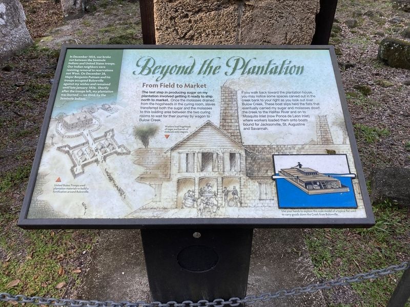
From Field to Market
If you walk back toward the plantation house, you may notice some spaces carved out in the creek bank to your right as you look out over Bulow Creek. These boat slips held the flats that eventually carried my sugar and molasses down the creek to the Halifax River and on to Mosquito Inlet (now Ponce de Leon Inlet) where workers loaded them onto boats bound for Jacksonville, St. Augustine and Savannah.
In December 1835, war broke out between the Seminole Indians and United States troops. Our Indian neighbors were resisting removal to reservations out West. On December 28, Major Benjamin Putnam and his troops occupied Bulowville against my wishes and remained until late January 1836. Shortly after the troops left, my plantation was burned—we think by the Seminole Indians.
(captions)
Workers load hogsheads of sugar and barrels of molasses onto wagons.
United States Troops used plantation materials to build a fortification around Bulowville.
Erected by Florida State Parks.
Topics. This historical marker is listed in these topic lists: African Americans • Agriculture • Forts and Castles • Industry & Commerce • Wars, US Indian • Waterways & Vessels. A significant historical month for this entry is December 1835.
Location. 29° 26.129′ N, 81° 8.594′ W. Marker is near Flagler Beach, Florida, in Flagler County. Marker can be reached from Old Kings Road South, 0.3 miles south of Audubon Road, on the left when traveling south. Located in Bulow Plantation Ruins Historic State Park. Touch for map. Marker is at or near this postal address: 3501 Old Kings Road, Flagler Beach FL 32136, United States of America. Touch for directions.
Other nearby markers. At least 8 other markers are within walking distance of this marker. Just just a spoonful of sugar (a few steps from this marker); Riding the "Jamaica Train" (a few steps from this marker); Driven by Sweat & Steam (a few steps from this marker); Bulow Sugar Mill (about 400 feet away, measured in a direct line); The Bulow Plantation House (approx. 0.3 miles away); Indigo Production (approx. 0.3 miles away); Slave Cabin Area (approx. 0.4 miles away); Bulow Ville Plantation House (approx. 0.4 miles away). Touch for a list and map of all markers in Flagler Beach.
Also see . . . Bulow Plantation Ruins Historic State Park. Florida State Parks (Submitted on October 25, 2023.)
Credits. This page was last revised on October 25, 2023. It was originally submitted on October 22, 2023, by Connor Olson of Kewaskum, Wisconsin. This page has been viewed 73 times since then and 22 times this year. Photos: 1, 2. submitted on October 22, 2023, by Connor Olson of Kewaskum, Wisconsin. • Bernard Fisher was the editor who published this page.

