Middletown in Frederick County, Virginia — The American South (Mid-Atlantic)
Signal Knob During the Civil War
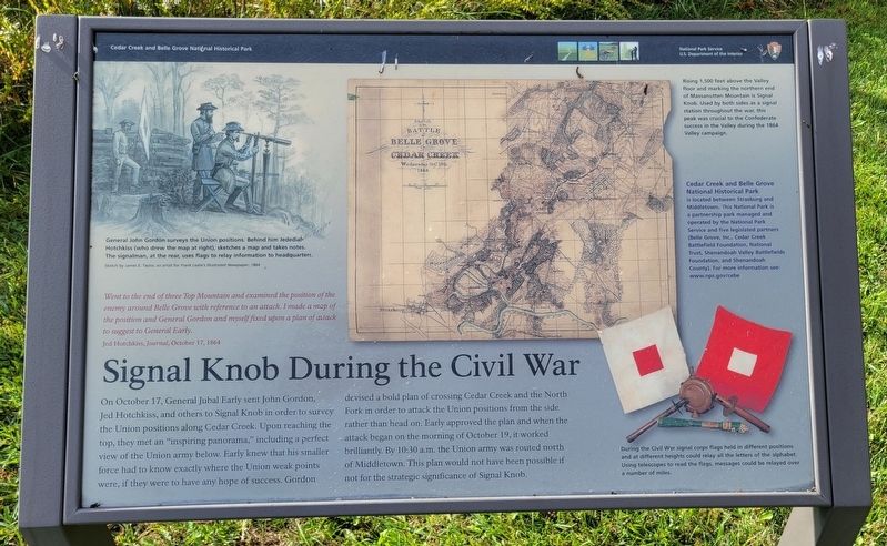
Went to the end of three Top Mountain and examined the position of the enemy around Belle Grove with reference to an attack. I made a map of the position and General Gordon and myself fixed upon a plan of attack to suggest to General Early.
Jed Hotchkiss, Journal, October 17, 1864
On October 17, General Jubal Early sent John Gordon, Jed Hotchkiss, and others to Signal Knob in order to survey the Union positions along Cedar Creek. Upon reaching the top, they met an "inspiring panorama," including a perfect view of the Union army below. Early knew that his smaller force had to know exactly where the Union weak points were, if they were to have any hope of success. Gordon devised a bold plan of crossing Cedar Creek and the North Fork in order to attack the Union positions from the side rather than head on. Early approved the plan and when the attack began on the morning of October 19, it worked brilliantly. By 10:30 a.m. the Union army was routed north of Middletown. This plan would not have been possible if not for the strategic significance of Signal Knob.
(Captions):
General John Gordon surveys the Union positions. Behind him Jedediah Hotchkiss (who drew the map at right), sketches a map and takes notes. The signalman, at the rear, uses flags to relay information to headquarters.
Sketch by James E. Taylor, an artist for Frank Leslie's Illustrated Newspaper, 1864
Rising 1,500 feet above the Valley floor and marking the northern end of Massanutten Mountain is Signal Knob. Used by both sides as a signal station throughout the war, this peak was crucial to the Confederate success in the Valley during the 1864 Valley campaign.
Cedar Creek and Belle Grove National Historical Park is located between Strasburg and Middletown. This National Park is a partnership park managed and operated by the National Park Service and five legislated partners (Belle Grove, Inc., Cedar Creek Battlefield Foundation, National Trust, Shenandoah Valley Battlefields Foundation, and Shenandoah County). For more information see:
www.nps.gov/cebe
During the Civil War signal corps flags held in different positions and at different heights could relay all the letters of the alphabet. Using telescopes to read the flags, messages could be relayed over a number of miles.
Erected by National Park Service, U.S. Department of the Interior.
Topics. This historical marker is listed in these topic lists: Natural Features • Parks & Recreational Areas • War, US Civil. A significant historical date for this entry is October 17, 1864.
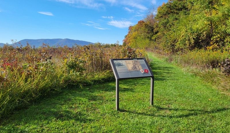
Location. 39° 0.594′ N, 78° 18.206′ W. Marker is in Middletown, Virginia, in Frederick County. Marker can be reached from Valley Pike (U.S. 11) 0.4 miles north of Water Plant Road, on the right when traveling north. Marker is located on the Thomas Brigade Loop Trail portion of the Morning Attack Trails. Touch for map. Marker is at or near this postal address: 8693 Valley Pike, Middletown VA 22645, United States of America. Touch for directions.
Other nearby markers. At least 8 other markers are within walking distance of this marker. Cedar Creek (about 300 feet away, measured in a direct line); Stand of the Eighth Vermont (about 300 feet away); Slowing the Advance (about 800 feet away); The Shenandoah Valley / Battle of Cedar Creek, October 19, 1864 (approx. 0.2 miles away); Eve of Battle (approx. 0.2 miles away); a different marker also named Eve of Battle (approx. ¼ mile away); Battle of Cedar Creek (approx. ¼ mile away); 128th New York Volunteer Regiment (approx. 0.3 miles away). Touch for a list and map of all markers in Middletown.
Credits. This page was last revised on October 22, 2023. It was originally submitted on October 22, 2023, by Bradley Owen of Morgantown, West Virginia. This page has been viewed 64 times since then and 19 times this year. Photos: 1, 2. submitted on October 22, 2023, by Bradley Owen of Morgantown, West Virginia.

