Sterling Heights in Macomb County, Michigan — The American Midwest (Great Lakes)
Holcombe Beach

Photographed by J.T. Lambrou, March 8, 2022
1. Holcombe Beach Marker
Erected 1978 by Michigan History Division, Department of State. (Marker Number S309.)
Topics and series. This historical marker is listed in these topic lists: Anthropology & Archaeology • Indigenous Peoples and Communities. In addition, it is included in the Michigan Historical Commission
this page online
Location. This marker has been replaced by another marker nearby. It was located near 42° 34.148′ N, 83° 0.603′ W. Marker was in Sterling Heights, Michigan, in Macomb County. It was on Dodge Park Road 0.3 miles north of Metropolitan Parkway, on the right when traveling north. Touch for map. Marker was at or near this postal address: 37400 Dodge Park Road, Sterling Heights MI 48312, United States of America. Touch for directions.

Regionally, this marker was in Southeast Michigan and in Greater Detroit. It was also in the American Midwest. Globally, it was in North America, on the Great Lakes, in the Western Hemisphere, in the Western World, and in the Anglosphere. Historically, it found itself in what was once the Northwest Territory.
Other nearby markers. At least 8 other markers are within 4 miles of this location, measured as the crow flies: A different marker also named Holcombe Beach (within shouting distance of this marker); In Memory of Leroy H. Imus (approx. 0.2 miles away); Upton House (approx. 1.6 miles away); Red Run (approx. 3.2 miles away); a different

Photographed by Joel Seewald, August 7, 2010
2. Holcombe Beach Marker
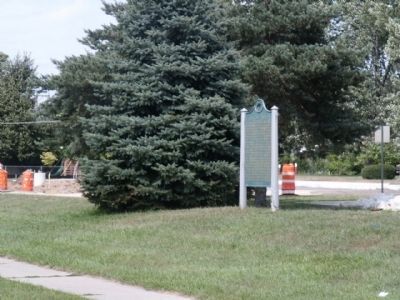
Photographed by Joel Seewald, August 7, 2010
3. Holcombe Beach Marker
Original 1978 marker at its original location.
Credits. This page was last revised on October 30, 2024. It was originally submitted on August 9, 2010, by Joel Seewald of Madison Heights, Michigan. This page has been viewed 3,087 times since then and 95 times this year. Last updated on October 25, 2023, by Melanie Davis of Sterling Heights, Michigan. Photos: 1. submitted on March 8, 2022, by J.T. Lambrou of New Boston, Michigan. 2, 3. submitted on August 9, 2010, by Joel Seewald of Madison Heights, Michigan. • J. J. Prats was the editor who published this page.
