Oakwood in Lawrence County, Pennsylvania — The American Northeast (Mid-Atlantic)
Millennium Park
History
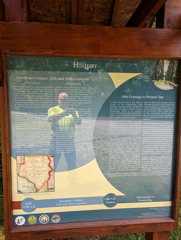
European Contact: 17th and 18th Centuries
17th Century
French and English fur traders and explorers began to traverse the Allegheny Mountains in the late 17th century. The American Indians traded primarily beaver, mink, and other fur-bearing animal skins for European knives, guns, mirrors, and glass beads. As the American Indians began to rely on these superior weapons and tools, fur trading became so intense that most beaver populations in Eastern Pennsylvania were eliminated by 1650.
18th Century
Conflicts among the French, English, and American Indians dominated the history of the region throughout the 18th century as many significant battles and treaties established the great geographic and economic significance of western Pennsylvania. The French and Indian War, the Revolutionary War, and a long period of American Indian raiding resulted in a dangerous and chaotic period.
The Treaty of Fort Stanwix, signed in 1768, was one of the first negotiations that resulted in land purchases that finally established Pennsylvania's western boundaries. It was not until 1795 that American Indian raiding ceased and lands in western Pennsylvania were available for permanent settlement by Europeans.
Shortly after the first settlers arrived in the region, the boundaries of the western Pennsylvania counties were surveyed and the state began to divide large tracts of land within the counties. During the Revolutionary War, currency had depreciated rapidly, and the Pennsylvania Assembly passed an act to reward the soldiers who had received depreciated currency for pay. The first settlers, many of whom were veterans of the Revolutionary War, were given land for their services. These parcels were located within Allegheny, Armstrong, Beaver, Butler, and Lawrence counties.
19th Century to Present Day
In 1849, Lawrence County was officially formed by the Pennsylvania State Assembly. Previous to that, Neshannock Township was part of Mercer County. Neshannock, which is an American Indian word meaning "place between two waters," is located between the Shenango River and the Neshannock Creek.
Neshannock Township began to grow into a significant coal mining area around 1845. The need for coal in New Castle sparked the creation of a canal system that connected New Castle to Neshannock from 1826-1836. Prior to canals, coal was transported by wagon on a road know as Plank Road.
The faster transportation of goods expanded the lumber, coal, iron, and wool industries in the area. In 1826, Pennsylvania authorized the construction of the Pennsylvania Main Line Canal from Philadelphia to Pittsburgh with an extension that ran between the confluence of the Ohio and Beaver Rivers to Lake Erie. Known as the Beaver and Lake Erie Canal, this canal was extended to the industrial facilities in New Castle and also to the coal mines on the Neshannock Creek. However, the canal system soon became too costly and inefficient to continue. The canal boom ended with the rise of railroads, which provided a safer, more reliable, year-round mode of transport.
The Erie and Pittsburgh Railroad (E&P) was completed at the end of the Civil War in 1864. The E&P passed along the west bank of the Shenango River and provided freight and passenger services between New Castle to Erie. The E&P Railroad then joined with the New Castle & Beaver Valley Railroad to form a continuous railroad system on the west side of the Beaver and Shenango Rivers, extending from the Ohio River to Lake Erie.
Another railroad, the Erie Railroad, was set to be built as a 20-mile connection between the industrial cities of New Castle in Lawrence County and Sharon in Mercer County. Construction on the railroad began in 1883 but was never finished. In 1886, G. W. Johnson of New Castle purchased the partially-built railroad, changed its name to the New Castle & Shenango Valley Railroad, and completed in in 1889, the same time the city was emerging as one of the most important industrial cities in Northeastern America, centered around the tin-plate industry. The Erie railroad eventually took over the New Castle & Shenango Valley Railroad.
Divided north to south by the former Erie Railroad, Millennium Park encompasses an area of approximately 530 acres locate on former agricultural lands bisected by Camp Run and a series of other springs that flow into the Shenango River. The Millennium Park site includes agricultural lands, deciduous woodlots, wetlands, and residential properties, and hopes to attract commercial development in the future.
Topics. This historical marker is listed in these topic lists: Colonial Era • Industry & Commerce • Native Americans • Parks & Recreational Areas. A significant historical year for this entry is 1650.
Location. 41° 2.257′ N, 80° 24.178′ W. Marker is in Oakwood, Pennsylvania, in Lawrence County. Marker can be reached from the intersection of Kings Chapel Road and Pulaski Road, on the right when traveling south. Touch for map. Marker is in this post office area: New Castle PA 16101, United States of America. Touch for directions.
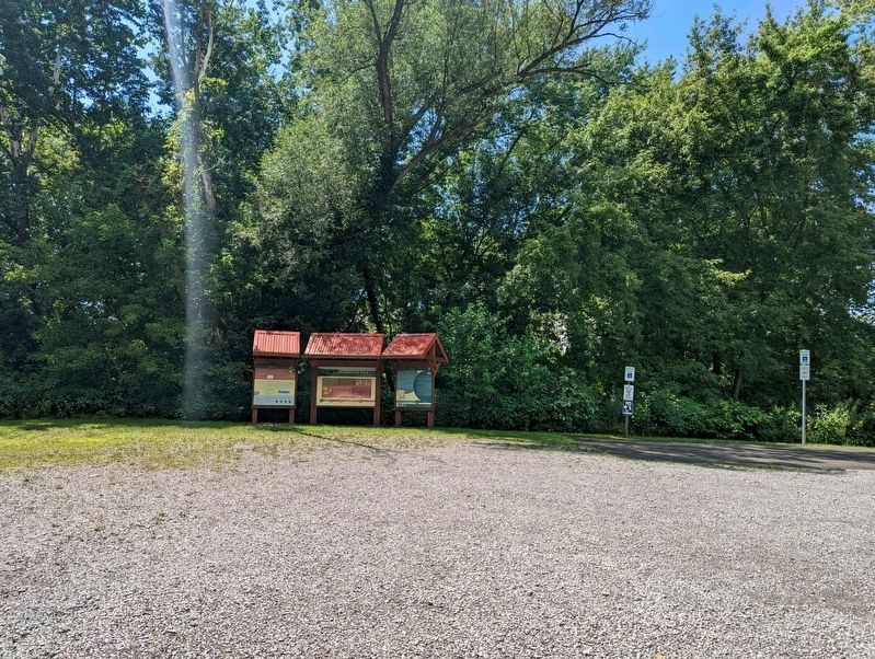
Other nearby markers. At least 8 other markers are within 3 miles of this marker, measured as the crow flies. A different marker also named Millennium Park (here, next to this marker); a different marker also named Millennium Park (here, next to this marker); Harbor Creek (approx. ¼ mile away); The First M.E. Church in Lawrence County (approx. 1.1 miles away); Cross-Cut Canal (approx. 2.3 miles away); Ira D. Sankey (approx. 2.4 miles away); Edinburg World War II Memorial (approx. 2½ miles away); Kush-Kush-Kee (approx. 2.6 miles away). Touch for a list and map of all markers in Oakwood.
Credits. This page was last revised on December 29, 2023. It was originally submitted on August 2, 2022, by Mike Wintermantel of Pittsburgh, Pennsylvania. This page has been viewed 131 times since then and 54 times this year. Last updated on October 28, 2023, by Carl Gordon Moore Jr. of North East, Maryland. Photos: 1, 2. submitted on August 2, 2022, by Mike Wintermantel of Pittsburgh, Pennsylvania. • Devry Becker Jones was the editor who published this page.

