Near Louisville in Winston County, Mississippi — The American South (East South Central)
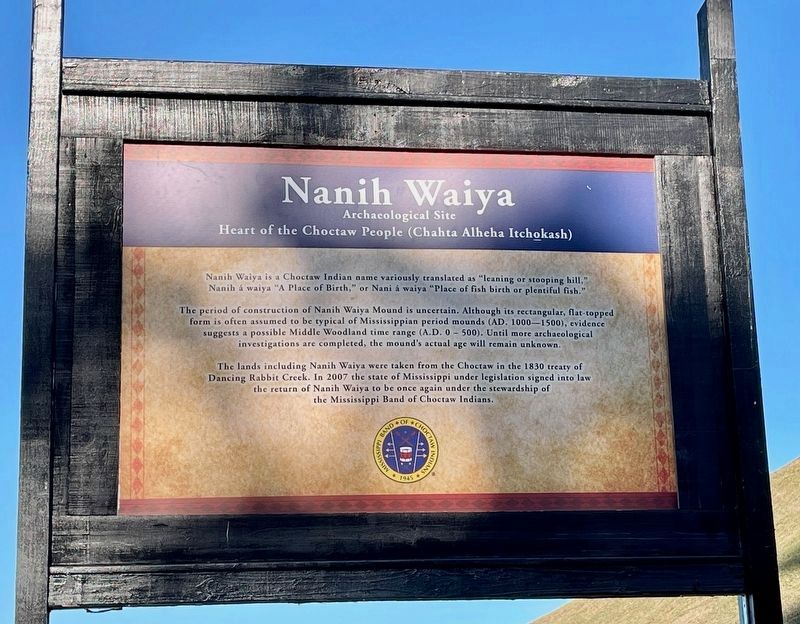
Nanih Waiya
Heart of the Choctaw People (Chahta Alheha Itchokash)
— Archaeological Site —
Inscription.
Nanih Waiya is a Choctaw Indian name variously translated as "leaning or stooping hill," Nanih á waiya "A Place of Birth," or Nani á waiya "Place of fish birth or plentiful fish."
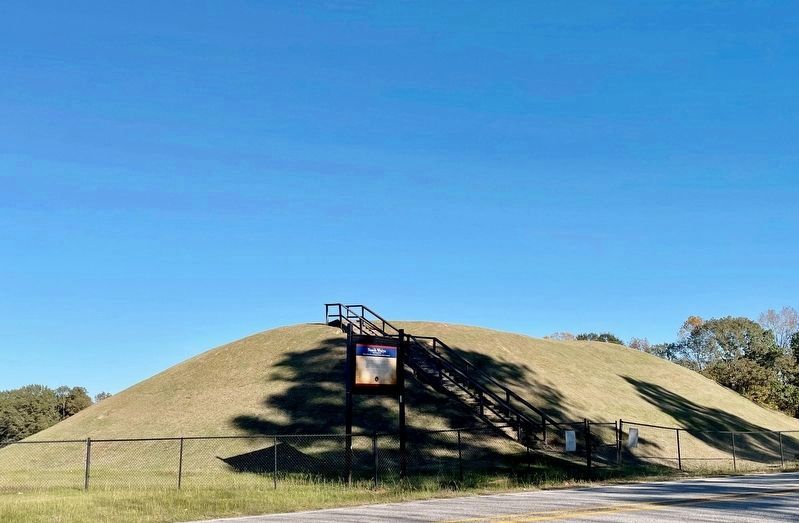
The period of construction of Nanih Waiya Mound is uncertain. Although its rectangular, flat-topped form is often assumed to be typical of Mississippian period mounds (AD. 1000 – 1500), evidence suggests a possible Middle Woodland time range (A.D. 0 – 500). Until more archaeological investigations are completed, the mound's actual age will remain unknown.
The lands including Nanih Waiya were taken from the Choctaw in the 1830 treaty of Dancing Rabbit Creek. In 2007 the state of Mississippi under legislation signed into law the return of Nanih Waiya to be once again under the stewardship of the Mississippi Band of Choctaw Indians.
Erected by the Mississippi Band of Choctaw Indians.
Topics. This historical marker is listed in these topic lists: Anthropology & Archaeology • Cemeteries & Burial Sites • Native Americans.
Location. 32° 55.293′ N, 88° 56.899′ W. Marker is near Louisville, Mississippi, in Winston County. Marker is on Mississippi Route 393, 1.3 miles north of County Road 856, on the right when traveling north. Located within the Nanih Waiya State Park. Touch for map. Marker is at or near this postal address: 182 MS-393, Louisville MS 39339, United States of America. Touch for directions.
Other nearby markers. At least 8 other markers are within 14 miles of this marker, measured as the crow flies. Holy Cross Catholic Church (approx. 9.8 miles away); Dancing Rabbit Creek Treaty Site (approx. 12.7 miles away); Grierson's Raid 1863 (approx. 13.8 miles away); Adam Monroe Byrd (approx. 13.8 miles away); Marty Gamblin (approx. 13.9 miles away); Booker T. Washington School (approx. 14 miles away); Old Neshoba County Jail (approx. 14 miles away); Neshoba County Confederate Monument (approx. 14 miles away).
Regarding Nanih Waiya. The mound is no longer open to the public.
Related marker. Click here for another marker that is related to this marker. This related marker has been reported missing.
Also see . . . National Park Service about the Nanih Waiya Mound. (Submitted on October 29, 2023, by Mark Hilton of Montgomery, Alabama.)

Photographed By Mark Hilton, October 24, 2023
3. Nanih Waiya Marker
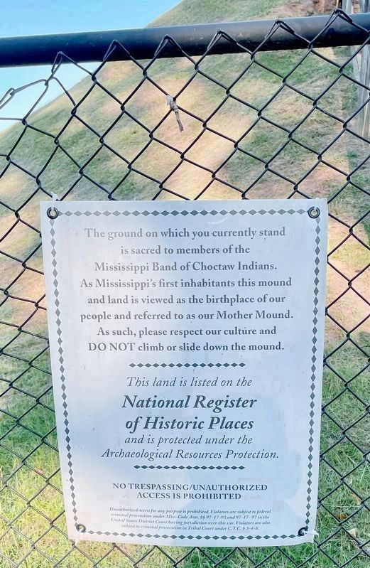
The ground on which you currently stand
is sacred to members of the
Mississippi Band of Choctaw Indians.
As Mississippi's first inhabitants this mound
and land is viewed as the birthplace of our
people and referred to as our Mother Mound.
As such, please respect our culture and
DO NOT climb or slide down the mound.
This land is listed on the National Register of Historic Places and is protected under the Archaeological Resources Protection.
No Trespassing/Unauthorized Access is Prohibited
Unauthorized access for any purpose is prohibited. Violators are subject to federal criminal prosecution under Miss. Code Ann. §§ 97-17-93 and 97-17-97 in the United States District Court having jurisdiction over this site. Violators are also subject to criminal prosecution in Tribal Court under C.T.C. § 3-4-8.
Credits. This page was last revised on October 30, 2023. It was originally submitted on October 29, 2023, by Mark Hilton of Montgomery, Alabama. This page has been viewed 105 times since then and 64 times this year. Photos: 1, 2, 3. submitted on October 29, 2023, by Mark Hilton of Montgomery, Alabama.

