Goliad in Goliad County, Texas — The American South (West South Central)
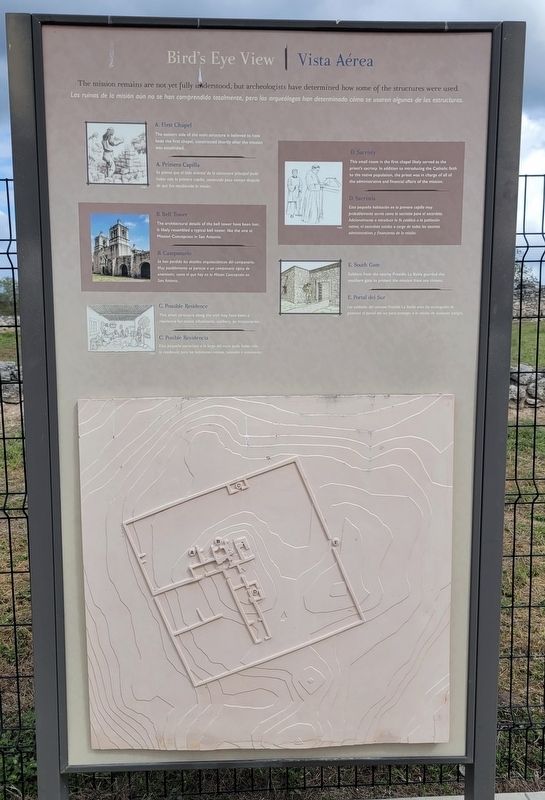
Bird's Eye View
⎯⎯⎯
Vista Aérea
Photographed by James Hulse, October 23, 2023
1. Bird's Eye View / Vista Aérea Marker
 The mission remains are not yet fully understood, but archeologists have determined how some of the structures were used.
A. First Chapel
The eastern side of the main structure is believed to have been the first chapel, constructed shortly after the mission was established.
B. Bell Tower
The architectural details of the bell tower have been lost. It likely resembled a typical bell tower, like the one at Mission Concepcion in San Antonio.
C. Possible Residence
This small structure along the wall may have been a residence for native inhabitants, soldiers, or missionaries.
D. Sacristy
This small room in the first chapel likely served as the priest's sacristy. In addition to introducing the Catholic faith to the native population, the priest was in charge of all of the administrative and financial affairs of the mission.
E. South Gate
Soldiers from the nearby Presidio La Bahía guarded the southern gate to protect the mission from any threats.
Spanish:
A. Primera Capilla
Se piensa que el lado oriental de la estructura principal pudo haber sido la primera capilla, construida poco tiempo después de que fue establecida la misión.
B. Campanario
Se han perdido los detalles arquitectónicos del campanario. Muy posiblemente se parecía a un campanario típico de unamisión, como el que hay en la Misión Concepción en San Antonio.
C. Posible Residencia
Esta pequeña estructura a lo largo del muro pudo haber sido la residencia para los habitantes nativos, soldados o misioneros.
D. Sacristía
Esta pequeña habitación en la primera capilla muy probablemente servía como la sacristía para el sacerdote. Adicionalmente a introducir la fe católica a la
this page online
E. Portal del Sur
Los soldados del cercano Presidio La Bahia eran los encargados de guarecer el portal del sur para proteger a la misión de cualquier peligro.
Erected by Mission Nuestra Señora del Rosario.
Topics. This historical marker is listed in these topic lists: Anthropology & Archaeology • Colonial Era • Indigenous Peoples and Communities • Religion & Religious Structures.
Location. 28° 38.67′ N, 97° 26.361′ W. Marker is in Goliad, Texas, in Goliad County. It is on U.S. 59 0.2 miles west of State Highway 239, on the left when traveling west. The marker is located in the southeastern section of the Mission Nuestra Señora del Rosario. Touch for map. Marker is at or near this postal address: 1958-5802 US-59, Goliad TX 77963, United States of America. Touch for directions.

Regionally, this marker is in South Texas. It is also in the American South. Globally, it is in North America, a Gulf of Mexico state, the Western Hemisphere, the Western
Photographed by James Hulse, October 23, 2023
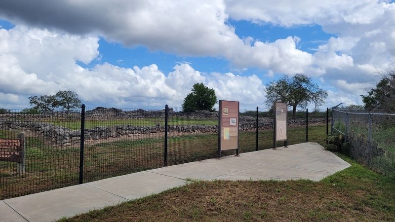
2. The Bird's Eye View / Vista Aérea Marker is the right marker of the two markers
Other nearby markers. At least 8 other markers are within 3 miles of this marker, measured as the crow flies: Blazing New Trails / Abriendo Nuevos Horizontes (here, next to this marker); Mission Rosario State Historic Site / Sitio Histórico Estatal Misión Nuestra Señora del Rosario (within shouting distance of this marker); Site of Mission Nuestra Señora del Rosario (about 300 feet away); Mission Nuestra Senora del Rosario (about 400 feet away); Goliad County (about 400 feet away); Lott Cemetery (approx. 2 miles away); Peck Cemetery (approx. 2.8 miles away); Fannin Street United Methodist Church (approx. 3 miles away). Touch for a list and map of all markers in Goliad.
Another marker is no longer nearby. Mission Rosario (was about 300 feet away, measured in a direct line but has been confirmed missing).
More about this marker. The ruins of the Mission Rosario State Historic Site are fenced off and not open to the general public. However, there is a small parking
Photographed by James Hulse, October 23, 2023
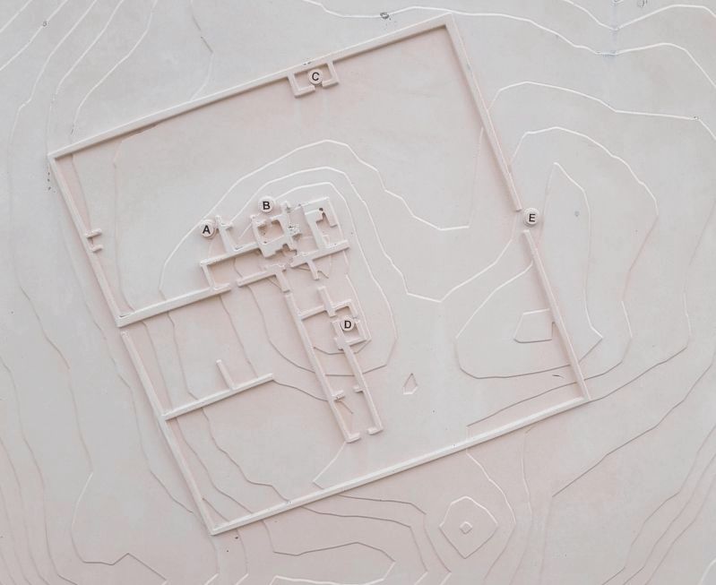
3. The outline of the mission ruins
Also see . . . Nuestra Señora del Rosario Mission. Texas State Historical Association (TSHA)
Nuestra Señora del Rosario Mission, Goliad County, so named by Capt. Manuel Ramírez de la Piscina of nearby Presidio La Bahía for the church in his native town in Spain, was also known as Nuestra Señora del Rosario de los Cujanes, Misión del Santísimo Rosario, and Misión del Rosario. It was established in November 1754 by Father Juan de Dios Camberos of the College of Nuestra Señora de Guadalupe de Zacatecas in an attempt to make peace with the various Karankawan tribes-the Cujanes, Copanes, Guapites, and Karankawas proper-who did not get along with the other Indians at the already existing missions. The site on the San Antonio River four miles west of Goliad was given to the Goliad State Park Commission by W. J. O'Connor in 1935. It is not open to the public.(Submitted on November 3, 2023, by James Hulse of Medina, Texas.)
Photographed by James Hulse, October 23, 2023
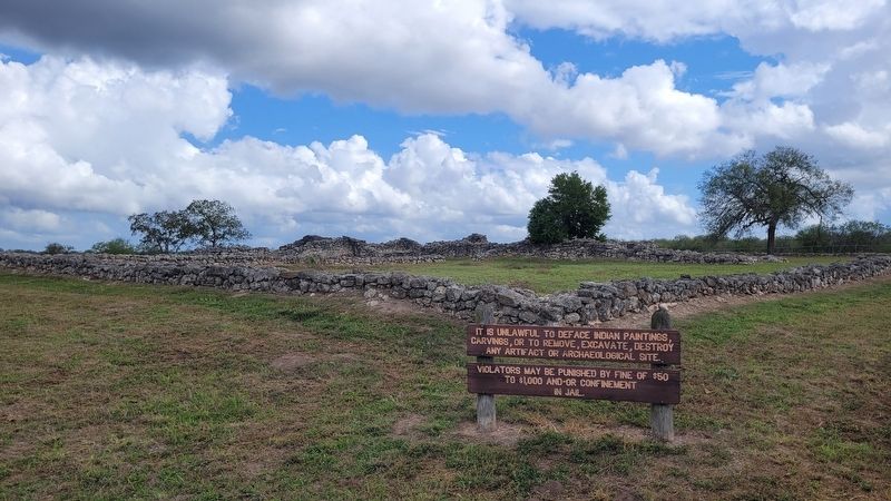
4. The mission ruins
Credits. This page was last revised on September 23, 2025. It was originally submitted on November 2, 2023, by James Hulse of Medina, Texas. This page has been viewed 244 times since then and 27 times this year. Photos: 1, 2, 3, 4. submitted on November 3, 2023, by James Hulse of Medina, Texas.
