Goliad in Goliad County, Texas — The American South (West South Central)
Mission Rosario State Historic Site / Sitio Histórico Estatal Misión Nuestra Señora del Rosario
Inscription.
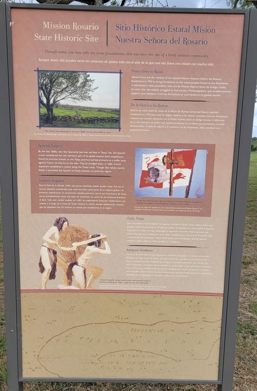
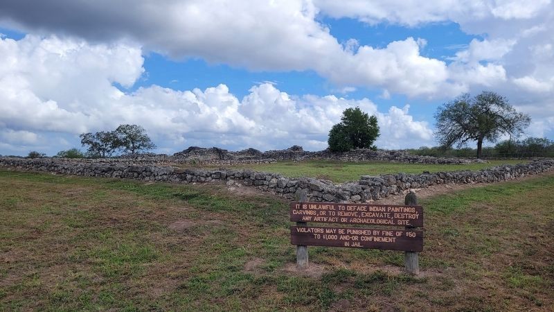
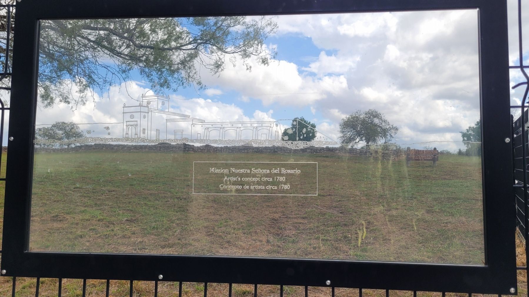
Though today you may only see stone foundations, this was once the site of a lively mission community.
From Glory to Ruins
Ahead of you are the remains of the Spanish Mission Nuestra Señora del Rosario. Established in 1754 to bring Christianity to the native peoples known as the Karankawa, it maintained a close association with nearby Mission Espíritu Santo de Zuñiga. Unlike its sister site, the mission struggled to find success. Mismanagement, lack of administrative support, and resistance from the Karankawa all contributed to its gradual decline.
Spanish Empire
By the late 1600s, very few Spaniards had ever set foot in Texas. Yet, the Spanish crown considered the vast territory part of its global empire. Early expeditions found no precious metals, so the Texas province served primarily as a buffer zone against French territories to the east. That all changed when, in 1685, French explorers established a colony along the Texas coast. Though that colony quickly failed, it provoked the Spanish to finally attempt to settle the region.
Early Trails
For thousands of years before the Spanish arrived in South Texas, Native American groups called the area home. Primarily hunters and gatherers, they moved frequently from place to place to take advantage of seasonal resources. Native groups also communicated and traded with each other, establishing a network of footpaths that crisscrossed the landscape. These trade paths were eventually used by Spanish explorers who relied on native guides for navigation.
Captions
Upper Left: The mission was abandoned in the early 1800s, and has since fallen to ruins.
Right: Though they failed to build a lasting community at Mission Rosario, the Spanish ultimately succeeded in introducing their culture to South Texas.
Lower Left: Ancient footpaths evolved into the vast road network known as El Camino Real de los Tejas-a path we can still travel today.
Spanish:
De la Gloria a las Ruinas
Delante de usted están los restos de la Misión de Nuestra Señora del Rosario española. Establecida en 1754 para traer la religión cristiana a los nativos, conocidos como los Karankawa, mantuvo una cercana asociación con la Misión Espíritu Santo de Zúñiga cercana. A diferencia de su sitio hermano, la misión tuvo muchos problemas en su intento por permanecer. La mala administración, la falta de soporte y la resistencia de los Karankawa, todo contribuyó a su gradual declinación.
Imperio Español
Para el final de la década 1600, muy pocos españoles habian pisado Texas. Aun así, la corona española consideraba este vasto territorio como parte de su imperio global. Las primeras expediciones no encontraron metales preciosos, por lo que la provincia de Texas servía principalmente como una zona de contención en contra de los territorios franceses al este. Todo esto cambió cuando, en 1685, los exploradores franceses establecieron una colonia a lo largo de la costa de Texas. Aunque la colonia decayó rápidamente, provocó que los españoles por fin hicieran un intento por establecerse en la región.
Antiguos Senderos
Por miles de años antes de que llegaran los españoles, los grupos de nativos americanos llamaban su hogar al sur de Texas. Eran principalmente cazadores y recolectores, por lo que se trasladaban frecuentemente de un lugar a otro para aprovechar los recursos de cada temporada. Los grupos nativos también se comunicaban e intercambiaban mercancía entre unos y otros, estableciendo una red de senderos que crearon un paisaje de caminos entrecruzados. Estos caminos fueron los mismos que posteriormente usaron los exploradores españoles que se apoyaban en los guías nativos para sus traslados.
Subtítulos
Arriba a la izquierda: La misión fue abandonada a principios de la década de 1800, y desde entonces se ha ido convirtiendo en ruinas.
Derecho: Aunque no lograron establecer una comunidad duradera en la Misión Rosario, los españoles finalmente tuvieron éxito en introducir su cultura en el sur de Texas.
Inferior izquierda: Estos antiguos senderos evolucionaron hasta convertirse en una vasta red conocida como El Camino Real de los Tejas, caminos que aún hoy en día transitamos.
Erected by Mission Nuestra Señora del Rosario.
Topics. This historical marker is listed in these topic lists: Anthropology & Archaeology • Churches & Religion • Colonial Era • Native Americans. A significant historical year for this entry is 1754.
Location. 28° 38.689′ N, 97° 26.369′ W. Marker is in Goliad, Texas, in Goliad County. Marker is on U.S. 59, 2 miles west of State Highway 239, on the left when traveling west. The marker is located in the southeastern section of the Mission Nuestra Señora del Rosario. Touch for map. Marker is in this post office area: Goliad TX 77963, United States of America. Touch for directions.
Other nearby markers. At least 8 other markers are within 4 miles of this marker, measured as the crow flies. Blazing New Trails / Abriendo Nuevos Horizontes (within shouting distance of this marker); Bird's Eye View / Vista Aérea (within shouting distance of this marker); Site of Mission Nuestra Señora del Rosario (within shouting distance of this marker); Goliad County (about 300 feet away, measured in a direct line); Peck Cemetery (approx. 2.8 miles away); Fannin Street United Methodist Church (approx. 2.9 miles away); Founding Site of First Baptist Church of Goliad (approx. 3.1 miles away); Judge Pryor Lea Home (approx. 3.1 miles away). Touch for a list and map of all markers in Goliad.
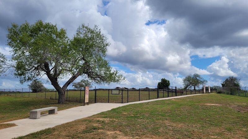
More about this marker. The ruins of the Mission Rosario State Historic Site are fenced off and not open to the general public. However, there is a small parking lot at the site which allow the general public access to a viewing area of the mission ruins.
Also see . . . Nuestra Señora del Rosario Mission. Texas State Historical Association (TSHA)
Nuestra Señora del Rosario Mission, Goliad County, so named by Capt. Manuel Ramírez de la Piscina of nearby Presidio La Bahía for the church in his native town in Spain, was also known as Nuestra Señora del Rosario de los Cujanes, Misión del Santísimo Rosario, and Misión del Rosario. It was established in November 1754 by Father Juan de Dios Camberos of the College of Nuestra Señora de Guadalupe de Zacatecas in an attempt to make peace with the various Karankawan tribes-the Cujanes, Copanes, Guapites, and Karankawas proper-who did not get along with the other Indians at the already existing missions. The site on the San Antonio River four miles west of Goliad was given to the Goliad State Park Commission by W. J. O'Connor in 1935. It is not open to the public.(Submitted on November 3, 2023, by James Hulse of Medina, Texas.)
Credits. This page was last revised on November 3, 2023. It was originally submitted on November 2, 2023, by James Hulse of Medina, Texas. This page has been viewed 68 times since then and 18 times this year. Photos: 1, 2, 3, 4. submitted on November 3, 2023, by James Hulse of Medina, Texas.


