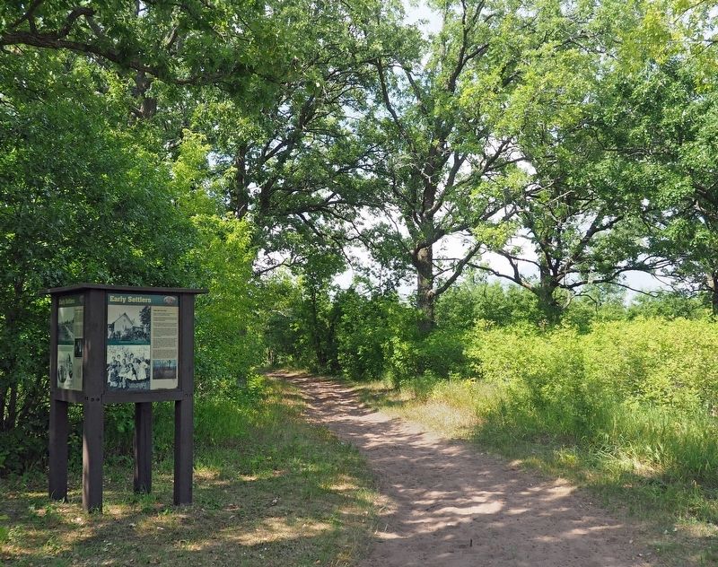
Wild River State Park near Almelund in Chisago County, Minnesota — The American Midwest (Upper Plains)
Early Settlers
— Looking for a Better Life —
[Panel 1]
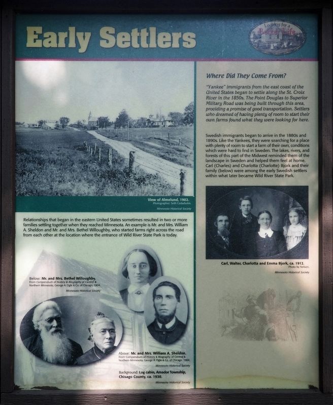
View of Almelund, 1902.
Photographer: Seth Cedarholm
Relationships that began in the eastern United States sometimes resulted in two or more families settling together when they reached Minnesota. An example is Mr. and Mrs. William A. Sheldon and Mr. and Mrs. Bethel Willoughby, who started farms right across the road from each other at the location where the entrance of Wild River State Park is today.
Below: Mr. and Mrs. Bethel Willoughby.
From Compendium of History & Biography of Central & Northern Minnesota, George A. Ogle & Co. of Chicago, 1904.
Above: Mr. and Mrs William A Sheldon.
From Compendium of History & Biography of Central & Northern Minnesota, George A. Ogle & Co. of Chicago, 1904.
Background: Log cabin, Amador Township, Chisago County, ca. 1930.
Minnesota Historical Society
Where Did They Come From?
"Yankee" immigrants from the east coast of the United States began to settled along the St. Croix River in the 1850s. The Point Douglas to Superior Military Road was being built through this area, providing a promise of good transportation. Settlers who dreamed of having plenty of room to start their own farms found what they were looking for here.
Swedish immigrants began to arrive in the 1880s and 1890s. Like the Yankees, they were searching for a place with plenty of room to start a farm of their own, conditions which were hard to find in Sweden. The lakes, rivers, and forests of this part of the Midwest reminded them of the landscape in Sweden and helped them feel at home. Carl (Charles) and Charlotta (Charlotte) Bjork and their family (below) were among the early Swedish settlers within what later became Wild River State Park.
Carl, Walter, Charlotta and Emma Bjork, ca. 1912.
Photo by Nelson
[Panel 2]
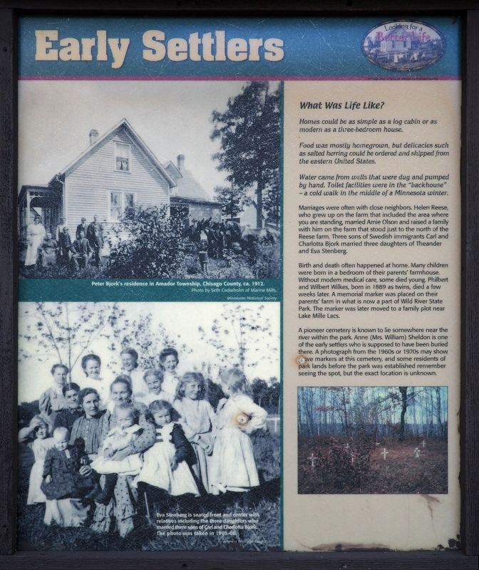
Peter Bjork's residence in Amador Township, Chisago County, ca. 1912.
Photo by Seth Cedarholm of Marine Mills
Eva Stenberg is seated front and center with relatives including the three daughters who married the three sons of Carl and Charlotta Bjork. The photo was taken in 1905-06.
What Was Life Like?
Homes could be as simple as a log cabin or as modern as a three-bedroom house.
Food was mostly homegrown, but delicacies such as salted herring could be ordered and shipped from the eastern United States.
Water came from wells that were dug and pumped by hand. Toilet facilities were in the "backhouse" – a cold walk in the middle of a Minnesota winter.
Marriages were often with close neighbors. Helen Reese, who grew up on the farm that included the area where you are standing, married Arnie Olson and raised a family with him on the farm that stood just to the north of the Reese farm. Three sons of Swedish immigrants Carl and Charlotta Bjork married three daughters of Theander and Eva Stenberg.
Birth and death often happened at home. Many children were born in a bedroom of their parents' farmhouse. Without modern medical care, some died young. Philbert and Wilbert Wilkes, born in 1889 as twins, died a few weeks later. A memorial marker was placed on their parents' farm in what is now a part of Wild River State Park. The marker was later moved to a family plot near Lake Mille Lacs.
A pioneer cemetery is known to lie somewhere near the river within the park. Anne (Mrs. William) Sheldon is one of the early settlers who is supposed to have been buried there. A photograph from the 1960s or 1970s may show grave markers at this cemetery, and some residents of park lands before the park was established remember seeing the spot, but the exact location is unknown.
[panel 3]
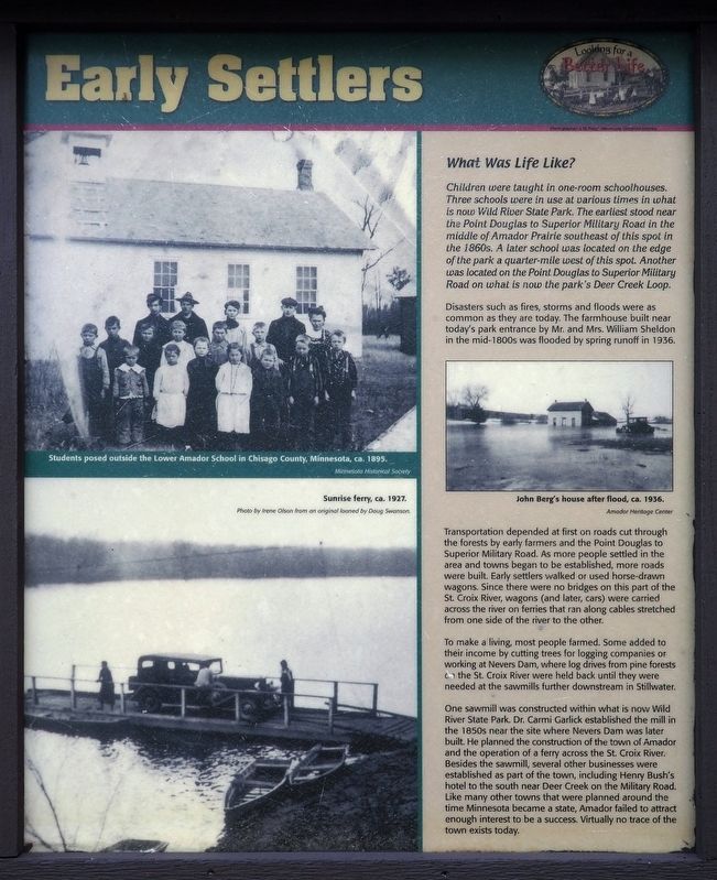
Students posed outside the Lower Amador School in Chisago County, Minnesota, ca. 1895.
Minnesota Historical Society
Sunrise ferry, ca. 1927.
Photo by Irene Olson from an original loaned by Doug Swanson.
What Was Life Life?
Children were taught in one-room schoolhouses. Three schools were in use at various times in what is now Wild River State Park. The earliest stood near the Point Douglas to Superior Military Road in the middle of Amador Prairie southeast of this spot in the 1860s. A later school was located on the edge of the park a quarter-mile west of this spot. Another was located on the Point Douglas to Superior Military Road on what is now the park's Deer Creek Loop.
Disasters such as fires, storms and floods were as common as they are today. The farmhouse built near today's park entrance by Mr. and Mrs. William Sheldon in the mid-1800s was flooded by spring runoff in 1936.
John Berg's house after a flood, ca. 1936.
Amador Heritage Center
Transportation depended at first on roads cut through the forests by early farmers and the Point Douglas to Superior Military Road. As more people settled in the area and towns began to be established, more roads were built. Early settlers walked or used horse-drawn wagons. Since there were no bridges on this part of the St. Croix River, wagons (and later, cars) were carried across the river on ferries that ran along cables stretched from one side of the river to the other.
To make a living, most people farmed. Some added to their income by cutting trees for logging companies or working at Nevers Dam, where log drives from pine forests on the St. Croix River were held back until they were needed at the sawmills further downstream in Stillwater.
One sawmill was constructed within what is now Wild River State Park. Dr. Carmi Garlick established the mill in the 1850s near the site where Nevers Dam was later built. He planned the construction of the town of Amador and the operation of a ferry across the St. Croix River. Besides the sawmill, several other businesses were established as part of the town, including Henry Bush's hotel to the south near Deer Creek on the Military Road. Like many other towns that were planned around the time Minnesota became a state, Amador failed to attract enough interest to be a success. Virtually no trace of the town exists today.
[Panel 4]
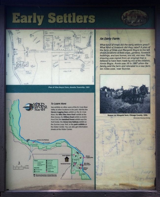
Plan of Silas Boyce Farm, Amador Township, 1887.
To Learn More...
See exhibits on other users of the St. Croix River Valley at other locations in the park. Visit the Nevers Logging Dam exhibit on the St. Croix River, the Who Was Here First? exhibit at the River Access, the Military Road exhibit on Amik's Pond Trail, the Vanished Forest exhibit near the Trail Center,
the Arrow Line Railway exhibit on the Sunrise Loop, or the park exhibits at the Visitor Center. You can also get information sheets at the Visitor Center.
An Early Farm
What kind of crops did the early settlers grow? What kind of livestock did they raise? A plan of the farm of Silas and Margaret Boyce to the left shows locations of field crops, gardens, livestock buildings, and two homes, one old, one new. This drawing was copied from an original that is believed to have been made by one of the children, Annie Boyce. Annie was 16 in 1887 when the family sold the farm and relocated to a new farm ten miles west, near Sunrise.
Reaper on Almquist farm, Chisago County, 1900.
Minnesota Historical Society
Erected by Minnesota Department of Natural Resources.
Topics. This historical marker is listed in these topic lists: Agriculture • Cemeteries & Burial Sites • Immigration • Settlements & Settlers. A significant historical year for this entry is 1850.
Location. 45° 32.504′ N, 92° 44.904′ W. Marker is near Almelund, Minnesota, in Chisago County. It is in Wild River State Park. The marker is at the trail intersection northwest of the Group Camp. Touch for map. Marker is at or near this postal address: 37475 Park Trail, North Branch MN 55056, United States of America. Touch for directions.
Other nearby markers. At least 8 other markers are within 2 miles of this marker, measured as the crow flies. Bringing Back the Prairie (approx. 0.9 miles away); What Happened (approx. 1.1 miles away); What Was It Like (approx. 1.1 miles away); Timber! (approx. 1.1 miles away); End of an Era (approx. 1.1 miles away); Nevers Dam (approx. 1.1 miles away); Who Was Here First? (approx. 1.6 miles away); Wild River State Park (approx. 1.7 miles away). Touch for a list and map of all markers in Almelund.
Credits. This page was last revised on November 11, 2023. It was originally submitted on November 4, 2023, by McGhiever of Minneapolis, Minnesota. This page has been viewed 39 times since then and 7 times this year. Photos: 1, 2, 3, 4, 5. submitted on November 4, 2023, by McGhiever of Minneapolis, Minnesota. • Andrew Ruppenstein was the editor who published this page.
