Marshall Terrace in Minneapolis in Hennepin County, Minnesota — The American Midwest (Upper Plains)
Marshall Terrace
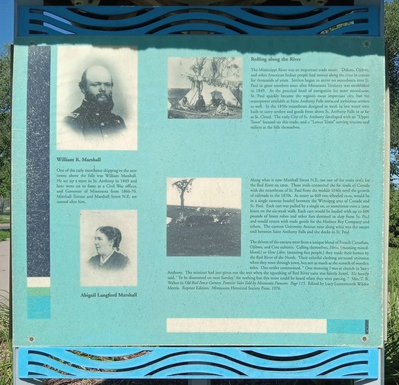
Rolling along the River
The Mississippi River was an important trade route. Dakota, Ojibwe, and other American Indian people had moved along the river in canoes for thousands of years. Settlers began to arrive on steamboats into St. Paul in great numbers soon after Minnesota Territory was established in 1849. As the practical head of navigation for most steamboats, St. Paul quickly became the region's most important city, but the waterpower available at Saint Anthony Falls attracted ambitious settlers as well. In the 1850s steamboats designed to work in low water were built to carry settlers and goods from above St. Anthony Falls to as far as St. Cloud. The early City of St. Anthony developed with an "Upper Town" focused on this trade, and a "Lower Town" serving tourists and millers at the falls themselves.
Along what is now Marshall Street N.E. ran one of the main trails for the Red River ox carts. These trails connected the fur trade of Canada with the steamboats of St. Paul from the middle 1840s until the growth of railroads in the 1870s. As many as 400 two wheeled carts would be in a single caravan headed between the Winnipeg area of Canada and St. Paul. Each cart was pulled by a single ox, or sometimes even a tame bison on the six-week walk. Each cart would be loaded with up to 600 pounds of bison robes and other furs destined to ship from St. Paul and would return with trade goods for the Hudson Bay Company and others. The current University Avenue runs along what was the oxcart trail between Saint Anthony Falls and the docks in St. Paul.
The drivers of the oxcarts were from a unique blend of French Canadian, Ojibwe, and Cree cultures. Calling themselves,
William R. Marshall
One of the early merchants shipping to the new towns above the falls was William Marshall. He set up a store in St. Anthony in 1849 and later went on to fame as a Civil War officer, and Governor of Minnesota from 1866-70. Marshall Terrace and Marshall Street N.E. are named after him.
Abigail Langford Marshall
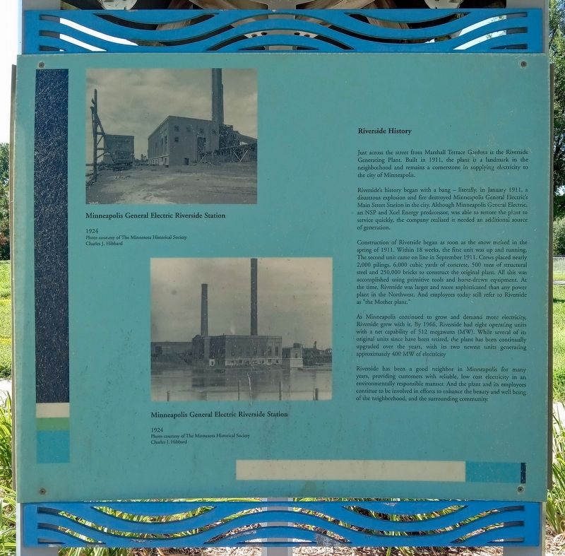
Minneapolis General Electric Riverside Station
1924
Photo courtesy of The Minnesota Historical Society
Charles J. Hibbard
Minneapolis General Electric Riverside Station
1924
Photo courtesy of The Minnesota Historical Society
Charles J. Hibbard
Riverside History
Just across the street from Marshall Terrace Gardens is the Riverside Generating Plant. Built in 1911, the plant is a landmark in the neighborhood and remains a cornerstone in supplying electricity to the city of Minneapolis.
Riverside's history began with a bang – literally. In January 1911, a disastrous explosion and fire destroyed Minneapolis General Electric's Main Street Station in the city. Although Minneapolis General Electric, an NSP and Xcel Energy predecessor, was able to restore the plant to service quickly, the company realized it needed an additional source of generation.
Construction of Riverside began as soon as the snow melted in the spring of 1911.
Within 18 weeks, the first unit was up and running. The second unit came on line in September 1911. Crews placed nearly 2,000 pilings, 6,000 cubic yards of concrete, 500 tons of structural steel and 250,000 bricks to construct the original plant. All this was accomplished using primitive tools and horse-drawn equipment. At the time, Riverside was larger and more sophisticated than any power plant in the Northwest. And employees today still refer to Riverside as "the Mother plant."
As Minneapolis continued to grow and demand more electricity, Riverside grew with it. By 1966, Riverside had eight operating units with a net capability of 512 megawatts (MW). While several of its original units since have been retired, the plant has been continually upgraded over the years, with its two newest units generating approximately 400 MW of electricity.
Riverside has been a good neighbor in Minneapolis for many years, providing customers with reliable, low cost electricity in an environmentally responsible manner. And the plant and its employees continue to be involved in efforts to enhance the beauty and well being of the neighborhood, and the surrounding community.
Topics. This historical marker is listed in these topic lists: Industry & Commerce • Native Americans • Roads & Vehicles • Waterways & Vessels. A significant historical year for this entry is 1849.
Location. 45° 1.418′ N, 93° 16.399′ W. Marker is in Minneapolis, Minnesota, in Hennepin County. It is in Marshall Terrace. Marker is at the intersection of Marshall Street NE and 31st Avenue NE, on the right when traveling north on Marshall Street NE. Touch for map. Marker is at or near this postal address: 3101 Marshall Street NE, Minneapolis MN 55418, United States of America. Touch for directions.
Other nearby markers. At least 8 other markers are within walking distance of this marker. MLB ★ Minnesota Twins Rod Carew All★Star Field (approx. 0.2 miles away); Carl Ripken, Sr. (approx. 0.2 miles away); Prairie to Brickyard: The Landscape of Northtown (approx. 0.3 miles away); Park Planning and the Grand Rounds (approx. 0.3 miles away); Columbia Park and Golf Course (approx. 0.3 miles away); Northtown and the St. Anthony Parkway Bridge (approx. 0.3 miles away); New Bridge Planning Process and Design (approx. 0.3 miles away); Land Use (approx. ¾ mile away). Touch for a list and map of all markers in Minneapolis.
Credits. This page was last revised on November 18, 2023. It was originally submitted on November 5, 2023, by McGhiever of Minneapolis, Minnesota. This page has been viewed 46 times since then and 17 times this year. Photos: 1, 2, 3. submitted on November 5, 2023, by McGhiever of Minneapolis, Minnesota. • J. Makali Bruton was the editor who published this page.


