Swansea in Bristol County, Massachusetts — The American Northeast (New England)
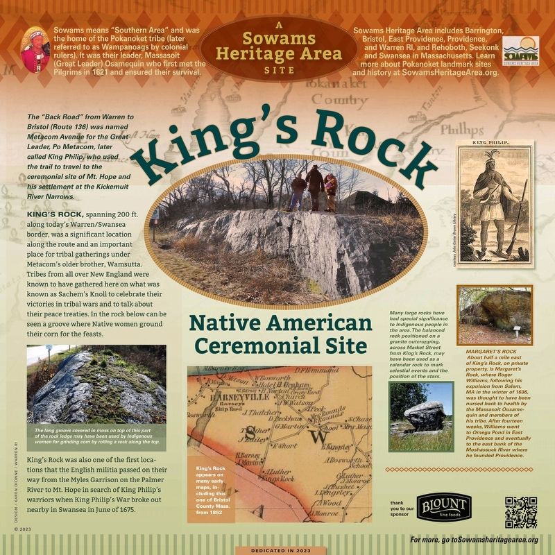
King's Rock
Native American Ceremonial Site
— Sachem's Knoll —
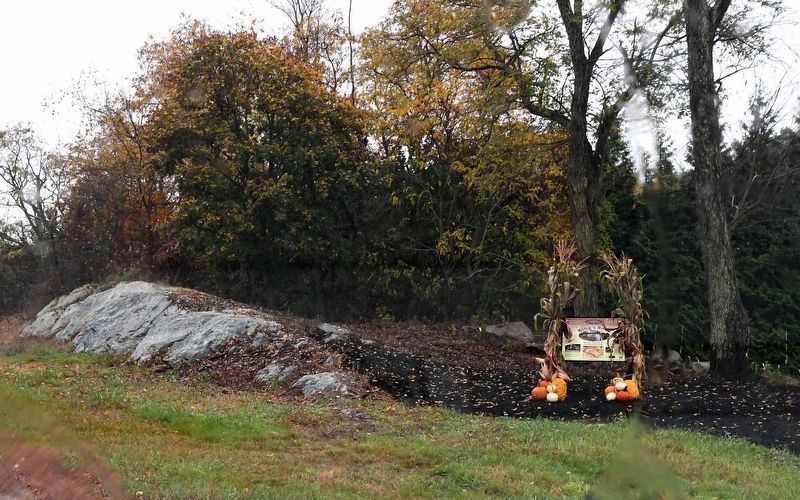
King’s Rock, spanning 200 ft. along today’s Warren/Swansea border, was a significant location along the route and an important place for tribal gatherings under Metacom’s older brother, Wamsutta. Tribes from all over New England were known to have gathered here on what was known as Sachem’s Knoll to celebrate their victories in tribal wars and to talk about their peace treaties. In the rock can be seen a groove where Native women ground their corn for the feasts.
King’s Rock was also one of the first locations that the English militia passed on their way from the Myles Garrison on the Palmer River to Mt. Hope in search of King Philip’s warriors when King Philip’s War broke out nearby in Swansea in June of 1675.
Many large rocks have had special significance to Indigenous people in the area. The balanced rock positioned on a granite outcropping, across Market Street from King's Rock, may have been used as a calendar rock to mark celestial events and the position of the stars.
Margaret’s Rock
About half a mile east of King’s Rock, on private property, is Margaret’s Rock, where Roger Williams, following his expulsion from Salem, MA in the winter of 1636, was thought to have been nursed back to health by the Massasoit Ousamequin and members of his tribe. After fourteen weeks, Williams went to Omega Pond in East Providence and eventually to the east bank of the Moshassuck River where he founded Providence.
Sowams Heritage Area Site
Sowams means “Southern Area” and was the home of the Pokanokets (later renamed Wampanoags by colonial rulers). It was their leader, Massasoit (Great Leader) Osamequin who first met the Pilgrims in 1621 and ensured their survival.
Sowams Heritage Area includes Barrington, Bristol, East, Providence, Providence and Warren RI, and Rehoboth, Seekonk and Swansea in Massachusetts. Learn more about Pokanoket landmark sites and history at SowamsHeritageArea.org
( photo captions )
— The long groove in moss on top of this part of the rock ledge may have been used by Indigenous women for grinding corn by rolling a rock along the top.
— King’s Rock appears on many early maps, including this one of Bristol County Massachusetts. From 1852
Erected 2023.
Topics. This historical marker is listed in these topic lists: Anthropology & Archaeology • Colonial Era • Native Americans • Settlements & Settlers.
Location. 41° 45.385′ N, 71° 16.257′ W. Marker is in Swansea, Massachusetts, in Bristol County. Marker is on Market Street (Massachusetts Route 136) south of Stoney Hill Road, on the right when traveling south. Touch for map. Marker is in this post office area: Swansea MA 02777, United States of America. Touch for directions.
Other nearby markers. At least 8 other markers are within 2 miles of this marker, measured as the crow flies. Miles (Myles) Bridge (approx. 1.3 miles away); Site of Jonathan Barney - Mason Barney Shipyard (approx. 1.3 miles away); Myles Garrison House Site (approx. 1.4 miles away); The Warren Bridge (approx. 1.6 miles away in Rhode Island); Vietnam Memorial (approx. 1.6 miles away in Rhode Island); William Schaff (approx. 1.8 miles away in Rhode Island); New Meadow Neck (approx. 1.8 miles away in Rhode Island); Baptist Church in Warren, R.I. (approx. 1.9 miles away in Rhode Island). Touch for a list and map of all markers in Swansea.
Also see . . . Sowams Heritage Area. (Submitted on November 13, 2023, by Michael Herrick of Southbury, Connecticut.)
Additional keywords. Sachem's Knoll, perched rock
Credits. This page was last revised on November 13, 2023. It was originally submitted on November 7, 2023, by David Weed of Warren, Rhode Island. This page has been viewed 138 times since then and 81 times this year. Photos: 1. submitted on November 7, 2023, by David Weed of Warren, Rhode Island. 2. submitted on November 12, 2023, by David Weed of Warren, Rhode Island. • Michael Herrick was the editor who published this page.

