Waukee in Dallas County, Iowa — The American Midwest (Upper Plains)
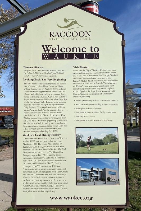
Welcome to Waukee
— Raccoon River Valley Trail —
Waukee History
Adapted from "The Road to Waukee's Future" By Deborah Mikelson (Originally published in the July 2014 issue of myWaukee Magazine)
Looking Back-The Very Beginning
The first people to lay the cornerstone for Waukee were General Lewis Addison Grant and Major William Ragan, who, on April 30, 1869, purchased the land surrounding the area on which The Des Moines Valley Railroad had just announced that it would be building a railroad. Gen. Grant and Major Ragan named the town Shirley, but when Gen. Reid of the Des Moines Valley Railroad heard about it, he said it should be changed. As reported in the Daily Register, "The proprietors named it Shirley, but the 'powers that be' in the railroad office in Keokuk insisted that it should have an Indian appellation, and hence Waukee it had to be. What Waukee means, we don't know. For that, you must ask Gen. Reid." Businesses popped up quickly after the railroad was built, including lumber yards and hardware, drug, grocery and grain stores. Daily post office service began in November 1869, and Waukee incorporated on July 2nd, 1878.
Waukee's Coal Mining History
There were coal mines all over the state of Iowa in the late 1800's, and speculators first surveyed Waukee in 1883. The Harris Mine opened on September 20th, 1920, just two and a half miles northeast of Hickman Road in Waukee. The Shuler Mine, owned and operated by The Shuler Coal Company, opened in 1921. It was the largest producer of coal in Iowa, and it had the deepest mine shaft — 387 feet. It was located one mile east of Harris, until it closed on May 27, 1949. It employed up to 500 men and used 32 mules. A substantial mining camp community developed, comprised mostly of immigrants from Italy, Croatia and Sweden. The community included churches, a school, a dance hall, a tavern, two restaurants, a hardware store and a grocery store. Some of them lived in small homes built by Shuler that were called "South Camp" and "North Camp." These were located on what is now called Alice's Road. To read more, visit www.waukee.org/history.
Visit Waukee
Come visit the City of Waukee! Waukee hosts many events and activities throughout the year and invites you to be a part of the action. The Triangle, Waukee's downtown business district, plays host to the Farmer's Market, 4th of July Parade, and WaukeeFest, in addition to other annual festivals. Take advantage of Waukee's many amenities available in its eight recreational parks and three major trails or play a round of golf at the Sugar Creek Municipal Golf Course. Waukee is the recipient of a number of accolades, including:
• Fastest-growing city in Iowa —2013 Census Projection
• No. 1 city for homeownership in Iowa —NerdWallet
• Safest place in Iowa—Movoto
• Best place in Iowa to raise a family —NerdWallet
• Best city 2014 —Movoto
• Best places to live in America —CNN Money
www.waukee.org
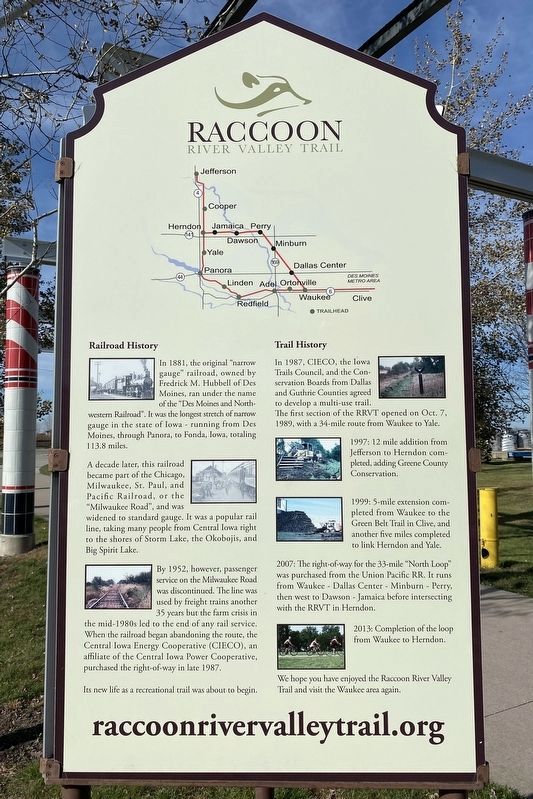
Railroad History
In 1881, the original "narrow gauge" railroad, owned by Fredrick M. Hubbell of Des Moines, ran under the name of the "Des Moines and Northwestern Railroad". It was the longest stretch of narrow gauge in the state of Iowa - running from Des Moines, through Panora, to Fonda, Iowa, totaling 113.8 miles.
A decade later, this railroad became part of the Chicago, Milwaukee, St. Paul, and Pacific Railroad, or the "Milwaukee Road", and was widened to standard gauge. It was a popular rail line, taking many people from Central Iowa right to the shores of Storm Lake, the Okobojis, and Big Spirit Lake.
By 1952, however, passenger service on the Milwaukee Road was discontinued. The line was used by freight trains another 35 years but the farm crisis in the mid-1980s led to the end of any rail service. When the railroad began abandoning the route, the Central Iowa Energy Cooperative (CIECO), an affiliate of the Central Iowa Power Cooperative, purchased the right-of-way in late 1987.
Its new life as a recreational trail was about to begin.
Trail History
In 1987, CIECO, the Iowa Trails Council, and the Conservation Boards from Dallas and Guthrie Counties agreed to develop a multi-use trail. The first section of the RRVT opened on Oct. 7, 1989, with a 34-mile route from Waukee to Yale.
1997: 12 mile addition from Jefferson to Herndon completed, adding Greene County Conservation.
1999: 5-mile extension completed from Waukee to the Green Belt Trail in Clive, and another five miles completed to link Herndon and Yale.
2007: The right-of-way for the 33-mile "North Loop" was purchased from the Union Pacific RR. It runs from Waukee - Dallas Center - Minburn - Perry, then west to Dawson - Jamaica before intersecting with the RRVT in Herndon.
2013: Completion of the loop from Waukee to Herndon.
We hope you have enjoyed the Raccoon River Valley Trail and visit the Waukee area again.
raccoonrivervalleytrail.org
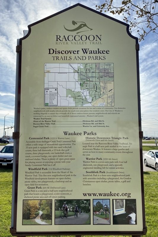
Discover Waukee
Trails and Parks
Waukee's parks, outdoor shelters and sports fields provide occasions for fun and a sense of community. Our distinctive neighborhoods with nearby schools provide the small-town atmosphere that residents crave. The City of Waukee is working diligently to ensure that eventually all of those outdoor leisure pursuits, neighborhoods and schools are connected by an easy to follow and beautifully maintained amenity—Waukee's trail system.
Waukee Trail System
Heart of the Warrior Trail................................................Hickman Rd. and 10th St.
Racoon River Valley Trail...................................................Hickman Rd. and 10th St.
Sugar Creek Trail............................................................... Warrior Ln. and University Ave.
Waukee Parks
Centennial Park (1255 S. Warrior Lane)
Accessible from theSugar Creek Trail, Centennial Park offers a wide range of recreational opportunities. The 33-acre park is equipped with two sand volleyball courts, three ball diamonds, a 12-hole disc golf course, three playgrounds, one basketball court, a creek, a covered bridge, one open shelter and one enclosed shelter. There is plenty of open green space for playing soccer or enjoying a picnic with your family. Centennial Park has it all!
Windfield Park (114 Windfield Parkway)
Windfield Park is accessible from the Heart of the Warrior Trail. This five-acre neighborhood park in the Windfield development features an open shelter, picnic tables, two playgrounds, a backstop and an open field for recreation.
Grant Park (605 SE Driftwood Lane)
Grant Park is a one-and-a-half-acre neighborhood park that boasts a playground, a joint restroom, a sheltered picnic area and off-street parking.
Historic Downtown Triangle Park (Ashworth Drive and 6th Street)
Located near the Raccoon River Valley Trailhead, Triangle Park is a half-acre park nestled in the heart of downtown Waukee. It features a large gazebo and serves as host to many community events throughout the year.
Warrior Park (1050 4th Street)
Warrior Park is a seven-acre park with four ball diamonds, one playground, and a specially engineered sledding hill for winter activities.
Southfork Park (Southbranch Drive)
Southfork Park is a three-acre neighborhood park with amenities including a playground, the Gordon Christianson open shelter, picnic tables, a grill and benches.
www.waukee.org
Topics. This historical marker is listed in these topic lists: Parks & Recreational Areas • Railroads & Streetcars • Roads & Vehicles • Waterways & Vessels. A significant historical date for this entry is April 30, 1869.
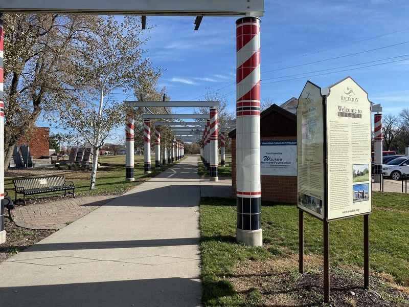
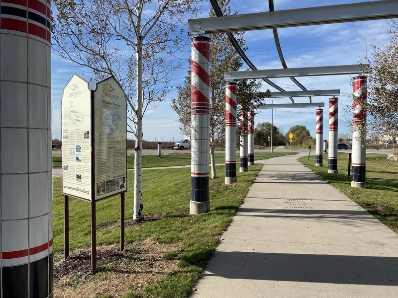
Location. 41° 36.94′ N, 93° 53.455′ W. Marker is in Waukee, Iowa, in Dallas County. Marker can be reached from North 10th Street north of Hickman Road (U.S. 6), on the right when traveling north . Located along the Raccoon River Valley Trail, at the Waukee trailhead. Touch for map. Marker is at or near this postal address: 955 Hickman Rd, Waukee IA 50263, United States of America. Touch for directions.
Other nearby markers. At least 7 other markers are within 11 miles of this marker, measured as the crow flies. Ortonville (approx. 3.6 miles away); Dallas County (approx. 4.3 miles away); Walnut Creek, Clive (approx. 8 miles away); Prairie Engine (approx. 8 miles away); Welcome to the Jordan House (approx. 9 miles away); Valley Junction (approx. 10 miles away); Granger Subsistence Homestead Project (approx. 10.6 miles away).
Credits. This page was last revised on November 22, 2023. It was originally submitted on November 21, 2023. This page has been viewed 91 times since then and 43 times this year. Photos: 1, 2, 3, 4, 5. submitted on November 21, 2023.
