Adams Morgan in Northwest Washington in Washington, District of Columbia — The American Northeast (Mid-Atlantic)
Seeking Freedom
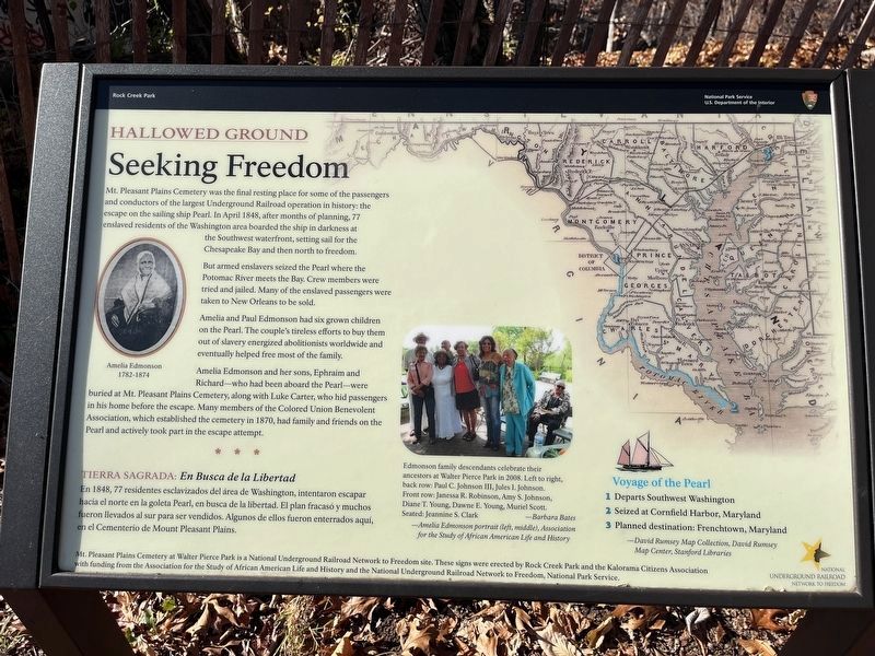
Hallowed Ground
— Rock Creek Park, National Park Service, U.S. Department of the Interior —
Mt. Pleasant Plains Cemetery was the final resting place for some of the passengers and conductors of the largest Underground Railroad operation in history: the escape on the sailing ship Pearl. In April 1848, after months of planning, 77 enslaved residents of the Washington area boarded the ship in darkness at the Southwest waterfront, setting sail for the Chesapeake Bay and then north to freedom.
But armed enslavers seized the Pearl where the Potomac River meets the Bay. Crew members were tried and jailed. Many of the enslaved passengers were taken to New Orleans to be sold.
Amelia and Paul Edmonson had six grown children on board the Pearl. The couple's tireless efforts to buy them out of slavery energized abolitionists worldwide and eventually helped free most of the family.
Amelia Edmonson and her sons, Ephraim and Richard—who had been aboard the Pearl—were buried at Mt. Pleasant Plains Cemetery, along with Luke Carter, who hid passengers in his home before the escape. Many members of the Colored Union Benevolent Association, which established the cemetery in 1870, had family and friends on the Pearl and actively took part in the escape attempt.
En 1848, 77 residentes esclavizados del área de Washington, intentaron escapar hacia el norte en la goleta Pearl, en busca de la libertad. El plan fracasó y muchos fueron llevados al sur para ser vendidos. Algunos de ellos fueron enterrados aquí, en el Cementario de Mount Pleasant Plains.
[Captions:]
Edmonson family descendants celebrate their ancestors at Walter Pierce Park in 2008. Left to right, back row: Paul C. Johnson III, Jules I. Johnson. Front row: Janessa R. Robinson, Amy S. Johnson, Diane T. Young, Dawne E. Young, Muriel Scott. Seated: Jeannine S. Clark — Barbara Bates
— Amelia Edmonson portrait (left, middle), Association for the Study of African American Life and History
Voyage of the Pearl
1 Departs Southwest Washington
2

Photographed By Devry Becker Jones (CC0), November 25, 2023
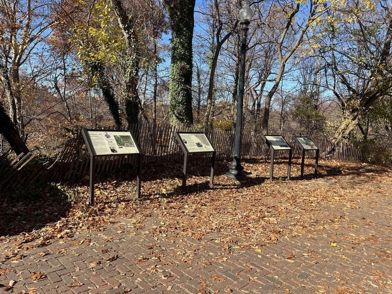
2. Hollowed Ground markers on the grounds of Walter Pierce Park
3 Planned destination: Frenchtown, Maryland
— David Rumsey Map Collection, David Rumsey Map Center, Stanford Libraries
Erected by National Park Service, U.S. Department of the Interior.
Topics and series. This historical marker is listed in these topic lists: Abolition & Underground RR • African Americans • Cemeteries & Burial Sites • Waterways & Vessels. In addition, it is included in the National Underground Railroad Network to Freedom series list. A significant historical month for this entry is April 1848.
Location. 38° 55.411′ N, 77° 2.851′ W. Marker is in Northwest Washington in Washington, District of Columbia. It is in Adams Morgan. Marker is at the intersection of Calvert Street Northwest and 20th Street Northwest, on the right when traveling west on Calvert Street Northwest. Touch for map. Marker is at or near this postal address: 1971 Calvert Street Northwest, Washington DC 20009, United States of America. Touch for directions.
Other nearby markers. At least 8 other markers are within walking distance of this marker. Resilience and Resistance (here, next to this marker); Soldiers, Sailors, and Refugees of War (here, next to this marker); Rediscovery and Remembrance (here, next to this marker); Archaeology in Adams Morgan: Surveying the Walter Pierce Park Cemeteries, 2005-2013 (a few steps from this marker); The ›Duke‹ Ellington Memorial Bridge (a few steps from this marker); Historic Cemetery (about 400 feet away, measured in a direct line); Walter Pierce Park (approx. 0.2 miles away); Herring Highway (approx. 0.2 miles away). Touch for a list and map of all markers in Northwest Washington.
Credits. This page was last revised on November 25, 2023. It was originally submitted on November 25, 2023, by Devry Becker Jones of Washington, District of Columbia. This page has been viewed 59 times since then and 27 times this year. Photos: 1, 2. submitted on November 25, 2023, by Devry Becker Jones of Washington, District of Columbia.
