Ouidah, Atlantique Department, Benin — West Africa
The French Military Cemetery
Photographed by J. Makali Bruton, September 5, 2023
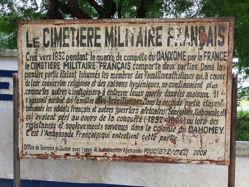
1. The French Military Cemetery Marker

Crée vers 1892 pendant la guerre de conquête du Danxome par la France, le Cimetiere Militaire Français.comporte deux parties. Dans la première partie étaient inhumés les membres des familles catholiques qui à cause de leur conversion religieuse et des raisons hygiéniques, ne continuaient plus comme les autres «indigènes» à enterrer leurs morts dans les maisons. Il s'agissait surtout des familles afro-brésiliennes. Dans la seconde partie étaient inhumés les soldats français et autres guerriers africains (Sénégalais, Gabonnais, etc.) qui avaient péri au cours de la conquête (1892-1894) ou lors des resistances et soulevements survenus dans la colonie du Dahomey. C'est l'Ambassade Français qui entretient cette partie.
Office de Tourisme de Ouidah avec l'appui de la operation Allemande PDDC/GTZ/DED 2008
The French Military Cemetery
Created around 1892 during the war of conquest of Danxome by France, the French Military Cemetery has two parts. In the first part were buried the members of Catholic families who, because of their religious conversion and hygienic reasons,
this page online
Ouidah Tourist Office with the support of the German operation PDDC/GTZ/DED 2008
Erected 2008 by Ouidah Tourist Office with the support of the German operation PDDC/G7Z/DED.
Topics. This historical marker is listed in these topic lists: Cemeteries & Burial Sites • Wars, Non-US. A significant historical year for this entry is 1892.
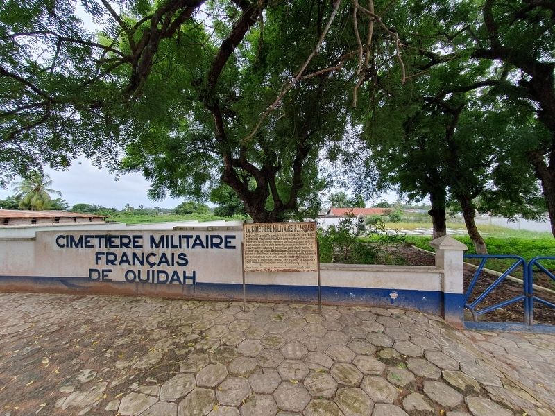
Location. 6° 21.589′ N, 2° 5.746′ E. Marker is in Ouidah, Atlantique Department. It is on Rue van Vollenhoven east of Route des Esclaves, on the right when traveling east. Touch for map. Marker is at or near this postal address: Rue van Vollenhoven, Ouidah, Atlantique Department, Benin. Touch for directions.

Regionally, it is in Africa, Sub-Saharan Africa, and specifically West Africa. Historically, it finds itself in
Photographed by J. Makali Bruton, September 5, 2023
2. The French Military Cemetery Marker
Other nearby markers. At least 3 other markers are within walking distance of this marker: French Military Memorial (a few steps from this marker); Father Francesco Borghero (approx. 1.2 kilometers away); Pope Benedict XVI and Africae Munus (approx. 1.2 kilometers away).
Credits. This page was last revised on November 30, 2023. It was originally submitted on November 28, 2023, by J. Makali Bruton of Washington, District of Columbia. This page has been viewed 185 times since then and 21 times this year. Photos: 1, 2. submitted on November 28, 2023, by J. Makali Bruton of Washington, District of Columbia.
