Bethel in Prince William County, Virginia — The American South (Mid-Atlantic)
Old Telegraph Road
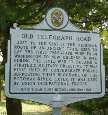
Photographed by Kevin White, August 24, 2007
1. Old Telegraph Road Marker
Erected 1986 by Prince William County Historical Commission. (Marker Number 24.)
Topics and series. This historical marker is listed in these topic lists: Science & Medicine • War, US Civil. In addition, it is included in the Virginia, Prince William County Historical Commission series list. A significant historical year for this entry is 1847.
Location. 38° 38.445′ N, 77° 17.511′ W. Marker is in Bethel, Virginia, in Prince William County. It is at the intersection of Potomac Mills Circle and Bidderford Way, on the left when traveling north on Potomac Mills Circle. Touch for map. Marker is in this post office area: Woodbridge VA 22192, United States of America. Touch for directions.

Regionally, this marker is in the Washington Metropolitan Area, in Northern Virginia, and in the
this page online
Other nearby markers. At least 8 other markers are within 2 miles of this marker, measured as the crow flies: William Grayson’s Grave (approx. 0.9 miles away); Revolutionary Soldiers Spence and William Grayson (approx. one mile away); Spence and William Grayson (approx. one mile away); Old Bethel High School (approx. 1.3 miles away); Old Bethel Church (approx. 1.4 miles away); Freedom High School Sundial Memorial (approx. 1.4 miles away); Russell House and Store (approx. 1.4 miles away); Potomac Path (approx. 1½ miles away).
More about this marker. Marker used to be located at the main entrance to Potomac Mills Mall.
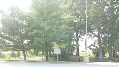
Photographed by Kevin White, August 24, 2007
2. Old Telegraph Road Marker
Behind the marker is one of at least two cemeteries on land housing Potomac Mills.
Credits. This page was last revised on December 4, 2023. It was originally submitted on August 24, 2007, by Kevin W. of Stafford, Virginia. This page has been viewed 5,047 times since then and 158 times this year. Last updated on December 4, 2023, by N. Jozsa of Woodbridge, Virginia. Photos: 1, 2. submitted on August 24, 2007, by Kevin W. of Stafford, Virginia. • Bernard Fisher was the editor who published this page.
