Buckhead in Atlanta in Fulton County, Georgia — The American South (South Atlantic)
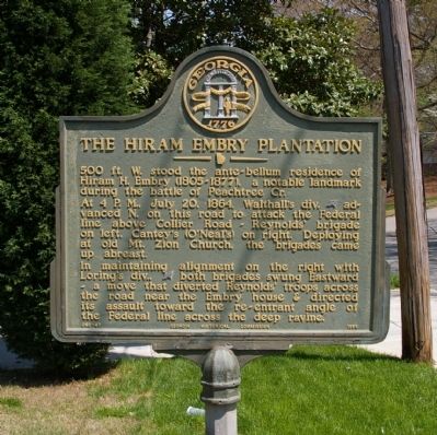
The Hiram Embry Plantation
Photographed by David Seibert, April 8, 2009
1. The Hiram Embry Plantation Marker
At 4 P.M., July 20, 1864, Walthall’s div. [CS] advanced N. on this road to attack the Federal line above Collier Road ~ Reynolds’ brigade on left, Cantey’s (O’Neal’s) on right. Deploying at old Mt. Zion Church, the brigades came up abreast.
In maintaining alignment on the right with Loring’s div., [CS] both brigades swung Eastward ~ a move that diverted Reynolds’ troops across the road near the Embry house & directed its assault toward the re-entrant angle of the Federal line across the deep ravine.
Erected 1955 by Georgia Historical Commission. (Marker Number 060-47.)
Topics and series. This historical marker is listed in this topic list: War, US Civil. In addition, it is included in the Georgia Historical Society series list. A significant historical date for this entry is July 20, 1864.
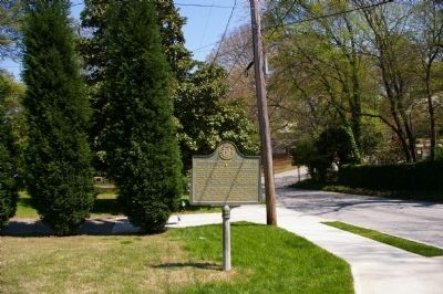
Location. 33° 48.475′ N, 84° 24.725′ W. Marker is in Atlanta, Georgia, in Fulton County. It is in Buckhead. It is on Channing Drive NW east of Howell Mill Road, on the left when traveling east. Touch for map.
this page online

Regionally, this marker is in the Piedmont. It is also in the American South and specifically in the Deep South. Globally, it is in North America, the Western Hemisphere, the Western World, and the Anglosphere. Historically, it finds itself in what was once the territory of the Mississippian Culture, one of the original Thirteen Colonies, one of the Confederate States of America, and the Antebellum South.
Other nearby markers. At least 8 other markers are within walking distance of this marker: Reynolds’ Brigade at the Ravine (about 700 feet away, measured in a direct line); Maj. William C. Preston C.S.A (approx. 0.2 miles away); Old Mt. Zion Church (approx. 0.2 miles away); Geary’s Refused Line (approx. 0.3 miles away); O’Neal’s Brigade (approx. 0.3 miles away); O’Neal’s Brigade at the Ravine (approx. 0.4 miles away); Williams' Div. Deployed (approx. half a mile away); Outer Defense Line (approx. half a mile away). Touch for a list and map of all markers in Atlanta.
Additional commentary.
1. Hiram Embry
My husbands
Photographed by David Seibert, April 8, 2009
2. The Hiram Embry Plantation Marker
— Submitted October 13, 2010, by Eileen Washington of Marble Falls, Texas.
Photographed by David Seibert, April 8, 2009
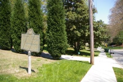
3. The Hiram Embry Plantation Marker
Looking east on Channing Drive
Photographed by David Seibert, March 27, 2010
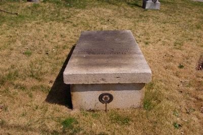
4. Hiram H. Embry Monument
This monument to Hiram H. Embry is located nearby at the site of the old Mt. Zion Baptist Church on Howell Mill Road
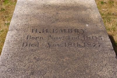
Photographed by David Seibert, March 27, 2010
5. Hiram H. Embry Monument
At the nearby old Mt. Zion Baptist Church
Credits. This page was last revised on December 11, 2023. It was originally submitted on April 8, 2009, by David Seibert of Sandy Springs, Georgia. This page has been viewed 2,873 times since then and 104 times this year. Last updated on December 9, 2023, by Amanda Zimmer of Atlanta, Georgia. Photos: 1, 2, 3. submitted on April 8, 2009, by David Seibert of Sandy Springs, Georgia. 4, 5. submitted on April 15, 2010, by David Seibert of Sandy Springs, Georgia. • Bernard Fisher was the editor who published this page.
