Near Menasha in Winnebago County, Wisconsin — The American Midwest (Great Lakes)
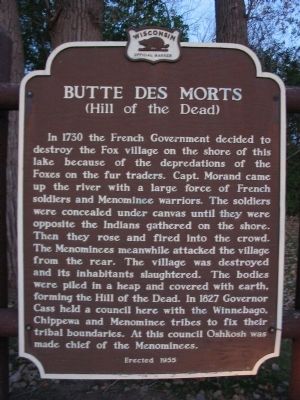
Butte des Morts
(Hill of the Dead)
Photographed by Keith L, August 6, 2008
1. Butte des Morts Marker
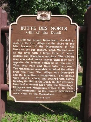
In 1730 the French Government decided to destroy the Fox village on the shore of this lake because of the depredations of the Foxes on the fur traders. Capt. Morand came up the river with a large force of French soldiers and Menominee warriors. The soldiers were concealed under canvas until they were opposite the Indians gathered on the shore. Then they rose and fired into the crowd. The Menominees meanwhile attacked the village from the rear. The village was destroyed and its inhabitants slaughtered. The bodies were piled in a heap and covered with earth, forming the Hill of the Dead. In 1827 Governor Cass held a council here with the Winnebago, Chippewa and Menominee tribes to fix their tribal boundaries. At this council Oshkosh was made chief of the Menominees.
Erected 1955 by the Wisconsin Historical Society. (Marker Number 40.)
Topics and series. This historical marker is listed in these topic lists: Cemeteries & Burial Sites • Landmarks • Wars, US Indian. In addition, it is included in the Wisconsin Historical Society series list. A significant historical year for this entry is 1730.
Location. Marker has been permanently removed. It was located
this page online
We have been informed that this marker is no longer there and will not be replaced. This page is an archival view of what was.
Regionally, this marker was in Wisconsin’s Fox River Valley. It was also in the American Midwest and in the Corn Belt. Globally, it was in North America, the Western Hemisphere, the Western World, and the Anglosphere. Historically, it found itself in what was once the territory of the Mississippian Culture and also the Northwest Territory.

Other nearby markers. At least 8 other markers are within 2 miles of this location, measured as the crow flies: Fritse Park - Indian Mound Reconstruction (about 400 feet away, measured in a direct line); Menasha Lock (approx. 0.6 miles away);
Photographed by Keith L, August 6, 2008
2. Butte des Morts Marker
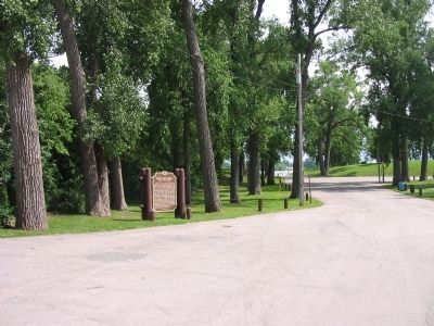
Regarding Butte des Morts. The wording of the marker and local belief that a major battle occurred here was debunked. See comments below. Because of this the marker was voluntarily removed. The marker had been enhanced with a billboard sized graphic that perhaps drew more attention to the belief.
Also see . . . Legends of Butte des Morts. Wisconsin Historical Society website entry:
“[The hill] was twelve feet high, sixty feet long north and south, and thirty-five feet wide. It stood in the midst of a wide prairie, 300 feet back from the lake shore, on a point of land that was thirty feet above the level of the lake, and the only high land on the west side of the lake.” (Submitted on October 30, 2007, by Keith L of Wisconsin Rapids, Wisconsin.)
Additional commentary.
1.

Photographed by Keith L, September 14, 2013
3. Butte des Morts Marker
The marker was removed in March 2015. Internet articles state the marker was removed because it could not be proven to be historically accurate. Note To Editor only visible by Contributor and editor
— Submitted June 30, 2017, by Eric Kuntz of Beaver Dam, Wisconsin.
Photographed by Keith L, August 6, 2008
4. Fox Cities Trestle
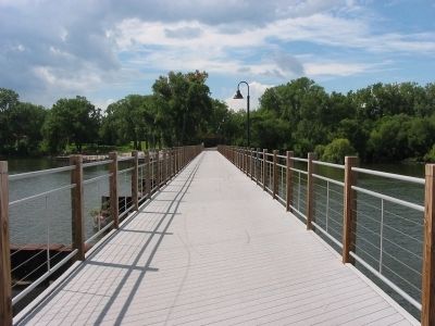
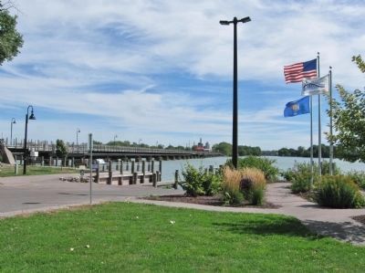
Originally a railroad bridge, the 1,600-foot long, lighted pedestrian bridge is the longest in Wisconsin.
Photographed by Keith L, September 14, 2013
5. Fox Cities Trestle
Photographed by Keith L, October 28, 2007
6. Butte des Morts Marker
Credits. This page was last revised on February 15, 2024. It was originally submitted on October 30, 2007, by Keith L of Wisconsin Rapids, Wisconsin. This page has been viewed 6,302 times since then and 441 times this year. Last updated on December 19, 2023, by shirley Heinz of Menasha, Wisconsin. Photos: 1, 2. submitted on August 10, 2008, by Keith L of Wisconsin Rapids, Wisconsin. 3. submitted on January 8, 2014, by Keith L of Wisconsin Rapids, Wisconsin. 4. submitted on August 10, 2008, by Keith L of Wisconsin Rapids, Wisconsin. 5. submitted on January 8, 2014, by Keith L of Wisconsin Rapids, Wisconsin. 6. submitted on October 30, 2007, by Keith L of Wisconsin Rapids, Wisconsin. • J. Makali Bruton was the editor who published this page.
