Riverfront in Chattanooga in Hamilton County, Tennessee — The American South (East South Central)
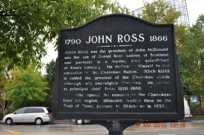
1790 John Ross 1866
Photographed by Sandra Hughes, September 27, 2010
1. 1790 John Ross 1866 Marker
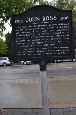
He fought against the removal of the Cherokees from this region, ultimately leading them on the Trail of Tears journey to Oklahoma in 1838.
Topics and series. This historical marker is listed in this topic list: Indigenous Peoples and Communities. In addition, it is included in the Trail of Tears series list. A significant historical year for this entry is 1838.
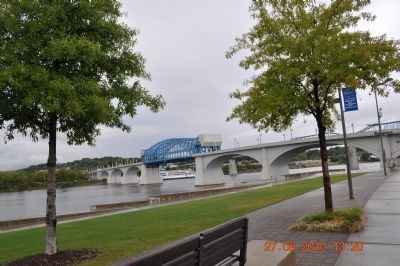
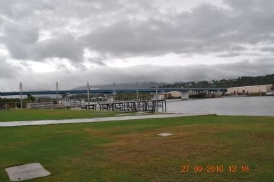
Location. Marker has been reported missing. It was located near 35° 3.387′ N, 85° 18.681′ W. Marker was in Chattanooga, Tennessee, in Hamilton County. It was in Riverfront. It could be reached from Riverfront Parkway. Located along the Chattanooga River walk near the Tennessee River, a few feet from Ross's Landing Marker. Just off Riverfront Parkway across the highway from the Tennessee Aquarium. Touch for map. Marker
this page online

Regionally, this marker was in the American South, specifically in the Upper South, in Appalachia, and specifically in Southern Appalachia. Globally, it was in North America, the Western Hemisphere, the Western World, and the Anglosphere. Historically, it found itself in what was once the original Cherokee Nation, the territory of the Mississippian Culture, one of the Confederate States of America, and the Antebellum South.
Other nearby markers. At least 8 other markers are within walking distance of this location: Chattanooga's First Citizens (here, next to this marker); Tennessee Valley Authority (here, next to this marker); Flooding Along the Tennessee River (a few steps from this marker); Ross's Landing (within shouting distance of this marker); "Cherokee" (about 300 feet away, measured in a direct line); a different marker also named Ross's Landing (about 300 feet away); Trail of Tears (about 400 feet away); Stickball / Seven Sisters (about 400 feet away). Touch for a list and map of all markers in Chattanooga.
Also see . . . John Ross Wikipedia Entry.
Photographed by Sandra Hughes, September 27, 2010
2. 1790 John Ross 1866 Marker
“In January 1824, Ross traveled to Washington to defend the Cherokees’ possession of their land. Calhoun offered two solutions to the Cherokee delegation: either relinquish title to their lands and remove west, or accept denationalization and become citizens of the United States. Rather than accept Calhoun’s ultimatum, Ross
Photographed by Sandra Hughes, September 27, 2010
3. 1790 John Ross 1866 Marker
Photographed by Sandra Hughes, September 27, 2010
4. Tennessee River
Photographed by Dale K. Benington, August 6, 2014
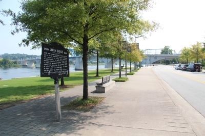
5. 1790 John Ross 1866 Marker
View of the marker, looking east along Riverfront Parkway.
Wikimedia Commons Collection, 1843
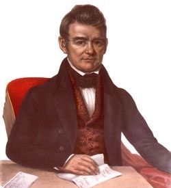
6. Chief John Ross (Guwisguwi) (b1790, d1866)
Library of Congress, Prints and Photographs Division LC-USZC4-3156
Credits. This page was last revised on August 12, 2024. It was originally submitted on September 29, 2010, by Sandra Hughes Tidwell of Killen, Alabama, USA. This page has been viewed 1,502 times since then and 54 times this year. Last updated on January 1, 2024, by Amanda Zimmer of Atlanta, Georgia. Photos: 1, 2, 3, 4. submitted on September 29, 2010, by Sandra Hughes Tidwell of Killen, Alabama, USA. 5. submitted on June 10, 2015, by Dale K. Benington of Toledo, Ohio. 6. submitted on December 17, 2010, by J. J. Prats of Powell, Ohio. • James Hulse was the editor who published this page.
