Houlton in St. Croix County, Wisconsin — The American Midwest (Great Lakes)
Indigenous Communities
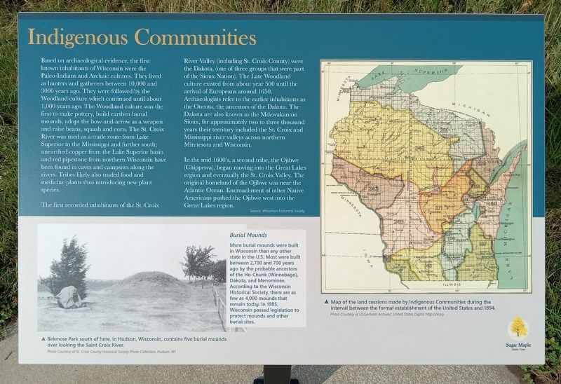
Based on archaeological evidence, the first known inhabitants of Wisconsin were the Paleo-Indians and Archaic cultures. They lived as hunters and gatherers between 10,000 and 3000 years ago. They were followed by the Woodland culture which continued until about 1,000 years ago. The Woodland culture was the first to make pottery, build earthen burial mounds, adopt the bow-and-arrow as a weapon and raise beans, squash and corn. The St. Croix River was used as a trade route from Lake Superior to the Mississippi and further south; unearthed copper from the Lake Superior basin and red pipestone from northern Wisconsin have been found in caves and campsites along the rivers. Tribes likely also traded food and medicine plants thus introducing new plant species.
The first recorded inhabitants of the St. Croix River Valley (including St. Croix County) were the Dakota, (one of three groups that were part of the Sioux Nation). The Late Woodland culture existed from about year 500 until the arrival of Europeans around 1650. Archaeologists refer to the earlier inhabitants as the Oneota, the ancestors of the Dakota. The Dakota are also known as the Mdewakanton Soiux, for approximately two to three thousand years their territory included the St. Croix and Mississippi river valleys across northern Minnesota and Wisconsin.
In the mid 1600's, a second tribe, the Ojibwe (Chippewa), began moving into the Great Lakes region and eventually the St. Croix Valley. The original homeland of the Ojibwe was near the Atlantic Ocean. Encroachment of other Native Americans pushed the Ojibwe west into the Great Lakes region.
Source: Wisconsin Historical Society
[Sidebar:]
Burial Mounds
More burial mounds were built in Wisconsin than any other state in the U.S. Most were built between 2,700 and 700 years ago by the probable ancestors of the Ho-Chunk (Winnebago), Dakota, and Menominee. According to the Wisconsin Historical Society, there are as few as 4,000 mounds that remain today. In 1985, Wisconsin passed legislation to protect mounds and other burial sites.
[Captions:]
Birkmose Park south of here, in Hudson, Wisconsin, contains five burial mounds over looking the Saint Croix River.
Photo Courtesy of St. Croix County Historical Society Photo Collection, Hudson, WI
Map of the land cessations made by Indigenous Communities during the interval between the formal establishment of the United States and 1894.
Photo Courtesy of USGenWeb Archives, United States Digital Map Library
State Tree
Topics. This historical marker is listed in these topic lists: Anthropology & Archaeology • Cemeteries & Burial Sites • Native Americans. A significant historical year for this entry is 1000 CE.
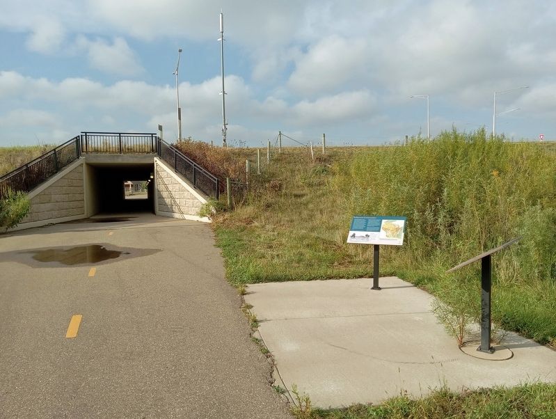
Location. 45° 3.536′ N, 92° 46.985′ W. Marker is in Houlton, Wisconsin, in St. Croix County. Marker can be reached from Wisconsin Route 35 east of Hawk Street, on the right when traveling east. The marker is on the St. Croix River Crossing Loop Trail, just south of the Blue Star Trailhead. Touch for map. Marker is at or near this postal address: 70 Houlton School Circle, Houlton WI 54082, United States of America. Touch for directions.
Other nearby markers. At least 8 other markers are within walking distance of this marker. Native American Communities (here, next to this marker); Western Prairie Restoration (approx. 0.2 miles away); Wisconsin Symbols (approx. 0.4 miles away); Loop Trail Fun Facts (approx. half a mile away); Glacial Landscape (approx. 0.6 miles away); Lower St. Croix River Sandbars (approx. 0.6 miles away); Town of St. Joseph (approx. 0.6 miles away); Houlton Hill History (approx. 0.7 miles away). Touch for a list and map of all markers in Houlton.
Credits. This page was last revised on January 5, 2024. It was originally submitted on January 5, 2024, by McGhiever of Minneapolis, Minnesota. This page has been viewed 49 times since then. Photos: 1, 2. submitted on January 5, 2024, by McGhiever of Minneapolis, Minnesota. • Devry Becker Jones was the editor who published this page.

