Hammond's Ferry in North Augusta in Aiken County, South Carolina — The American South (South Atlantic)
Riverfront Village
A Mississippi Native American Settlement
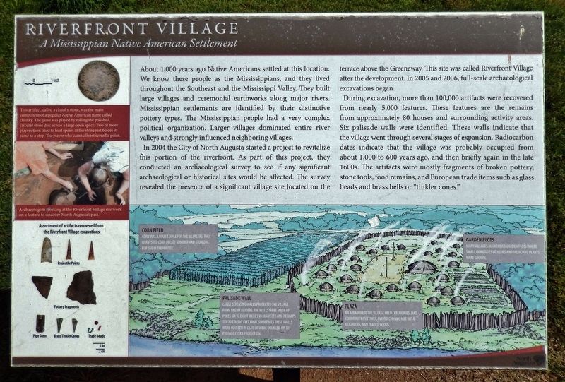
About 1,000 years ago Native Americans settled at this location. We know these people as the Mississippians, and they lived throughout the Southeast and the Mississippi Valley. They built large villages and ceremonial earthworks along major rivers. Mississippian settlements are identified by their distinctive pottery types. The Mississippian people had a very complex political organization. Larger villages dominated entire river valleys and strongly influenced neighboring villages.
In 2004 the City of North Augusta started a project to revitalize this portion of the riverfront. As part of this project, they conducted an archaeological survey to see if any significant archaeological or historical sites would be affected. The survey revealed the presence of a significant village site located on the terrace above the Greeneway. This site was called Riverfront Village after the development. In 2005 and 2006, full-scale archaeological excavations began.
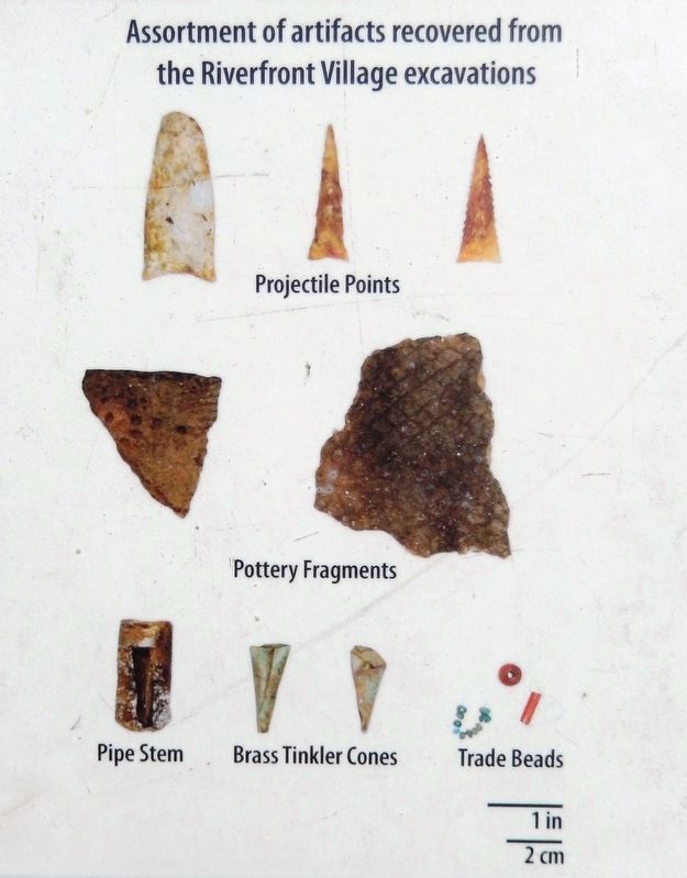
During excavation, more than 100,000 artifacts were recovered from nearly 5,000 features. These features are the remains from approximately 80 houses and surrounding activity areas. Six palisade walls were identified. These walls indicate that the village went through several stages of expansion. Radiocarbon dates indicate that the village was probably occupied from about 1,000 to 600 years ago, and then briefly again in the late 1600s. The artifacts were mostly fragments of broken pottery, stone tools, food remains, and European trade items such as glass beads and brass bells or "tinkler cones."
[other photo caption]
• Archaeologists working at the Riverfront Village site work on a feature to uncover North Augusta’s past.
Topics. This historical marker is listed in these topic lists: Anthropology & Archaeology • Native Americans • Settlements & Settlers • Waterways & Vessels.
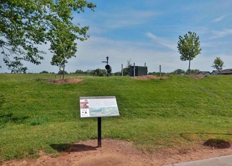
Location. 33° 29.1′ N, 81° 58.823′ W. Marker is in North Augusta, South Carolina, in Aiken County. It is in Hammond's Ferry. Marker can be reached from the intersection of Front Street and Blue Clay Drive, on the left when traveling west. The marker is located along the North Augusta Greeneway. Touch for map. Marker is in this post office area: North Augusta SC 29841, United States of America. Touch for directions.
Other nearby markers. At least 8 other markers are within walking distance of this marker. Boeckh Park (approx. 0.2 miles away); The Power of the Savannah River (approx. ¼ mile away); Sharon Lafaye Jones (approx. 0.3 miles away); Crossroads of the Southeast (approx. 0.4 miles away); Pottery Production in North Augusta (approx. 0.4 miles away); North Augusta's Historic Industrial Area
2022
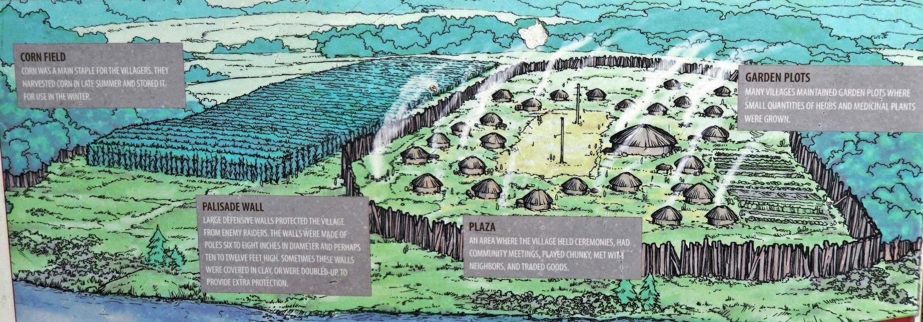
2. Marker detail: Riverfront Village Illustration
Corn Field
Corn was a main staple for the villagers. They harvested corn in late summer and stored it for use in the winter.
Corn was a main staple for the villagers. They harvested corn in late summer and stored it for use in the winter.
Palisade Wall
Large defensive walls protected the village from enemy raiders. The walls were made of poles six to eight inches in diameter and perhaps ten to twelve feet high. Sometimes these walls were covered in clay, or were doubled up, to provide extra protection.
Plaza
An area where the village held ceremonies, had community meetings, played chunky, met with neighbors, and traded goods.
Garden Plots
Many villages maintained garden plots where small quantities of herbs and medicinal plants were grown.
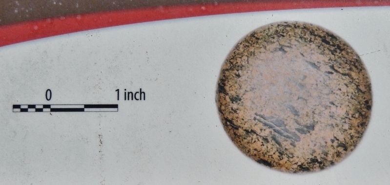
3. Marker detail: Chunky Stone
This artifact, called a chunky stone, was the main component of a popular Native American game called chunky. The game was played by rolling the polished, circular stone disc across a large open space. Two or more players then tried to hurl spears at the stone just before it came to a stop. The player who came closest scored a point.
Credits. This page was last revised on January 7, 2024. It was originally submitted on January 7, 2024, by Cosmos Mariner of Cape Canaveral, Florida. This page has been viewed 56 times since then. Photos: 1, 2, 3, 4, 5. submitted on January 7, 2024, by Cosmos Mariner of Cape Canaveral, Florida.
