South Beach on Staten Island in Richmond County, New York — The American Northeast (Mid-Atlantic)
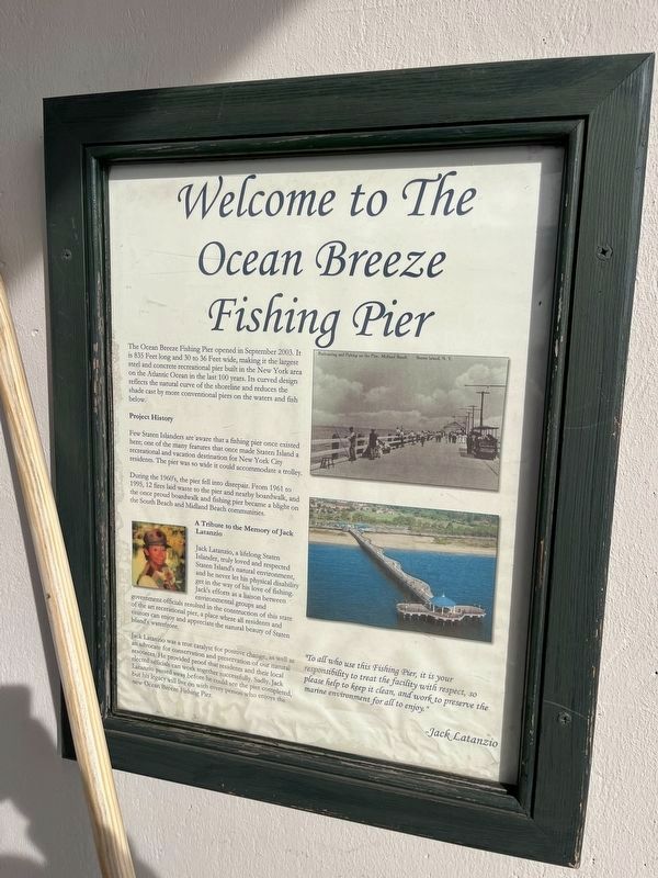
Welcome to the Ocean Breeze Fishing Pier

Photographed By Devry Becker Jones (CC0), January 12, 2024
1. Welcome to the Ocean Breeze Fishing Pier Marker
The Ocean Breeze Fishing Pier opened in September 2003. It is 835 Feet long and 30 to 36 Feet wide, making it the largest steel and concrete recreational pier built in the New York area and on the Atlantic Ocean in the last 100 years. Its curved design reflects the natural curve of the shoreline and reduces the shade cast by more than conventional piers on the waters and fish below.
Project History
Few Staten Islanders are aware that a fishing pier once existed here; one of the many features that once made Staten Island a recreational and vacation destination for New York City residents. The pier was so wide it could accommodate a trolley.
During the 1960's, the pier fell into disrepair. From 1961 to 1995, 12 fires laid waste to the pier and nearby boardwalk, and the once proud boardwalk and fishing pier became a blight on the South Beach and Midland Beach communities.
A Tribute to the Memory of Jack Latanzio
Jack Latanzio, a lifelong Staten Islander, truly loved and respected Staten Island's natural environment and he never let his physical disability get in the way of his love of fishing. Jack's efforts as a liaison between environmental groups and government officials resulted in the construction of this state of the art recreational pier, a place where all residents and visitors can enjoy and appreciate the natural beauty of Staten Island's waterfront.
Jack Latanzio was a true catalyst for positive change, as well as an advocate for conservation and preservation of our natural resources. He provided proof that residents and their elected officials can work together successfully. Sadly, Jack Latanzio passed away before he could see the pier completed, but his legacy will live on with every person who enjoys the new Ocean Breeze Fishing Pier.
"To all who use this Fishing Pier, it is your responsibility to treat the facility with respect, so please help to keep it clean, and work to preserve the marine environment for all to enjoy." - Jack Latanzio
Topics. This historical marker is listed in these topic lists: Architecture • Environment • Parks & Recreational Areas • Waterways & Vessels. A significant historical month for this entry is September 2003.
Location. 40° 34.786′ N, 74° 4.552′ W. Marker is on Staten Island, New York, in Richmond County. It is in South Beach. Marker is at the intersection of Franklin D. Roosevelt Boardwalk and Ocean Breeze Fishing Pier, on the left when traveling north on Franklin D. Roosevelt Boardwalk. Touch for map. Marker is at or near this postal address: 642 Father Capodanno Boulevard, Staten Island NY 10305, United States of America. Touch for directions.
Other nearby markers. At least 8 other markers are within 2 miles of this marker, measured as the crow flies. In Memory of Lieutenant Vincent R. Capodanno (approx. 0.9 miles away); Hurricane Sandy Memorial Garden (approx. 0.9 miles away); Midland Beach Veterans Memorial (approx. one mile away); 100 Years of Dedicated Service (approx. 1.2 miles away); New Dorp Beach Memorial (approx. 1.2 miles away); 102nd Observation Squadron (approx. 1.3 miles away); Elm Tree Light (approx. 1.3 miles away); Miller Field (approx. 1.3 miles away). Touch for a list and map of all markers in Staten Island.
Credits. This page was last revised on January 18, 2024. It was originally submitted on January 18, 2024, by Devry Becker Jones of Washington, District of Columbia. This page has been viewed 55 times since then. Photo 1. submitted on January 18, 2024, by Devry Becker Jones of Washington, District of Columbia.
Editor’s want-list for this marker. A wide shot of the marker in context. • Can you help?