Brigham City in Box Elder County, Utah — The American Mountains (Southwest)
Bushnell Hospital
⎯⎯⎯
Intermountain Indian School
| — | Brigham City Historic Tour | — |
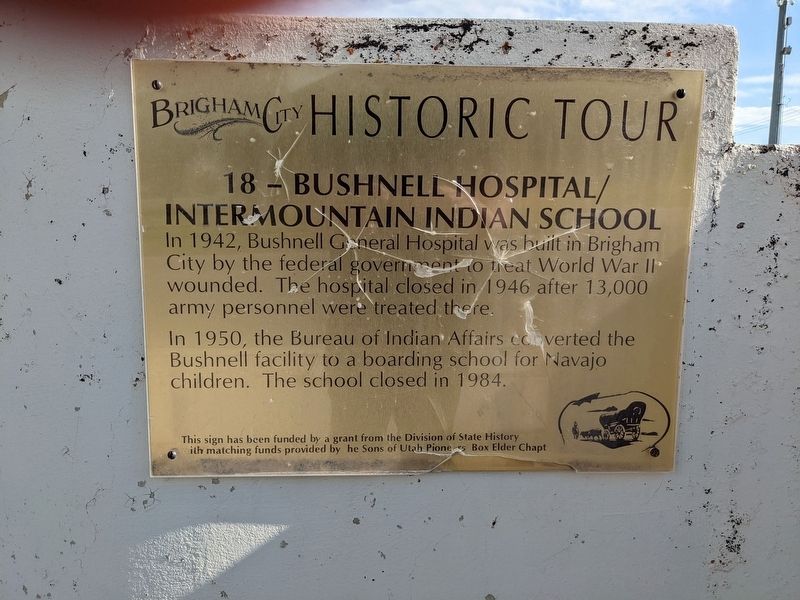
Photographed by Jeremy Snow, June 23, 2023
1. Bushnell Hospital/Intermountain Indian School Marker
In 1942, Bushnell General Hospital was built in Brigham City by the federal government to treat World War II wounded. The hospital closed in 1946 after 13,000 army personnel were treated there.
In 1950, the Bureau of Indian Affairs coverted the Bushnell facility to a boarding school for Navajo children. The school closed in 1984.
This sign has been funded by a grant from the Division of State History ith matching funds provided by he Sons of Utah Pioneers Box Elder Chapter (Marker Number 18.)
Topics and series. This historical marker is listed in these topic lists: Education • Indigenous Peoples and Communities • Science & Medicine • War, World II. In addition, it is included in the Sons of Utah Pioneers series list. A significant historical year for this entry is 1942.
Location. 41° 29.748′ N, 112° 0.609′ W. Marker is in Brigham City, Utah, in Box Elder County. It is at the intersection of East 700 South and S 400 E, on the right when traveling east on East 700 South. Touch for map. Marker is in this post office area: Brigham City UT 84302, United States of America. Touch for directions.

Regionally,
this page online
Other nearby markers. At least 8 other markers are within 2 miles of this marker, measured as the crow flies: Pioneer Care Center (approx. half a mile away); Lorenzo Snow Burial Site (approx. half a mile away); First Ward Meeting House (approx. 0.6 miles away); Brigham City Tabernacle (approx. 0.7 miles away); Brigham City Fire Station/City Hall (approx. 1.1 miles away); Brigham City Co-op Store (approx. 1.1 miles away); Baron Woolen Mill (approx. 1.1 miles away); A Pioneer Home (approx. 1.1 miles away). Touch for a list and map of all markers in Brigham City.
More about this marker. The marker is mounted to a decorative cement wall on the southwest corner of the intersection, across the street from the temple.
Credits. This page was last revised on September 29, 2024. It was originally submitted on February 6, 2024, by Jeremy Snow of Cedar City, Utah. This page has been viewed 441 times since then and 35 times this year. Photo 1. submitted on February 6, 2024, by Jeremy Snow of Cedar City, Utah. • Andrew Ruppenstein was the editor who published this page.
Editor’s want-list for this marker. photo of the marker and its surroundings • Can you help?
