Laurel Park in Henderson County, North Carolina — The American South (South Atlantic)
History & Restoration
Rhododendron Lake Nature Park
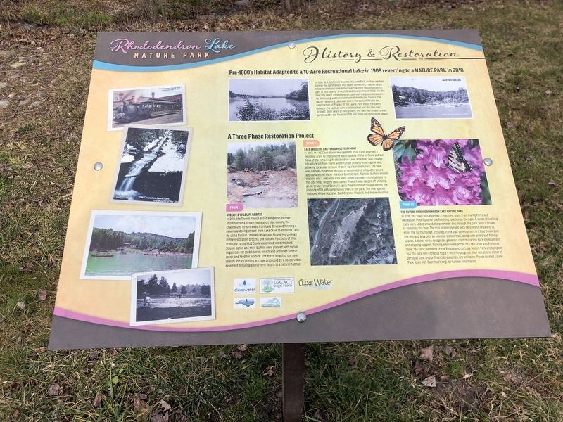
In 1909, W.A. Smith, the founder of Laurel Park, built an earthen dam on the north end of this valley converting a native forest into a recreational lake enhancing “the most beautiful natural park in this country” (French Broad Hustler, March 1909). For the next 60+ years, Rhododendron Lake was the premier location for swimming and entertainment in Henderson County. The Laurel Park Inn & Lake was sold in the early 1970's for the construction of Phase I of the Laurel Park Villas. For safety reasons, the earthen dam was breached and the lake was drained. After years of overgrowth, the lake bed property was purchased by the Town in 2009 and plans for restoration began.
A Three Phase Restoration Project
• Phase I: Stream & Wildlife Habitat – In 2011, the Town & French Broad Mitigation Partners implemented a stream restoration plan moving the channelized stream away from Lake Drive and forming a new meandering stream from Lake Drive to Primrose Lane. By using Natural Channel Design and Fluvial Morphology in the restoration process, the historic functions of this tributary to the Mud Creek watershed was restored. Stream banks and their buffers were planted with native vegetation for stabilization, which also provided habitat, cover, and food for wildlife. The entire length of the new stream and its buffers are now protected by a conservation easement ensuring a long-term return to a natural habitat.
• Phase II: Lake Dredging and Forebay Development – In 2013, the NC Clean Water Management Trust Fund awarded a matching grant to improve the water quality of the in-flows and out-flows of the remaining Rhododendron Lake. A forebay was created to capture silt from storm water run-off prior to entering the lake, allowing for easier removal of built-up silt in the future. The lake was dredged to remove decades of accumulated silt and to assure appropriate cold water releases downstream. Riparian buffers around the lake and a wetlands area were added to create microhabitats for fish and small wildlife sanctuaries. Phase II was capped off utilizing an NC Urban Forest Council Legacy Tree Fund matching grant for the planting of 28 additional native trees in the park. The tree species included Yellow Buckeye, Bald Cypress, Maple & Red-Horse chestnut.
• Phase III: The Future of Rhododendron Lake Nature Park – In 2016, the Town was awarded a matching grant from the NC Parks and Recreation Trust Fund for the finishing touches on the park. A series of walking trails were added around the perimeter and through the park, with a bridge to complete the loop. The trail is interspersed with benches to relax and to enjoy the surroundings. Included in the trail development is a boardwalk over the wetland area plus ab exercise station trail, along with picnic and fishing spaces. A donor circle recognizes generous contributors to park development and ongoing support. Parking areas were added on Lake Drive and Primrose Lane. The basic elements of the Rhododendron Lake Nature Park are complete but the park will continue to be a work-in-progress. Your donations, either in personal time and/or financial resources, are welcome. Please contact Laurel Park Town Hall (laurelpark.org) for further information.
Erected by Clean Water Management Trust Fund • North Carolina Urban Forest Council Legacy Tree Fund • ClearWater • North Carolina Parks and Recreation Trust Fund • North Carolina Urban Forest Council.
Topics. This historical marker is listed in these topic lists: Environment • Parks & Recreational Areas • Waterways & Vessels. A significant historical month for this entry is March 1909.
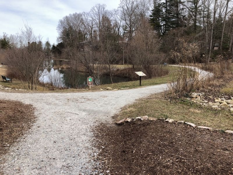
Location. 35° 18.574′ N, 82° 29.256′ W. Marker is in Laurel Park, North Carolina, in Henderson County. Marker can be reached from the intersection of Lake Drive and Silver Springs Drive, on the right when traveling west. Marker is on the Rhododendron Lake Nature Park trail, approximately 175 feet
from the Lake Drive parking lot. Touch for map. Marker is in this post office area: Hendersonville NC 28739, United States of America. Touch for directions.
Other nearby markers. At least 8 other markers are within walking distance of this marker. William Alexander Smith (within shouting distance of this marker); Rhododendron Lake (about 500 feet away, measured in a direct line); Original Water Reservoir and the Cascades (approx. 0.3 miles away); The Canal (approx. 0.3 miles away); Park Heights Tower (approx. 0.4 miles away); The Swiss Railway (approx. 0.4 miles away); Crystal Spring (approx. 0.4 miles away); The Laurel Park Railroad (approx. 0.4 miles away). Touch for a list and map of all markers in Laurel Park.
Credits. This page was last revised on February 13, 2024. It was originally submitted on February 12, 2024, by Duane and Tracy Marsteller of Murfreesboro, Tennessee. This page has been viewed 69 times since then. Photos: 1, 2. submitted on February 12, 2024, by Duane and Tracy Marsteller of Murfreesboro, Tennessee. 3. submitted on February 13, 2024, by Duane and Tracy Marsteller of Murfreesboro, Tennessee.


