Winchester, Virginia — The American South (Mid-Atlantic)
First Battle of Winchester
Photographed by Craig Swain, August 25, 2007
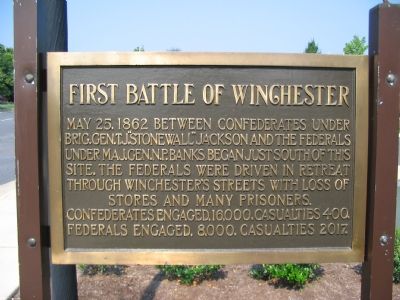
1. First Battle of Winchester Marker
May 25, 1862 between Confederates under Brig. Gen. T.J. “Stonewall” Jackson and the Federals under Maj. Gen. N.P. Banks began just south of this site. The Federals were driven in retreat through Winchester’s streets with loss of stores and many prisoners.
Confederates engaged, 16,000, casualties 400. Federals engaged, 8,000, casualties 2017.
Topics and series. This historical marker is listed in this topic list: War, US Civil. In addition, it is included in the Battlefield Markers Association series list. A significant historical date for this entry is May 25, 1862.
Location. 39° 10.177′ N, 78° 10.817′ W. Marker is in Winchester, Virginia. It is at the intersection of Jubal Early Drive and Valley Avenue, on the right when traveling west on Jubal Early Drive. Located at the side entrance to the First Bank. Touch for map. Marker is at or near this postal address: 1835 Valley Ave, Winchester VA 22601, United States of America. Touch for directions.

Regionally, this marker is in the Shenandoah Valley. It is also in the American South, specifically in the Upper South, and in the Mid-Atlantic. Globally, it is in North America,
this page online
Other nearby markers. At least 8 other markers are within one mile of this marker, measured as the crow flies: A different marker also named First Battle of Winchester (approx. 0.4 miles away); 1st Battle of Winchester (approx. half a mile away); a different marker also named First Battle of Winchester (approx. 0.6 miles away); Welcome to a Special Place (approx. 0.6 miles away); Massive Tent City (approx. one mile away); Patsy Cline (approx. one mile away); Dr. James A. Davis's Legacy (approx. one mile away); Patsy Cline House (approx. one mile away). Touch for a list and map of all markers in Winchester.
Another marker is no longer nearby. Shawnee Springs Hospital (was approx. one mile away but has been replaced with another marker now near it).
Also see . . .
1. The First Battle of Winchester. Shenandoah Valley Battlefields Foundation website entry
Photographed by Craig Swain, August 25, 2007
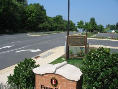
2. Start of the First Battle of Winchester
Marching parallel to the Valley Turnpike (present day US Highway 11), Brig. Gen. Charles Winder's Confederate brigade advanced towards the Federal positions near present day Handley High School. The starting point for their march was in this vicinity, crossing the street from left to right.
2. General Nathaniel Prentiss Banks. Mr. Lincoln's White House webste entry:
A close friend of Lincoln, Banks held rather high commands during the war. At Winchester, his forces left behind so much material and supplies that Confederates dubbed him "Old Jack's Commissary." Some chided that Banks did more to supply Jackson's command than the Confederate supply system. (Submitted on September 19, 2007, by Craig Swain of Leesburg, Virginia.)
Photographed by Craig Swain, March 15, 2008
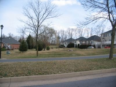
3. Bowers Hill
Looking northeast from Meadow Branch Avenue toward Bowers Hill. The hill today is in the middle of subdivisions and city utility yards. In the distance, beyond the tree line stands a water tower, roughly at the crest of Bowers Hill. The Federal right flank stood there and resisted one attack by Winder's Confederate Brigade. At around 7:30 a.m. Taylor's Louisiana Brigade attacked from the southwest, generally from the point of view offered in this photograph. The Louisiana "Tiger" Brigade carried the hill, precipitating a Federal route.
Photographed by Bernard Fisher, April 29, 2006
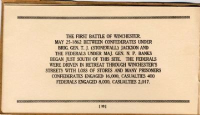
4. Battlefield Markers Association, Western Division (1929)
Credits. This page was last revised on February 20, 2024. It was originally submitted on September 19, 2007, by Craig Swain of Leesburg, Virginia. This page has been viewed 2,921 times since then and 51 times this year. Last updated on February 19, 2024, by Mike McKeown of Baltimore, Maryland. Photos: 1, 2. submitted on September 19, 2007, by Craig Swain of Leesburg, Virginia. 3. submitted on April 25, 2008, by Craig Swain of Leesburg, Virginia. 4. submitted on December 9, 2008, by Bernard Fisher of Richmond, Virginia. • Devry Becker Jones was the editor who published this page.
