Two Bridges in Manhattan in New York County, New York — The American Northeast (Mid-Atlantic)
Catherine Mall Market
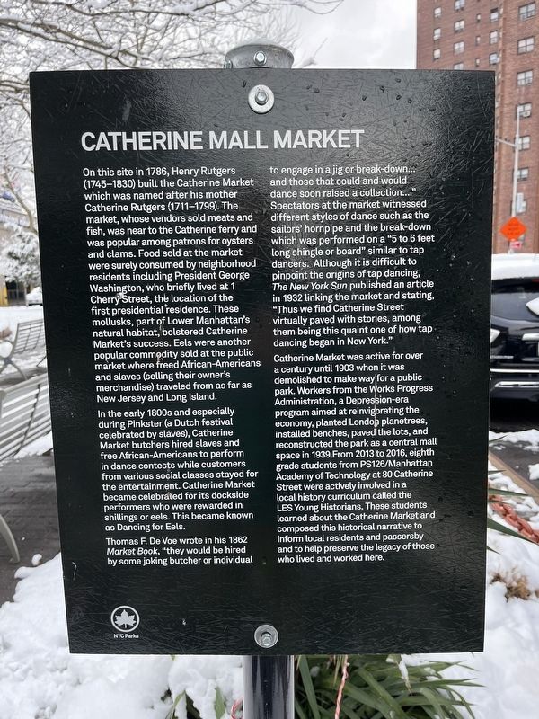
On this site in 1786, Henry Rutgers (1745-1830) built the Catherine Market which was named for his mother Catherine Rutgers (1711-1799). The market, whose vendors sold meats and fish, was near to the Catherine ferry and was popular among the patrons for oysters and clams. Food sold at the market were surely consumed by neighborhood residents including President George Washington, who briefly lived at 1 Cherry Street, the location of the first presidential residence. These mollusks, part of Lower Manhattan's natural habitat, bolstered Catherine Market's success. Eels were another popular commodity sold at the public market where freed African-Americans and slaves (selling their owner's merchandise) traveled from as far as New Jersey and Long Island.
In the early 1800s and especially during Pinkster (a Dutch festival celebrated by slaves), Catherine Market butchers hired slaves and free African-Americans to perform in dance contests while customers from various social classes stayed for the entertainment. Catherine Market became celebrated for its dockside performers who were rewarded in shillings or eels. This became known as Dancing for Eels.
Thomas F. De Voe wrote in his 1862 Market Book, "they would be hired by some joking butcher or individual to engage in a jib or breakdown… and those that could and would dance soon raised a collection...." Spectators at the market witnessed different styles of dance such as the sailors' hornpipe and the break-down which was performed on a "5 to 6 feet long shingle or board" similar to tap dancers. Although it is difficult to pinpoint the origins of tap dancing, The New York Sun published an article in 1932 linking the market and stating, "Thus we find Catherine Street virtually paved with stories, among them being this quaint one of how tap dancing began in New York."
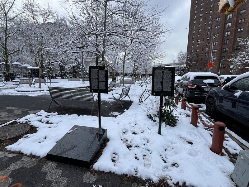
Catherine Market was active for over a century until 1903 when it was demolished to make way for a public park. Workers from the Works Progress Administration, a Depression-era program aimed at reinvigorating the economy, planted London planetrees, installed benches, paved the lots, and reconstructed the park as a central mall space in 1939. From 2013 to 2016, eight grade students from PS126/Manhattan Academy of Technology at 80 Catherine Street were actively involved in a local history curriculum called LES Young Historians. These students learned about the Catherine Market and composed this historical narrative to inform local residents and passersby and to help preserve the legacy of those who lived and worked here.
Erected by NYC Parks.
Topics and series. This historical marker is listed in these topic
Location. 40° 42.608′ N, 73° 59.784′ W. Marker is in Manhattan, New York, in New York County. It is in Two Bridges. Marker is at the intersection of Cherry Street and Catherine Slip, on the right when traveling east on Cherry Street. Touch for map. Marker is at or near this postal address: 97 Catherine Slip, New York NY 10038, United States of America. Touch for directions.
Other nearby markers. At least 8 other markers are within walking distance of this marker. History of Catherine Slip (here, next to this marker); Catherine Mall (here, next to this marker); Catherine Slip Malls (about 300 feet away, measured in a direct line); Alfred E. Smith Playground (about 400 feet away); Governor Alfred E. Smith Memorial (about 400 feet away); Happy Warrior Playground in Alfred E. Smith Park (about 400 feet away); Catherine Street (about 500 feet away); Governor Alfred E. Smith Houses Residents Memorial (about 600 feet away). Touch for a list and map of all markers in Manhattan.
Credits. This page was last revised on February 22, 2024. It was originally submitted on February 22, 2024, by Devry Becker Jones of Washington, District of Columbia. This page has been viewed 43 times since then. Photos: 1, 2. submitted on February 22, 2024, by Devry Becker Jones of Washington, District of Columbia.

