Coltons Point in St. Mary's County, Maryland — The American Northeast (Mid-Atlantic)
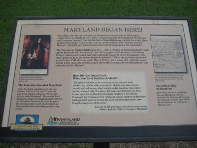
Maryland Began Here!
The Piscataway Nation, frightened by the Ark, a "Canoe as big as an island," built "great fires over all the country" and "drew together 500 bowmen." Governor Calvert sailed upriver and met with a friendly emperor of the Piscataway who "gave leave to us to set down where we pleased." When the governor returned he and other Catholics set aside March 25 to erect a cross and celebrate mass. Within a few days, the settlers sailed down the Potomac River and planted "our town we call St. Maries."
[image of Cecil Calvert] The Man who Founded Maryland
When the first Lord Baltimore, George Calvert, died in 1632, his 27-year-old son, Cecil Calvert, ably carried out his plan to settle Maryland. The second Lord Baltimore stayed in England and protected his Maryland interests for over 40 years. He proudly holds a map of Maryland as his grandson and namesake points to the colony.
How Did the Island Look When the First Settlers Arrived?
"The ground is heare, as in very many places, covered with pokiberries, (a little wilde walnut hard of shell, but with a sweet kernel) with ackhornes, black walnut, cedar, saxafras, vines, salad-herbes, and such like. It is above 400 acres, and therefore too little to seat upon for us; therefore they have designed it for a fort to Command the [Potomac] river, meaneing to raise another on the maine land against it, and soe to keep the river from forraigne trade, here being the narrowest of the river." - Account of Ark passanger and Jesuit missionary Father Andrew White in Voyage to Maryland.
[map image] The Oldest Map of Maryland
This map, created to publicize the new maryland Colony, includes the Potomac River and St. Clement's Island, here called Heron's Island, as well as St. Mary's City.
Erected by Chesapeake Bay Gateways Network, Maryland Department of Natural Resources.
Topics. This historical marker is listed in these topic lists: Churches & Religion • Colonial Era • Forts and Castles • Notable Events • Settlements & Settlers. A significant historical month for this entry is March 1634.
Location. This marker has been replaced by another marker nearby. It was located near
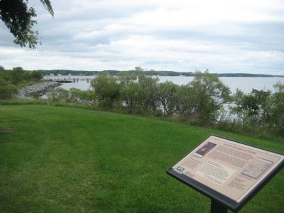
38° 12.747′ N, 76° 44.655′ W. Marker was in Coltons Point, Maryland, in St. Mary's County. Marker could be reached from Point Breeze Road, 0.2 miles Colton Point Road (Maryland Route 242). Marker is on St. Clements Island which is only accessibly by boat. A ferry operates on weekends from the St. Clement's Island Museum on Point Breeze Road. Touch for map. Marker was in this post office area: Coltons Point MD 20626, United States of America. Touch for directions.
Other nearby markers. At least 8 other markers are within walking distance of this location. This Stand of Trees (within shouting distance of this marker); Maryland Began Here (within shouting distance of this marker); St. Clement's Island State Park (approx. 0.2 miles away); Welcome to St. Clements Island State Park (approx. 0.2 miles away); Ancestral Garden (approx. ¼ mile away); St. Clement's Hundred (approx. ¼ mile away); St. Clement's Island (approx. ¼ mile away); Freedom to Worship (approx. 0.3 miles away). Touch for a list and map of all markers in Coltons Point.
Related marker. Click here for another marker that is related to this marker. This marker has been replaced by the linked marker.
Credits. This page was last revised on August 26, 2022. It was originally submitted on November 7, 2009, by F. Robby of Baltimore, Maryland. This page has been viewed 911 times since then and 11 times this year. Photos: 1, 2. submitted on November 7, 2009, by F. Robby of Baltimore, Maryland.

