Fredericksburg, Virginia — The American South (Mid-Atlantic)
The Mannahoac Indigenous Tribe
City of Fredericksburg, Virginia
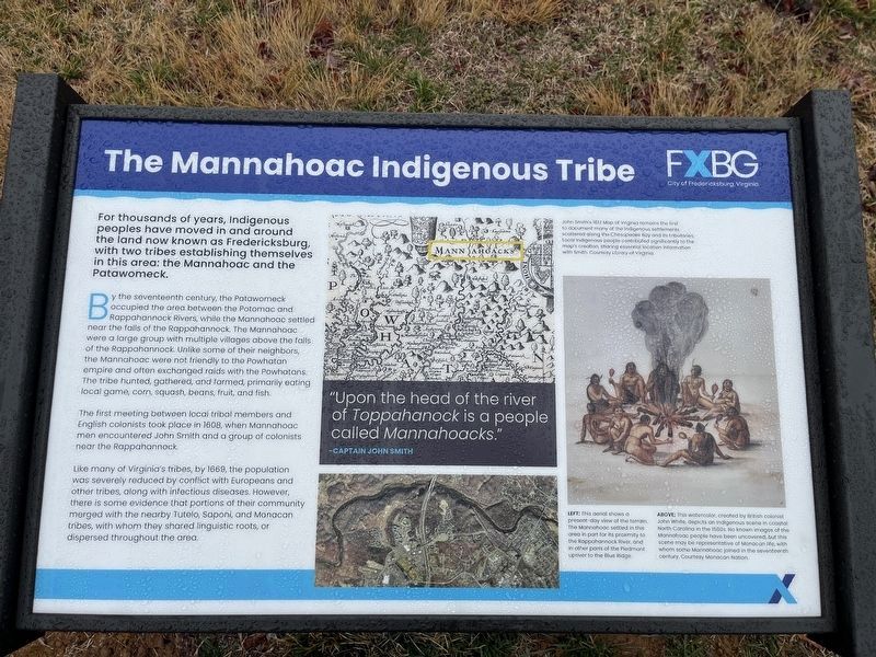
For thousands of years, indigenous peoples have moved in and around the land now known as Fredericksburg, with two tribes establishing themselves in this area: the Mannahoac and the Patawomeck.
By the seventeenth century, the Patawomeck occupied the area between the Potomac and Rappahannock Rivers, while the Mannahoac settled near the falls of the Rappahannock. The Mannahoac were a large group with multiple villages above the falls of the Rappahannock. Unlike some of their neighbors, the Mannahoac were not friendly to the Powhatan empire and often exchanged raids with the Powhatans. The tribe hunted, gathered, and farmed, primarily eating local game, corn, squash, beans, fruit, and fish.
The first meeting between local tribal members and English colonists took place in 1608, when Mannahoac men encountered John Smith and a group of colonists near the Rappahannock.
Like many of Virginia's tribes, by 1669, the population was severely reduced by conflict with Europeans and other tribes, along with infectious diseases. However there is some evidence that portions of their community merged with the nearby Tutelo, Saponi, and Monacan tribes, with whom they shared linguistic roots, or dispersed throughout the area.
"Upon the head of the river of Toppahanock is a people called Mannahoacks."
-Captain John Smith
[Captions:]
John Smith's 1612 Map of Virginia remains the first to document many of the Indigenous settlements scattered along the Chesapeake Bay and its tributaries. Local Indigenous people contributed significantly to the map's creation, sharing essential location information with Smith. Courtesy Library of Virginia.
Left: This aerial shows the present-day view of the terrain. The Mannahoac settled in this area in part of its proximity to the Rappahannock River, and in other parts of the Piedmont upriver to the Blue Ridge.
Above: This watercolor, created by British colonist John White, depicts an indigenous scene in coastal North Carolina in the 1580s. No known images of the Mannahoac people have been uncovered, but this scene may be representative of Monacan life, with whom some Mannahoac joined in the seventeenth century. Courtesy Monacan Nation.
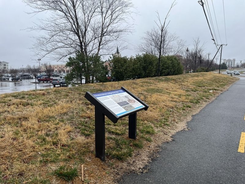
Erected 2024 by City of Fredericksburg, Virginia.
Topics. This historical marker is listed in these topic lists: Anthropology & Archaeology • Colonial Era • Native Americans • Settlements & Settlers. A significant historical year for this entry is 1608.
Location. 38° 18.684′ N, 77° 30.581′
Other nearby markers. At least 8 other markers are within walking distance of this marker. Historic Kenmore and George Washington's Ferry Farm (approx. 0.4 miles away); George Washington: Soldier and Virginia Planter (approx. 0.4 miles away); George Washington: Surveyor and Family Man (approx. 0.4 miles away); George Washington: Statesman and Public Servant (approx. 0.4 miles away); Auction Block (approx. ¾ mile away); Spirit of Freedom (approx. ¾ mile away); Quest For Knowledge (approx. ¾ mile away); Runaways (approx. ¾ mile away). Touch for a list and map of all markers in Fredericksburg.
Credits. This page was last revised on March 2, 2024. It was originally submitted on March 2, 2024, by Devry Becker Jones of Washington, District of Columbia. This page has been viewed 69 times since then. Photos: 1, 2. submitted on March 2, 2024, by Devry Becker Jones of Washington, District of Columbia.

