Batesville in Independence County, Arkansas — The American South (West South Central)
Sara Low Memorial Dog Park
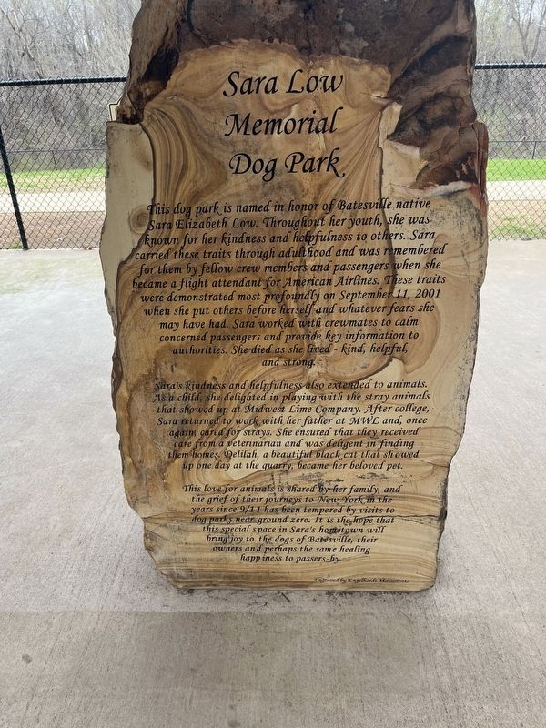
Photographed by Thomas Smith, March 4, 2024
1. Sara Low Marker
Sara's Kindness and helpfulness also extended to animals. As a child, she delighted in playing with the stray animals that showed up at Midwest Lime Company. After college, Sara returned to work with her father at MWL and, once again cared for strays. She ensured that they received care from a veterinarian and was diligent in finding them homes. Delilah, a beautiful black cat that showed up one day at the quarry, became her beloved pet.
This love for animals is shared by her family, and the grief
this page online
Topics. This historical marker is listed in these topic lists: 9/11 Attacks • Animals • Parks & Recreational Areas • Women. A significant historical date for this entry is September 11, 2001.
Location. 35° 45.487′ N, 91° 38.066′ W. Marker is in Batesville, Arkansas, in Independence County. It is at the intersection of Chaney Drive and Riverbank Rd., on the left when traveling east on Chaney Drive. Sara Low Memorial Dog park. Touch for map. Marker is at or near this postal address: 1850 Chaney Drive, Batesville AR 72501, United States of America. Touch for directions.

Regionally, this marker is on the Ozark Plateau. It is also in the American South and specifically in the Upper South. Globally, it is in North America, the Western Hemisphere, the Western World, and the Anglosphere. Historically, it finds itself in what was once the territory of
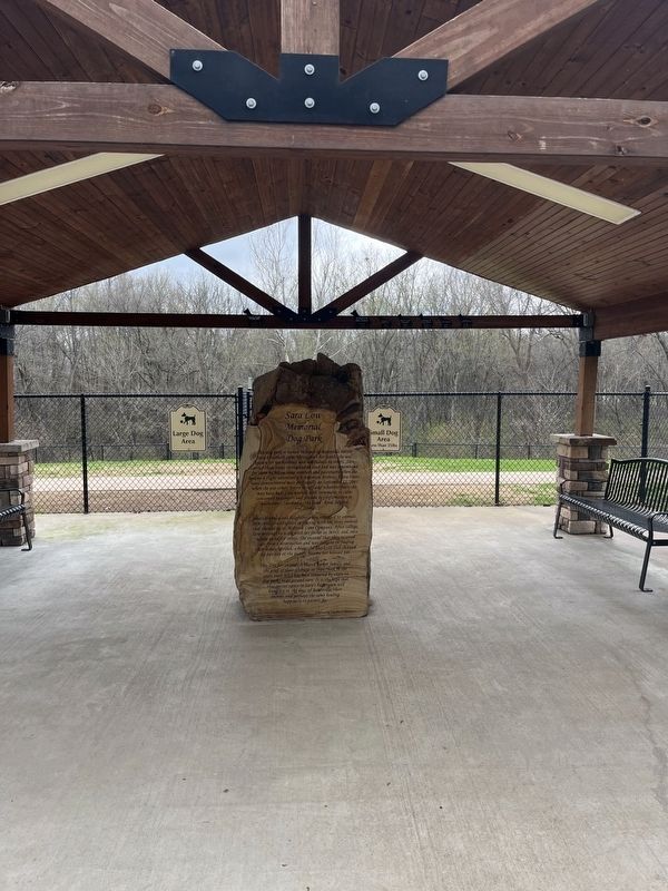
Photographed by Thomas Smith, March 4, 2024
2. Sara Low Marker
Other nearby markers. At least 8 other markers are within 2 miles of this marker, measured as the crow flies: Navigation of the White River (about 600 feet away, measured in a direct line); Engine Donor Ark. Lime Co. (approx. ¼ mile away); Governor Elisha Baxter (approx. 0.4 miles away); Col. Morgan Magness (approx. half a mile away); Bethel African Methodist Episcopal Church (approx. 1.1 miles away); Agricultural Wheel Political Platform 1887 (approx. 1.1 miles away); Batesville During the Civil War (approx. 1.1 miles away); Charles R. Handford House (approx. 1.2 miles away). Touch for a list and map of all markers in Batesville.
Credits. This page was last revised on November 24, 2024. It was originally submitted on March 5, 2024, by Thomas Smith of Waterloo, Ill. This page has been viewed 361 times since then and 37 times this year. Photos: 1, 2. submitted on March 5, 2024, by Thomas Smith of Waterloo, Ill. • Andrew Ruppenstein was the editor who published this page.
