Near Shorterville in Henry County, Alabama — The American South (East South Central)
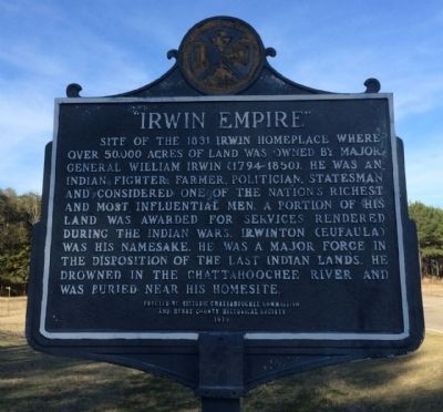
"Irwin Empire"
Photographed by Mark Hilton, February 16, 2014
1. Irwin Empire Marker
Erected 1979 by the Historic Chattahoochee Commission and the Henry County Historical Society.
Topics. This historical marker is listed in these topic lists: Indigenous Peoples and Communities • Settlements & Settlers • Wars, US Indian. A significant historical year for this entry is 1831.
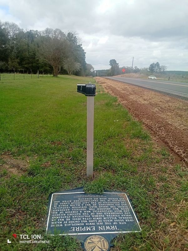
Location. 31° 34.874′ N, 85° 5.595′ W. Marker has been damaged. Marker is near Shorterville, Alabama, in Henry County. It is on Alabama Route 10 0.4 miles north of County Road 91, on the left when traveling north. Touch for map. Marker is at or near this postal address: 8916 AL-10, Shorterville AL 36373, United States of America.
this page online

Regionally, this marker is in the American South, specifically in the Deep South, and in the Wiregrass. Globally, it is in North America, a Gulf of Mexico state, the Western Hemisphere, the Western World, and the Anglosphere. Historically, it finds itself in what was once the territory of the Mississippian Culture, one of the Confederate States of America, and the Antebellum South.
Other nearby markers. At least 8 other markers are within 3 miles of this location, measured as the crow flies: Franklin - First Beachhead into East Alabama (approx. 2½ miles away); Chattahoochee River Crossings (approx. 2.6 miles away); Fort Gaines (approx. 2.8 miles away in Georgia); The 1836 Fort (approx. 2.8 miles away in Georgia); The Old Lattice Bridge (approx. 2.9 miles away in Georgia); Old Pioneer Cemetery (approx. 2.9 miles away in Georgia); Queen City of the Chattahoochee (approx. 3 miles away in Georgia); Site of the First Clay County Courthouse and Jail (approx. 3.1 miles away in Georgia). Touch for a list and map of all markers in Shorterville.
Other markers no longer nearby. In the Confederacy (was approx.
Photographed by Mark Hilton, February 16, 2014
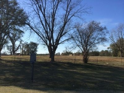
2. Irwin Empire Marker Location
Photographed by Mark Hilton, February 16, 2014
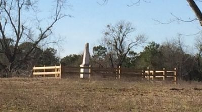
3. Nearby William Irwin Gravesite
Photographed by James L.Whitman, March 6, 2024
4. Damaged "Irwin Empire" marker
Credits. This page was last revised on March 8, 2024. It was originally submitted on February 17, 2014, by Mark Hilton of Montgomery, Alabama. This page has been viewed 2,916 times since then and 140 times this year. Last updated on March 7, 2024, by James L.Whitman of Eufaula, Alabama. Photos: 1, 2, 3. submitted on February 17, 2014, by Mark Hilton of Montgomery, Alabama. 4. submitted on March 7, 2024, by James L.Whitman of Eufaula, Alabama. • Devry Becker Jones was the editor who published this page.
