Rogers Park in Chicago in Cook County, Illinois — The American Midwest (Great Lakes)
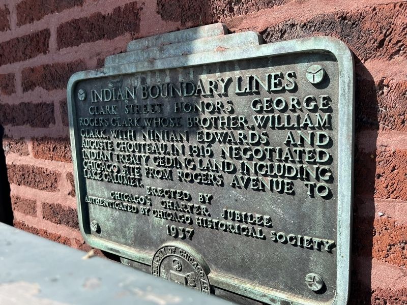
Indian Boundary Lines
Clark Street honors George Rogers Clark, whose brother, William Clark, with Ninian Edwards and Auguste Chouteau, in 1816 negotiated Indian treaty ceding land including Chicago site from Rogers Avenue to Lake Calumet.
Authenticated by the Chicago Historical Society
Erected 1937 by Chicago’s Charter Jubilee.
Topics and series. This historical marker is listed in these topic lists: Native Americans • Roads & Vehicles • Settlements & Settlers • Wars, US Indian. In addition, it is included in the Chicago's Charter Jubilee series list. A significant historical year for this entry is 1816.
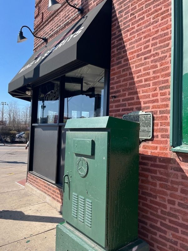
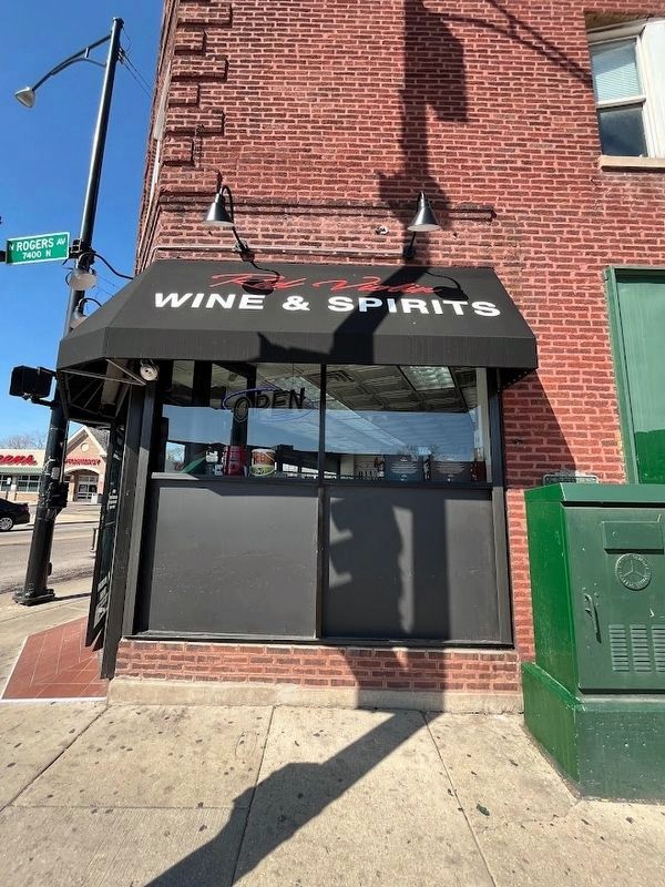
Location. 42° 0.975′ N, 87° 40.503′ W. Marker is in Chicago, Illinois, in Cook County. It is in Rogers Park. Marker is at the intersection of North Rogers Avenue and North Clark Street, on the right when traveling west on North Rogers Avenue. The marker is on the south-facing side of the 7401 S. Clark St. building, which, as of March 2024, houses a wine and spirits shop. The marker is partially obscured by an electrical box. Touch for map. Marker is at or near this postal address: 7407 North Clark Street, Chicago IL 60626, United States of America. Touch for directions.
Other nearby markers. At least 8 other markers are within 2 miles of this marker, measured as the crow flies. Burr Tillstrom (approx. 0.4 miles away); Emil Bach House (approx. half a mile away); Indian Boundary Park (approx. one mile away); Indian Boundary Village (approx. one mile away); 1877 Keystone from City Hall Building (approx. one mile away); Philip Rogers Home Site (approx. 1.1 miles away); The Spirit of the Fighting Yank (approx. 1.8 miles away); Residence of Charles Gates Dawes (approx. 1.8 miles away). Touch for a list and map of all markers in Chicago.
More about this marker. This plaque is one of 78 placed throughout the city by the Chicago Charter Jubilee in celebration of the 100th anniversary of Chicago’s city charter. A seal of the City of Chicago is at the bottom of the marker. A box for city lights is placed right in front of the marker, which can make it hard to notice from the street.
Regarding Indian Boundary Lines. Clark Street spans 98 blocks of Chicago beginning about ¼ mile north of this marker where it meets Howard Avenue at Chicago's border with Evanston (and becomes Chicago Avenue) and ending about 12 miles away on Chicago's south side, at Cermak Road (22nd Street). While the downtown
portion of Clark was part of the original plan for the city's center, the road on the city's north side runs diagonally along what was originally Green Bay Trail, an old Indian trail that spanned 200 miles from Chicago to Green Bay, Wisconsin (and is the subject of a different Jubilee marker).
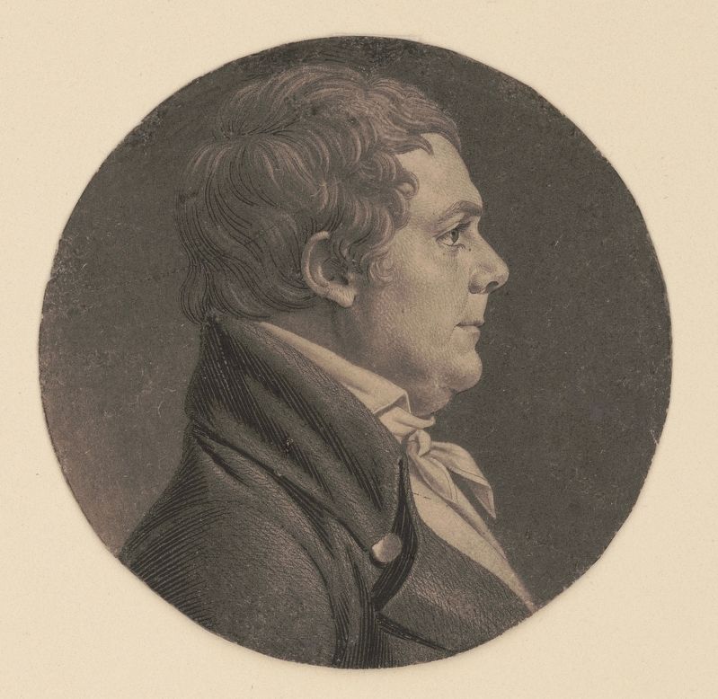
While some Chicago Jubilee markers are known for text that is perhaps historically questionable (despite being "authenticated by the Chicago Historical Society"), this one appears to be backed by the history. George Rogers Clark was a Revolutionary War military officer from Virginia who led militiamen on the Illinois campaign, where they captured several important British posts in what is today Indiana and Illinois. Clark's younger brother William, referenced on this plaque, was the youngest of 10 children and 18 years younger than George. He is certainly the best-remembered of his family, however, as he and Meriwether Lewis joined forces for the famed Lewis and Clark expedition to what is now the U.S. Northwest.
The treaty referenced on this plaque is the 1816 Treaty of St. Louis, which, most importantly, ceded land to the United States that connected Chicago and Lake Michigan with the Illinois River, which empties into the Mississippi. A little more than 30 years later, the Illinois and Michigan Canal would be completed, connecting the Great Lakes with the Mississippi.
The acquisition included land along Lake Michigan that ran 10 miles north and south from the Chicago River. Rogers Avenue, with its southwest-to-northeast diagonal set-up, is a modern remnant of the northern edge of this land. Indian Boundary Park, about a mile west of here, is a city park that also sits along this old border line. Forest Preserve Drive, farther west, also follows this route.
Also see . . .
1. Treaty with the Ottawa, Etc. Forest County Potawatomi website homepage:
The text of the Treaty of St. Louis, signed August 24, 1816, which ceded land whose northern boundary is memorialized with this marker. (Submitted on March 12, 2024, by Sean Flynn of Oak Park, Illinois.)
2. A Rogers Park Plaque Marks How US Grabbed Indigenous People’s Land That Became Chicago. Block Club Chicago website entry:
Subhead: "The Indian Boundary Lines plaque is one of 40 controversial monuments being reconsidered in a city program." The article looks at discussions about whether the plaque should remain, and if so whether it needs an accompanying plaque to explain more of the history behind it. (Submitted on March 12, 2024, by Sean Flynn of Oak Park, Illinois.)
3. Indians Cede the Land. An article from the Smithsonian Institution about paintings related to this Indian Boundary. (Submitted on March 12, 2024, by Sean Flynn of Oak Park, Illinois.)
Credits. This page was last revised on March 12, 2024. It was originally submitted on March 11, 2024, by Sean Flynn of Oak Park, Illinois. This page has been viewed 49 times since then. Photos: 1, 2, 3. submitted on March 11, 2024, by Sean Flynn of Oak Park, Illinois. 4, 5. submitted on March 12, 2024, by Sean Flynn of Oak Park, Illinois.
