Andrews in Georgetown County, South Carolina — The American South (South Atlantic)
Dissenter Meeting House and Cemetery
Photographed by Anna Inbody, April 28, 2012
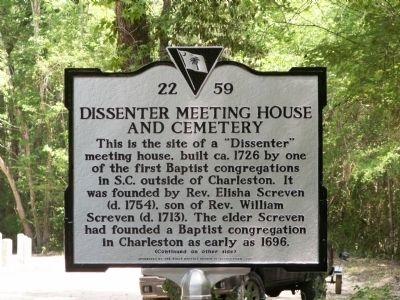
1. Dissenter Meeting House and Cemetery Marker
This is the site of a "Dissenter" meeting house, built ca. 1726 by one of the first Baptist congregations in S.C. outside of Charleston. It was founded by Rev. Elisha Screven (d. 1754). The elder Screven had founded a Baptist congregation in Charleston as early as 1696.
Erected 2012 by The First Baptist Church of Georgetown. (Marker Number 22-59.)
Topics. This historical marker is listed in these topic lists: Cemeteries & Burial Sites • Colonial Era • Religion & Religious Structures. A significant historical year for this entry is 1726.
Location. Marker has been reported missing. It was located near 33° 28.875′ N, 79° 26.904′ W. Marker was in Andrews, South Carolina, in Georgetown County. It was on Pump House Landing Road 1.4
this page online

Regionally, this marker was in South Carolina’s Pee Dee. It was also in the American South, specifically in the Deep South, and on the Eastern Seaboard. Globally, it was in the North Atlantic Region, North America, the Western Hemisphere, the Western World, and the Anglosphere. Historically, it found itself in what was once the territory of the Mississippian Culture, one of the original Thirteen Colonies, one of the Confederate States of America, and the Antebellum South.
Other nearby markers. At least 8 other markers are within 10 miles of this location, measured as the crow flies: Prince George Winyah Parish / Prince Frederick’s Parish (approx. 5 miles away); Early Settlers / Potatoe Ferry (approx. 5.4 miles away); Oak Grove Methodist Church (approx. 6.9 miles away); Georgetown County National Guard Memorial (approx. 7.2 miles away); Skirmish at Sampit Bridge (approx. 8.1 miles away); Sampit Methodist Church
Photographed by Anna Inbody, April 28, 2012
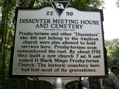
2. Dissenter Meeting House and Cemetery Marker Reverse
Also see . . . Video of Dedication - - "FBC Historical Marker April 28, 2012" ::. (Submitted on May 11, 2012, by Al Wolf of Veedersburg, Indiana.)
Additional commentary.
1. Missing
This marker has been reported as missing as on 3/30/2024.
— Submitted March 30, 2024, by Sharon F. Corey of Pawleys Island, South Carolina.
Photographed by Anna Inbody, April 28, 2012
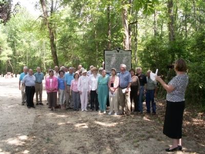
3. Dissenter Meeting House and Cemetery Marker
Taken at the unveiling ceremony on April 28, 2012
Photographed by Anna Inbody, April 28, 2012
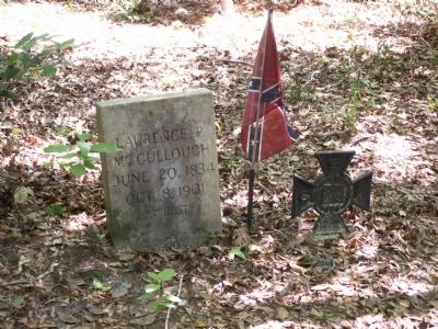
4. One of the tombstones in the cemetery mentioned on the marker
“Laurence P. McCullough, June 20, 1834 – Oct. 8, 1901. At Rest,”
Photographed by Anna Inbody, April 28, 2012
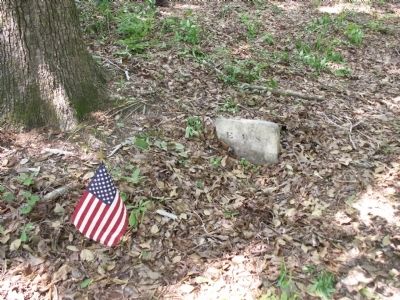
5. Another marker from the cemetery mention on the marker
The cemetery is in the woods near the marker. The tombstones are scattered as most are missing. This one reads, “E. B. S.”
Credits. This page was last revised on March 30, 2024. It was originally submitted on April 29, 2012, by Anna Inbody of Columbia, South Carolina. This page has been viewed 2,613 times since then and 139 times this year. Last updated on March 30, 2024, by Sharon F. Corey of Pawleys Island, South Carolina. Photos: 1, 2, 3, 4, 5. submitted on April 29, 2012, by Anna Inbody of Columbia, South Carolina. • Bernard Fisher was the editor who published this page.
