Near Haworth in McCurtain County, Oklahoma — The American South (West South Central)
Garland Cemetery
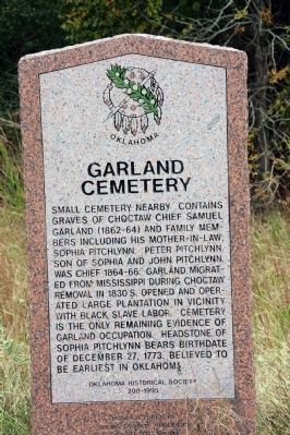
Photographed by Byron Hooks, October 21, 2009
1. Garland Cemetery Marker
Erected 1995 by Oklahoma Historical Society. (Marker Number 200.)
Topics and series. This historical marker is listed in these topic lists: Cemeteries & Burial Sites • Indigenous Peoples and Communities. In addition, it is included in the Oklahoma Historical Society series list. A significant historical date for this entry is December 27, 1831.
Location. 33° 44.161′ N, 94° 29.754′ W. Marker is near Haworth, Oklahoma, in McCurtain County. It is on State Highway 3, on the left when traveling east. Located on Route 3, west of the Oklahoma – Arkansas state line. Touch for map. Marker is in this post office area: Haworth OK 74740, United States of America. Touch for directions.

Regionally, this marker is in Oklahoma’s Choctaw Nation. It is also in the American South, specifically in the Piney Woods, on the prairies, and on the Southern Plains. Globally, it is in North America, the Western Hemisphere, the Western World, and the Anglosphere. Historically, it finds itself in what was once New Spain, the territory of the Mississippian Culture, and the Louisiana Purchase.
Other nearby markers. At least 5 other markers are within 15 miles of this marker, measured as the crow flies: First Permanent Site of Little River County Seat (approx. 5.4 miles away in Arkansas); World War II Memorial
this page online
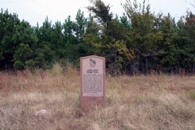
Photographed by Byron Hooks, October 21, 2009
2. Garland Cemetery Marker
Credits. This page was last revised on August 7, 2018. It was originally submitted on November 11, 2009, by Byron Hooks of Sandy Springs, Georgia. This page has been viewed 1,782 times since then and 42 times this year. Photos: 1, 2. submitted on November 11, 2009, by Byron Hooks of Sandy Springs, Georgia. • Bill Pfingsten was the editor who published this page.
