Wadesboro in Anson County, North Carolina — The American South (South Atlantic)
1900 Total Solar Eclipse
Wadesboro, NC
Photographed by Mark Parker, June 7, 2023
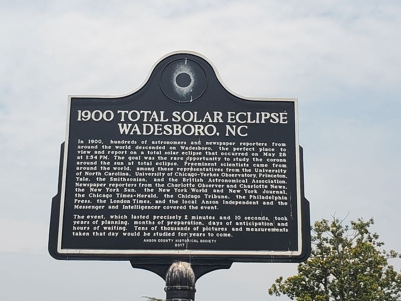
1. 1900 Total Solar Eclipse Wadesboro Marker
Inscription.
1900 Total Solar Eclipse. Wadesboro, NC. In 1900, hundreds of astronomers and newspaper reporters from around the world descended on Wadesboro, the perfect place to view and report on a total solar eclipse that occurred on May 28 at 1:54 PM. The goal was the rare opportunity to study the corona around the sun at total eclipse. Preeminent scientists came from around the world, among these representatives from the University of North Carolina, University of Chicago-Yerkes Observatory, Princeton, Yale, the Smithsonian, and the British Astronomical Association. Newspaper reporters from the Charlotte Observer and Charlotte News, the New York Sun, the New York World and New York Journal, the Chicago Times-Herald, the Chicago Tribune. the Philadelphia Press, the London Times, and the local Anson Independent and the Messenger and Intelligencer covered the event., The event, which lasted precisely 2 minutes and 10 seconds, took years of planning, months of preparation, days of anticipation and hours of waiting. Tens of thousands of pictures and measurements taken that day would be studied for years to come.
In 1900, hundreds of astronomers and newspaper reporters from around the world descended on Wadesboro, the perfect place to view and report on a total solar eclipse that occurred on May 28 at 1:54 PM. The goal was the rare opportunity to study the corona around the sun at total eclipse. Preeminent scientists came from around the world, among these representatives from the University of North Carolina, University of Chicago-Yerkes Observatory, Princeton, Yale, the Smithsonian, and the British Astronomical Association. Newspaper reporters from the Charlotte Observer and Charlotte News, the New York Sun, the New York World and New York Journal, the Chicago Times-Herald, the Chicago Tribune. the Philadelphia Press, the London Times, and the local Anson Independent and the Messenger and Intelligencer covered the event.
The event, which lasted precisely 2 minutes and 10 seconds, took years of planning, months of preparation, days of anticipation and hours of waiting. Tens of thousands of pictures and measurements taken that day would be studied for years to come.
Erected 2017 by Anson County Historical Society.
Topics.
Click or scan to see this page online
This historical marker is listed in these topic lists: Environment • Science & Medicine. A significant historical date for this entry is May 28, 1900.
Location. 34° 57.994′ N, 80° 4.6′ W. Marker is in Wadesboro, North Carolina, in Anson County. It is at the intersection of North Greene Street (North Carolina Route 109) and East Wade Street, on the right when traveling north on North Greene Street. Located on the Southeast corner of the Anson County Courthouse grounds. Touch for map. Marker is at or near this postal address: 114 N Greene St, Wadesboro NC 28170, United States of America. Touch for directions.
Regionally, this marker is in North Carolina’s Piedmont. It is also in the American South and specifically in the Upper South. Globally, it is in North America, the Western Hemisphere, the Western World, and the Anglosphere. Historically, it finds itself in what was once the territory of the Mississippian Culture, one of the original Thirteen Colonies, one of the Confederate States of America, and the Antebellum South.
Other nearby markers. At least 8 other markers are within 2 miles of this marker, measured as the crow
Photographed by Mark Parker, March 24, 2025
2. 1900 Total Solar Eclipse Marker near the Anson County Courthouse
Credits. This page was last revised on April 25, 2025. It was originally submitted on April 8, 2024, by Mark Parker of Hickory, North Carolina. This page has been viewed 551 times since then and 42 times this year. Photos:1. submitted on April 8, 2024, by Mark Parker of Hickory, North Carolina. 2. submitted on April 19, 2025, by Mark Parker of Hickory, North Carolina. • Bernard Fisher was the editor who published this page.