Vinton in El Paso County, Texas — The American South (West South Central)
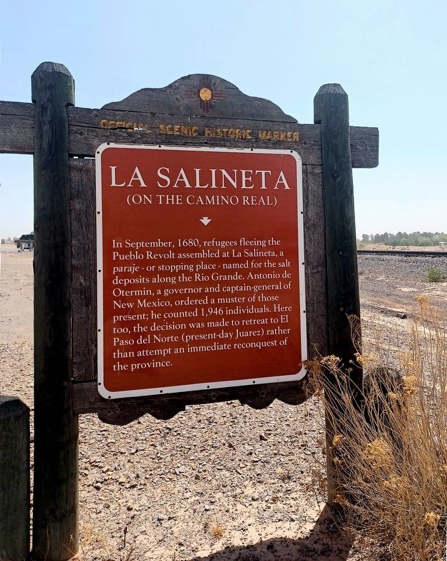
La Salineta
(on the Camino Real)
In September, 1680, refugees fleeing the Pueblo Revolt assembled at La Salineta, a paraje - or stopping place - named for the salt deposits along the Rio Grande. Antonio de Otermin, a governor and captain-general of New Mexico, ordered a muster of those present; he counted 1,946 individuals. Here too, the decision was made to retreat to El Paso del Norte (present-day Juarez) rather than attempt an immediate reconquest of the province.
Erected 2006 by New Mexico Historic Preservation Division. (Marker Number 501.)
Topics. This historical marker is listed in these topic lists: Colonial Era • Hispanic Americans • Native Americans • Settlements & Settlers. A significant historical year for this entry is 1680.
Location. 31° 56.886′ N, 106° 36.186′ W. Marker is in Vinton, Texas, in El Paso County. Marker is on Doniphan Drive (Texas Route 20) south of Hemley Road, on the right when traveling south. Touch for map. Marker is in this post office area: Anthony TX 79821, United States of America. Touch for directions.
Other nearby markers. At least 8 other markers are within 12 miles of this marker, measured as the crow flies. Texas (approx. 2.6 miles away); El Paso (approx. 2.6 miles away); Oñate’s Route (approx. 4.2 miles away in New Mexico); Brazito Battlefield (approx. 4.2 miles away in New Mexico); Butterfield Trail/Espejo's Expedition (approx. 4.2 miles away in New Mexico); MIM-23 Surface-to-Air Missile System (approx. 7.6 miles away in New Mexico); Fusselman Canyon (approx. 8.6 miles away); El Paso Del Rio Del Norte (approx. 12 miles away in New Mexico).
More about this marker. Although the marker was made by New Mexico's Historic Preservation Division, it is about 0.5 miles from New Mexico into Texas. It was placed in 2006.
Credits. This page was last revised on April 24, 2024. It was originally submitted on April 22, 2024, by Flexible Fotography of San Diego, California. This page has been viewed 48 times since then. Photos: 1, 2. submitted on April 22, 2024, by Flexible Fotography of San Diego, California. • James Hulse was the editor who published this page.

